MyTopo
Norris City Illinois US Topo Map
Couldn't load pickup availability
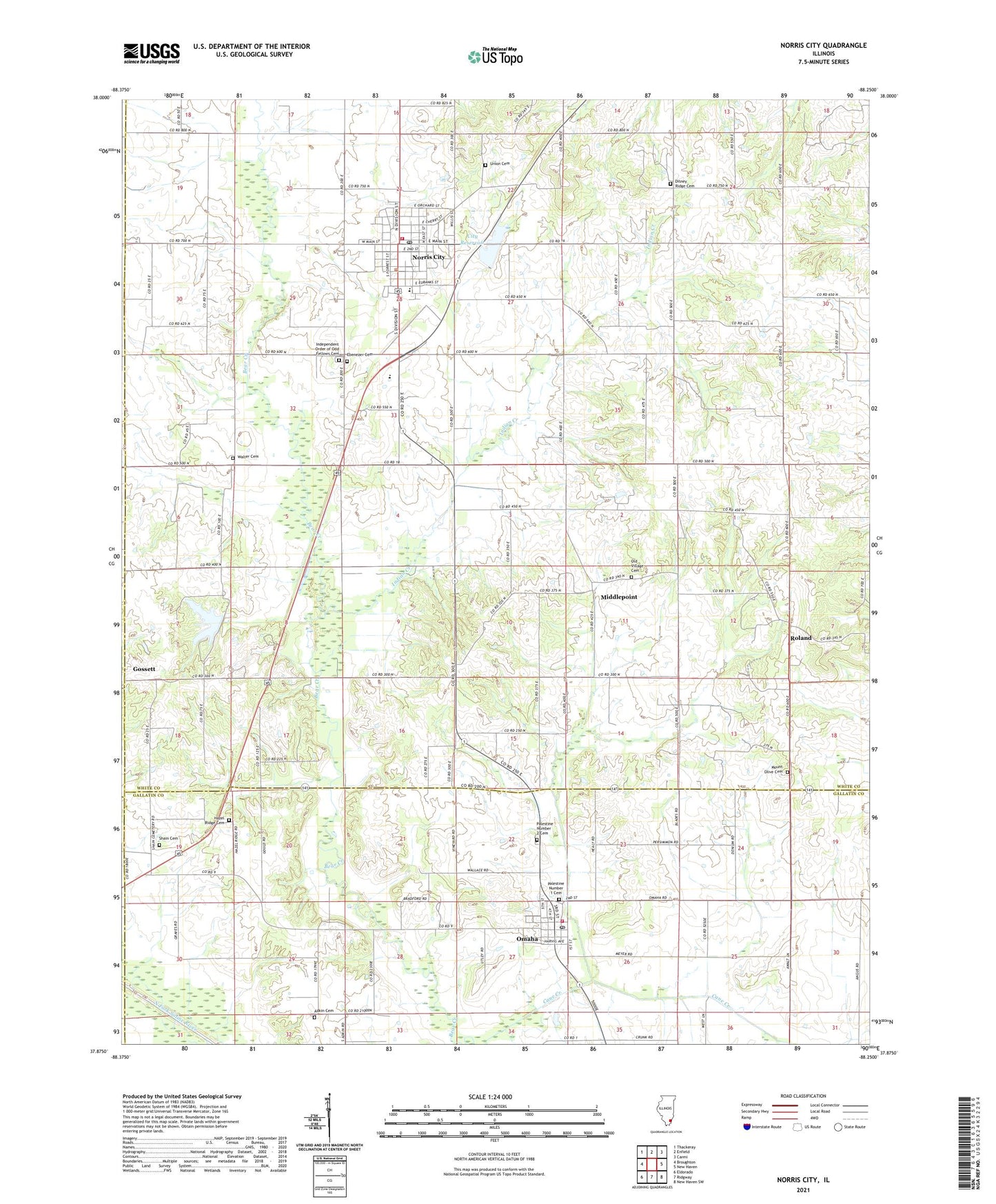
2024 topographic map quadrangle Norris City in the state of Illinois. Scale: 1:24000. Based on the newly updated USGS 7.5' US Topo map series, this map is in the following counties: White, Gallatin, Hamilton, Saline. The map contains contour data, water features, and other items you are used to seeing on USGS maps, but also has updated roads and other features. This is the next generation of topographic maps. Printed on high-quality waterproof paper with UV fade-resistant inks.
Quads adjacent to this one:
West: Broughton
Northwest: Thackeray
North: Enfield
Northeast: Carmi
East: New Haven
Southeast: New Haven SW
South: Ridgway
Southwest: Eldorado
This map covers the same area as the classic USGS quad with code o37088h3.
Contains the following named places: Adkin Cemetery, Bethlehem Church, City Reservoir, Ditney Ridge Cemetery, Ditney Ridge Church, Ebenezer Cemetery, Ebenezer Church, Gossett, Gossett Station, Hazel Ridge Cemetery, Hazel Ridge Church, Independent Order of Odd Fellows Cemetery, Indian Creek, Middlepoint, Mount Olive Cemetery, Mount Olive Church, Mount Oval Church, Norris City, Norris City Ambulance Service, Norris City Fire Protection District, Norris City Post Office, Norris City Reservoir Dam, Norris City-Omaha-Enfield High School, Old Village Cemetery, Old Village Church, Omaha, Omaha City Reservoir, Omaha City Reservoir Dam, Omaha Fire Department, Omaha Post Office, Palestine Number 1 Cemetery, Palestine Number 2 Cemetery, Powell Church, Roland, Sandy Run Lake, Sandy Run Lake Dam, Shain Cemetery, Township of Indian Creek, Township of Omaha, Union Cemetery, Union Church, Village of Norris City, Village of Omaha, Walter Cemetery, ZIP Codes: 62869, 62871