MyTopo
Shirland Illinois US Topo Map
Couldn't load pickup availability
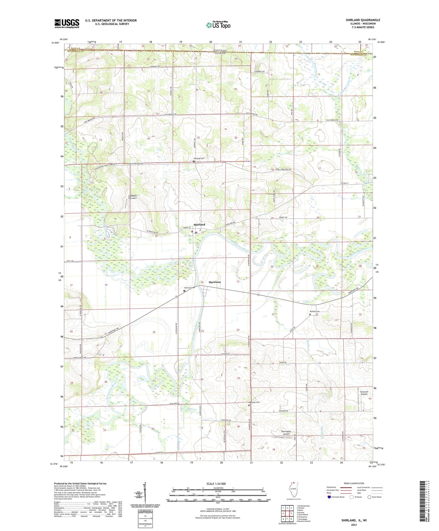
2024 topographic map quadrangle Shirland in the states of Illinois, Wisconsin. Scale: 1:24000. Based on the newly updated USGS 7.5' US Topo map series, this map is in the following counties: Winnebago, Rock. The map contains contour data, water features, and other items you are used to seeing on USGS maps, but also has updated roads and other features. This is the next generation of topographic maps. Printed on high-quality waterproof paper with UV fade-resistant inks.
Quads adjacent to this one:
West: Durand
Northwest: Brodhead East
North: Newark
Northeast: Beloit
East: South Beloit
Southeast: Rockford North
South: Winnebago
Southwest: Pecatonica
Contains the following named places: Bates School, Bennett School, Boys Farm School, Champion School, Colored Sands Bluff Nature Preserve, Colored Sands Forest Preserve, Darrington Airport, East Fork Raccoon Creek, Favor School, Harrison, Harrison Cemetery, Koch Airport, Leffingwell School, Loeppert CPL Aero, Meridian Cemetery, Otter Creek, Phelps School, Phillips Cemetery, Rhule Creek, Severson Airport, Shirland, Shirland Cemetery, Shirland Community Consolidated School, Shirland Post Office, Sugar River, Sugar River Forest Preserve, Sweet School, Timothy Creek, Township of Harrison, Township of Shirland, Tunnison Creek, Wilson School, Winnebago County Boys Reform School, Winnebago County Fire Protection District 1 Station 2, Youngs School, ZIP Codes: 61072, 61079