MyTopo
Durand Illinois US Topo Map
Couldn't load pickup availability
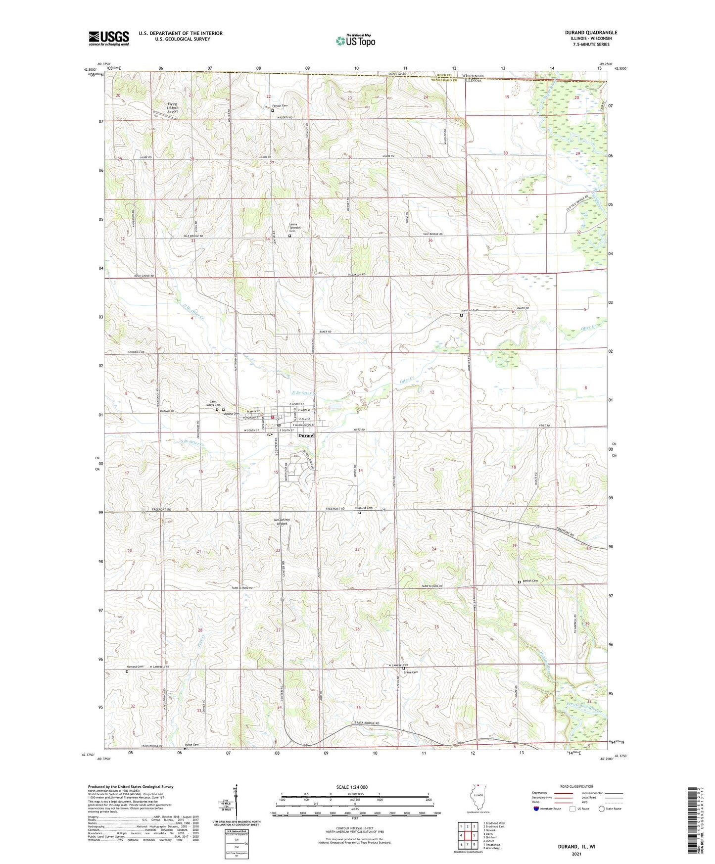
2024 topographic map quadrangle Durand in the states of Illinois, Wisconsin. Scale: 1:24000. Based on the newly updated USGS 7.5' US Topo map series, this map is in the following counties: Winnebago, Rock. The map contains contour data, water features, and other items you are used to seeing on USGS maps, but also has updated roads and other features. This is the next generation of topographic maps. Printed on high-quality waterproof paper with UV fade-resistant inks.
Quads adjacent to this one:
West: Davis
Northwest: Brodhead West
North: Brodhead East
Northeast: Newark
East: Shirland
Southeast: Winnebago
South: Pecatonica
Southwest: Ridott
Contains the following named places: Bethel Cemetery, Bethel Church, Cleveland School, Crane Cemetery, Crane School, Crow School, Dobson School, Dolan School, Durand, Durand Cemetery, Durand City Hall, Durand Fire Department, Durand High School, Durand Post Office, Durand United Methodist Church, Fairview School, Farm Quarry Number 110, Farmingdale School, Fenlon Cemetery, Fenton School, Flying Z Ranch Airport, Gilman School, Hanford Cemetery, Hartley Forest Preserve, Hartley Memorial Woods Nature Preserve, Howard Cemetery, Hulse Cemetery, Hungry Run, Laona Center School, Laona Heights Forest Preserve, Laona Heights Nature Preserve, Laona Post Office, Laona Township Cemetery, McCartney Airport, North Branch Otter Creek, Oakland Cemetery, Raymond E Laube Airport, Saint Marys Cemetery, South Branch Otter Creek, Sugar River Alder Nature Preserve, Sweet School, Township of Durand, Township of Laona, Tyler Post Office, Union Church, Union School, Village of Durand, ZIP Code: 61024