MyTopo
Brodhead East Wisconsin US Topo Map
Couldn't load pickup availability
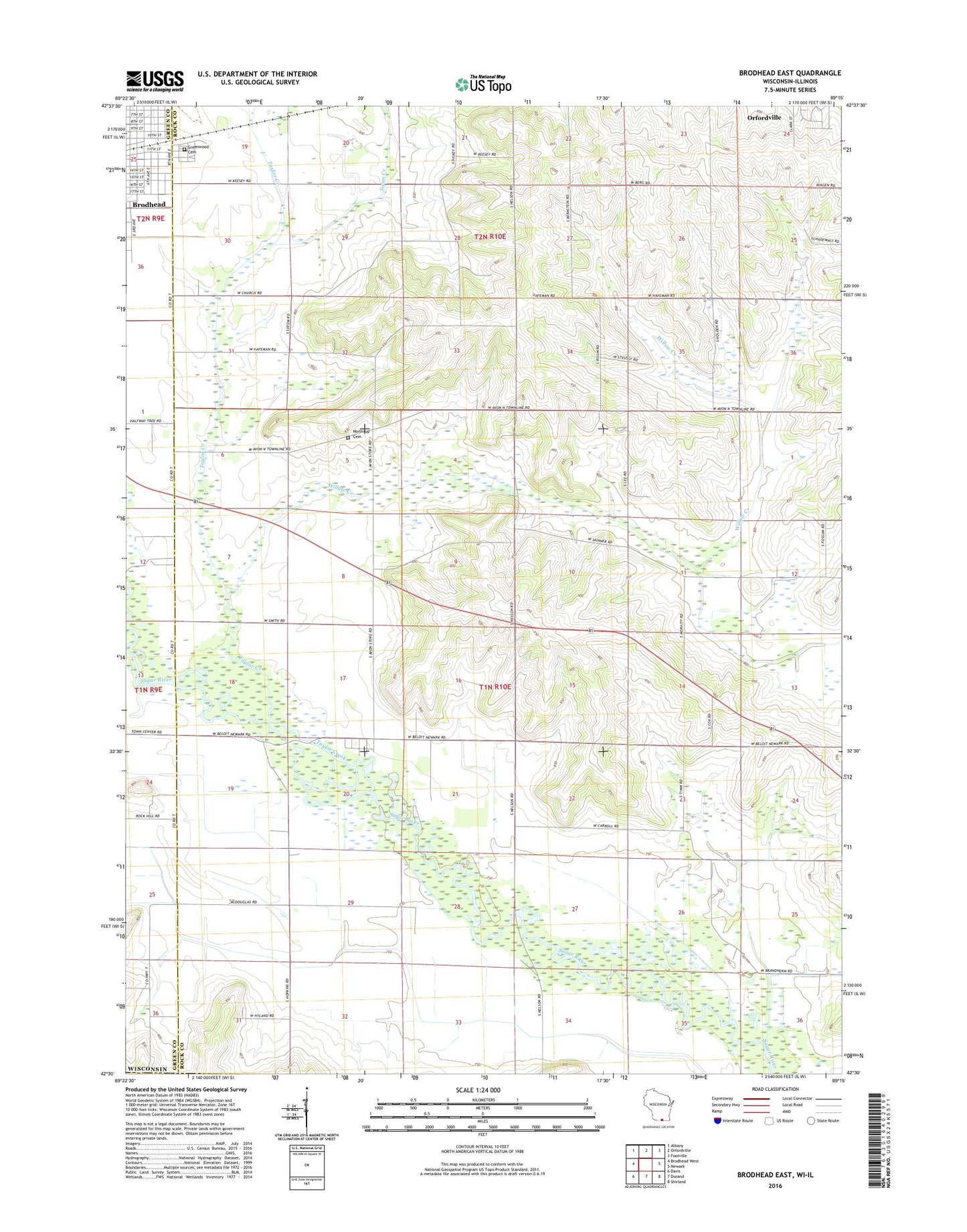
2022 topographic map quadrangle Brodhead East in the state of Wisconsin. Scale: 1:24000. Based on the newly updated USGS 7.5' US Topo map series, this map is in the following counties: Rock, Green, Winnebago. The map contains contour data, water features, and other items you are used to seeing on USGS maps, but also has updated roads and other features. This is the next generation of topographic maps. Printed on high-quality waterproof paper with UV fade-resistant inks.
Quads adjacent to this one:
West: Brodhead West
Northwest: Albany
North: Orfordville
Northeast: Footville
East: Newark
Southeast: Shirland
South: Durand
Southwest: Davis
This map covers the same area as the classic USGS quad with code o42089e3.
Contains the following named places: Avon, Avon Bottoms State Natural Area, Avon Church, Barr School, Greenwood Cemetery, Northrup Cemetery, Swan Creek, Swenson Wet Prairie State Natural Area, Taylor Creek, Town of Avon, Walnut Wash Airport, West Luther Valley Church, Willow Creek, ZIP Code: 53520