MyTopo
Stolletown Illinois US Topo Map
Couldn't load pickup availability
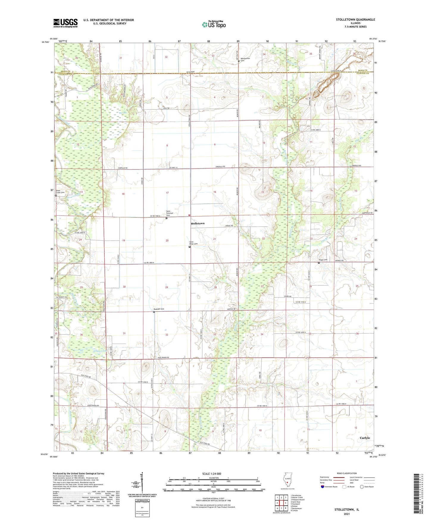
2024 topographic map quadrangle Stolletown in the state of Illinois. Scale: 1:24000. Based on the newly updated USGS 7.5' US Topo map series, this map is in the following counties: Clinton, Bond. The map contains contour data, water features, and other items you are used to seeing on USGS maps, but also has updated roads and other features. This is the next generation of topographic maps. Printed on high-quality waterproof paper with UV fade-resistant inks.
Quads adjacent to this one:
West: Saint Rose
Northwest: Pocahontas
North: Beaver Creek
Northeast: Pleasant Mound
East: Keyesport
Southeast: Carlyle
South: Beckemeyer
Southwest: Breese
This map covers the same area as the classic USGS quad with code o38089f4.
Contains the following named places: Beckemeyer Dairy Farm, Big Lake, Carlyle Airpark, Carlyle North Oil Field, Carlyle Oil Field, Diekemper Dairy, Flat Branch, Ford School, Frogtown, Frogtown Lake, Frogtown North Oil Field, Hull School, Kell School, Keyesport Pit, Lower Ford School, Miller School, Rudolph Cemetery, Saint Felicitas Cemetery, Saint Felicitas Church, Saint Peter Cemetery, SchwierJohn School, Shoal Creek Cemetery, Sparks Post Office, Stolletown, The Mound Church, The Mound School, Township of Wheatfield, Weinheimer Cemetery, Wheatfield Township Fire Protection District, Yingst Cemetery