MyTopo
Keyesport Illinois US Topo Map
Couldn't load pickup availability
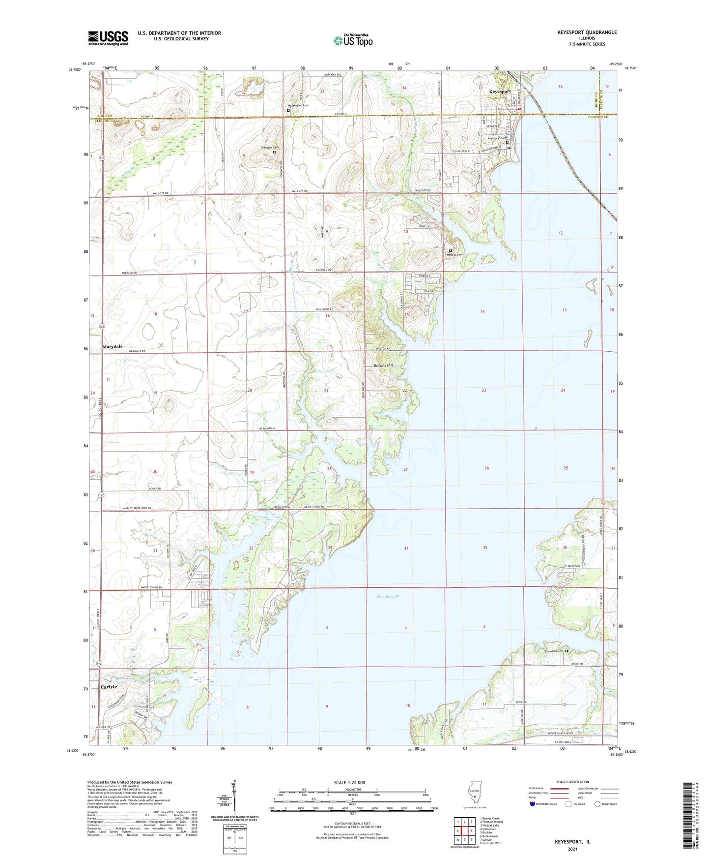
2024 topographic map quadrangle Keyesport in the state of Illinois. Scale: 1:24000. Based on the newly updated USGS 7.5' US Topo map series, this map is in the following counties: Clinton, Bond, Fayette. The map contains contour data, water features, and other items you are used to seeing on USGS maps, but also has updated roads and other features. This is the next generation of topographic maps. Printed on high-quality waterproof paper with UV fade-resistant inks.
Quads adjacent to this one:
West: Stolletown
Northwest: Beaver Creek
North: Pleasant Mound
Northeast: Wildcat Lake
East: Boulder
Southeast: Centralia West
South: Carlyle
Southwest: Beckemeyer
This map covers the same area as the classic USGS quad with code o38089f3.
Contains the following named places: Allen Branch, Beaver Creek Oil Field, Beaver Creek South Oil and Gas Field, Browns Hill, Browns School, Carlyle Lake, Carrillon Airport, Center Lake, Clear Lake, Club Lake, Coles Creek, Coles Creek Access Area, Coles Lake, Crappie Cove Picnic Area, Crosskey Lake, Dam West Marina, Deer Run Picnic Area, East Union School, Elmwood Cemetery, Gillespie Cemetery, Greene Lake, Harbor Light Bay, Hazlet State Park, Hickory Hollow Camping Area, Hopewell Church, Horseshoe Lake, Illini Campground, Keyesport, Keyesport Access Area, Keyesport Cemetery, Keyesport Fire Protection District, Keyesport Marina, Keyesport Oil Field, Keyesport Post Office, Keysport Branch, Lower Irishtown School, Marydale, McKendree Cemetery, McKendree Chapel, McMillian Lake, McNeill Cemetery, North Harbor, Oakgrove School, Osage Youth Group Campground, Ottawa Picnic Area, Panorama Hills, Parent Lake, Saddle Dam Number 3, Sycamore Lake, Township of Irishtown, Village of Keyesport, Walcott Lake, West Access Area, West Irishtown School, West Union School, Whites School