MyTopo
Beaver Creek Illinois US Topo Map
Couldn't load pickup availability
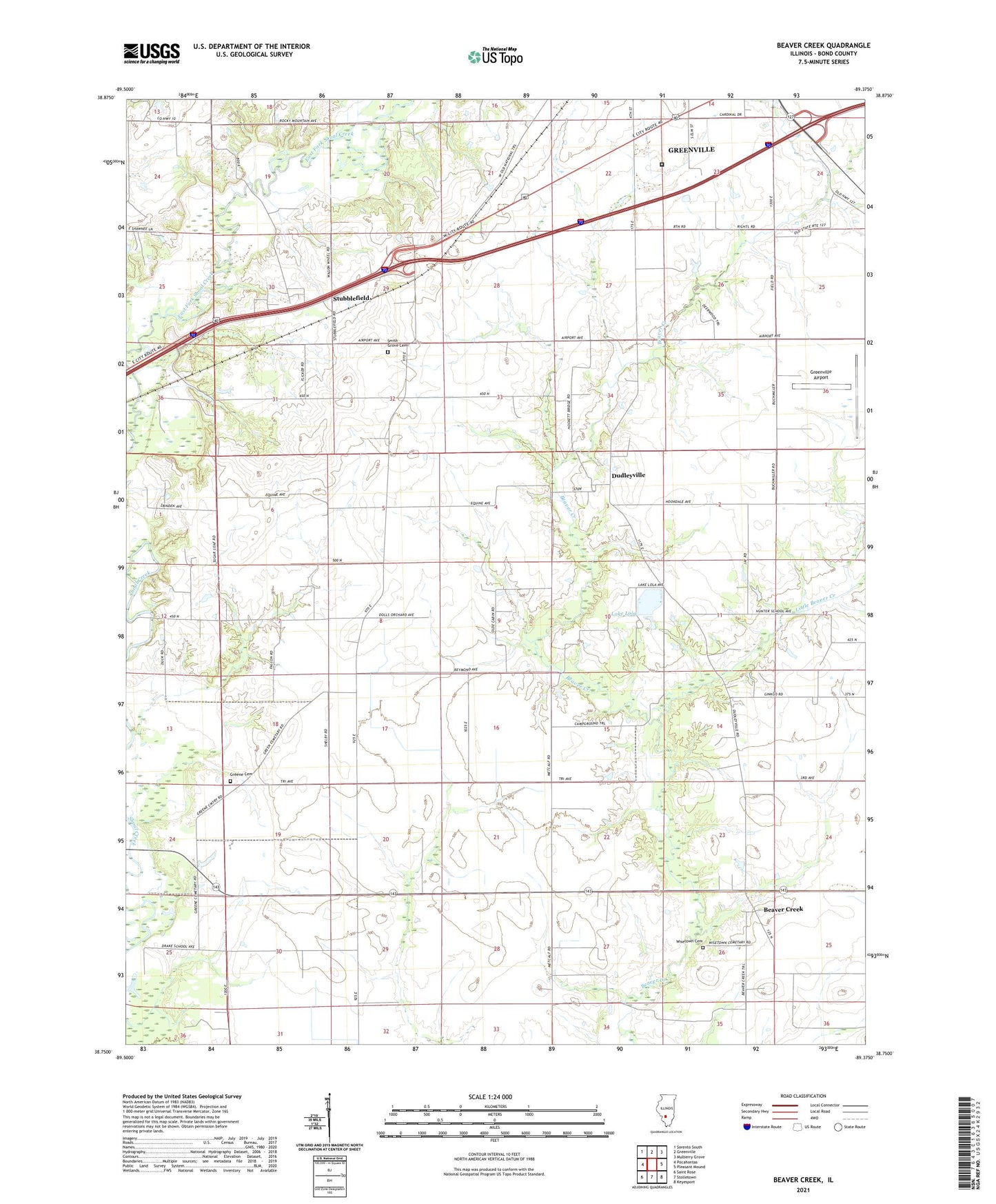
2024 topographic map quadrangle Beaver Creek in the state of Illinois. Scale: 1:24000. Based on the newly updated USGS 7.5' US Topo map series, this map is in the following counties: Bond. The map contains contour data, water features, and other items you are used to seeing on USGS maps, but also has updated roads and other features. This is the next generation of topographic maps. Printed on high-quality waterproof paper with UV fade-resistant inks.
Quads adjacent to this one:
West: Pocahontas
Northwest: Sorento South
North: Greenville
Northeast: Mulberry Grove
East: Pleasant Mound
Southeast: Keyesport
South: Stolletown
Southwest: Saint Rose
This map covers the same area as the classic USGS quad with code o38089g4.
Contains the following named places: Beaver Creek, Campground Church, Drake School, Dudleyville, East Fork Shoal Creek, Federal Correctional Institution Greenville, Greene Cemetery, Harris School, Hunter School, Lake Lola, Lindly School, Little Beaver Creek, Marcoot Jersey Farm, Metcalf School, Mount Carmel Church, Potts School, Ready View Farms, Rolling Lawns Farms, Shawnee School, Shoal Creek Farm, Shoal School, Smith Grove Cemetery, Smith Grove Church, Smith Grove School, Stubblefield, Stubblefield Gas Storage Field, Township of Central, Township of Mills, Wisetown Cemetery