MyTopo
Sutter Illinois US Topo Map
Couldn't load pickup availability
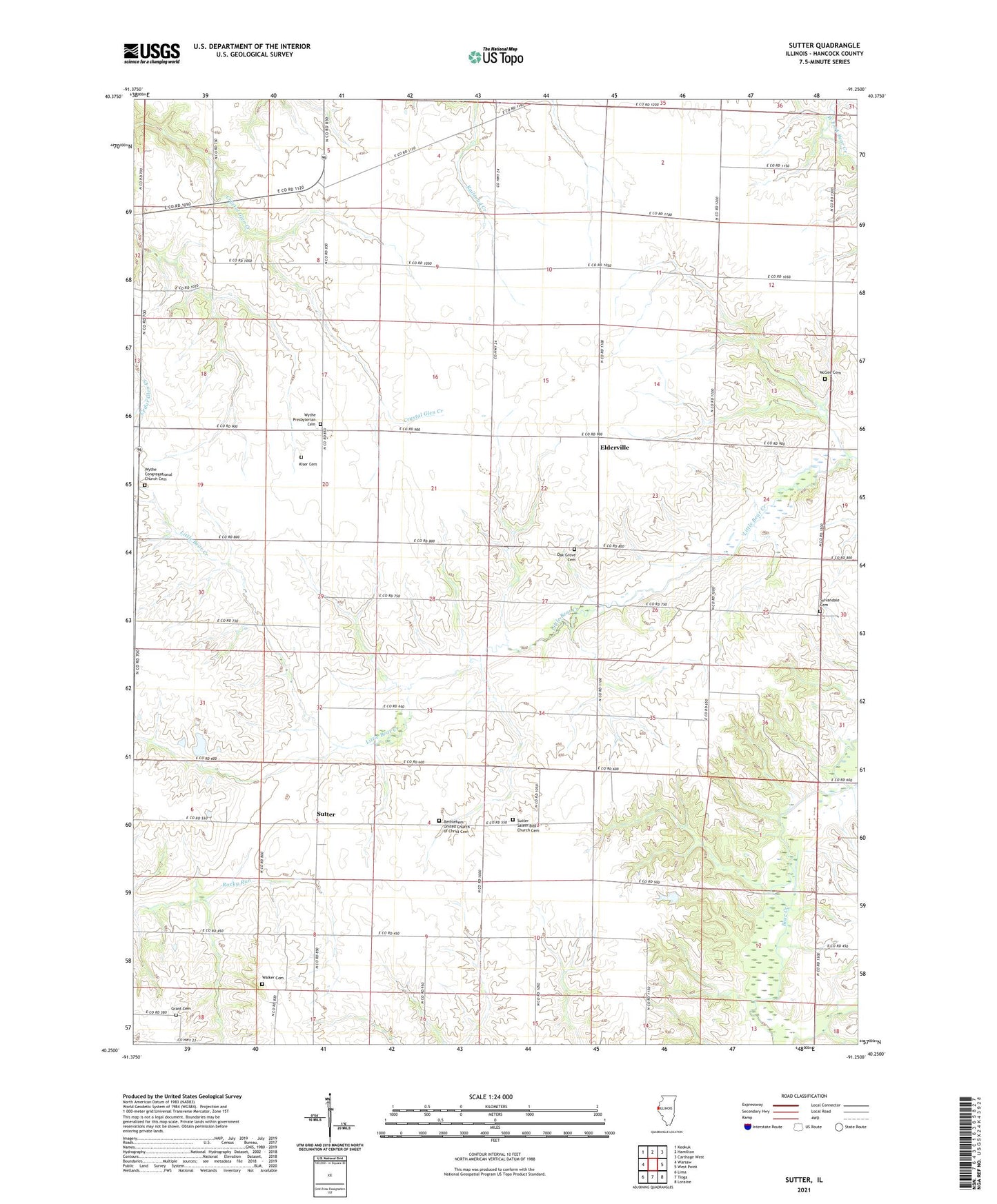
2024 topographic map quadrangle Sutter in the state of Illinois. Scale: 1:24000. Based on the newly updated USGS 7.5' US Topo map series, this map is in the following counties: Hancock. The map contains contour data, water features, and other items you are used to seeing on USGS maps, but also has updated roads and other features. This is the next generation of topographic maps. Printed on high-quality waterproof paper with UV fade-resistant inks.
Quads adjacent to this one:
West: Warsaw
Northwest: Keokuk
North: Hamilton
Northeast: Carthage West
East: West Point
Southeast: Loraine
South: Tioga
Southwest: Lima
This map covers the same area as the classic USGS quad with code o40091c3.
Contains the following named places: Bethlehem Church, Bethlehem United Church of Christ Cemetery, Elderville, Elm Grove School, Excelsior School, Froggy School, Grant Cemetery, Harmony School, McGee Cemetery, Mount Vernon School, Oak Grove School, Orange School, Prairie School, Salem Church, Sutter, Sutter Salem Bible Church Cemetery, Sylvandale School, Township of Wythe, Walker Cemetery, Walnut Grove School, WCAZ-AM (Carthage), Wythe Congregational Church Cemetery, Wythe Presbyterian Cemetery, Wythe School