MyTopo
West Point Illinois US Topo Map
Couldn't load pickup availability
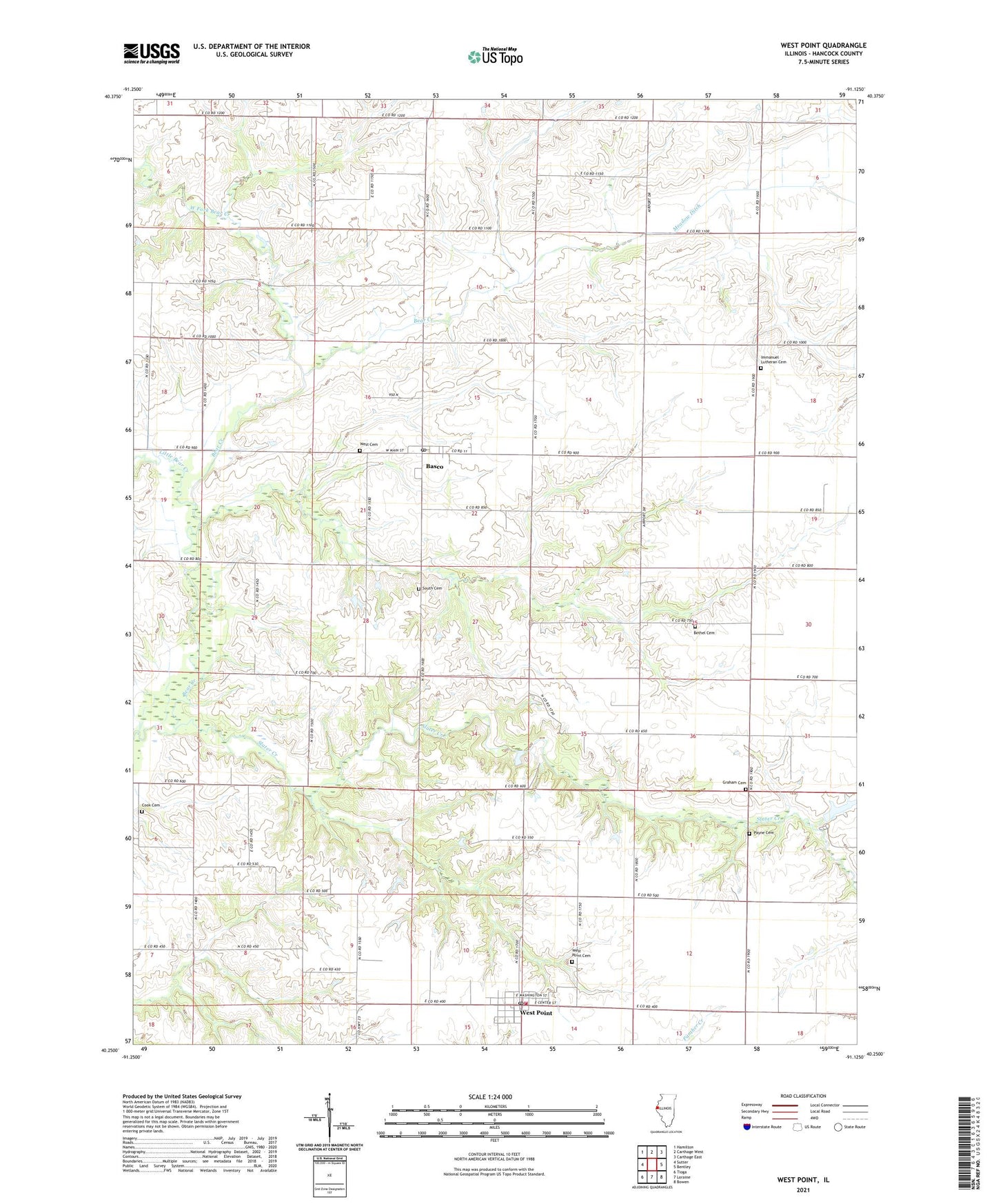
2024 topographic map quadrangle West Point in the state of Illinois. Scale: 1:24000. Based on the newly updated USGS 7.5' US Topo map series, this map is in the following counties: Hancock. The map contains contour data, water features, and other items you are used to seeing on USGS maps, but also has updated roads and other features. This is the next generation of topographic maps. Printed on high-quality waterproof paper with UV fade-resistant inks.
Quads adjacent to this one:
West: Sutter
Northwest: Hamilton
North: Carthage West
Northeast: Carthage East
East: Bentley
Southeast: Bowen
South: Loraine
Southwest: Tioga
This map covers the same area as the classic USGS quad with code o40091c2.
Contains the following named places: Apple Grove School, Basco, Basco Post Office, Bethel Cemetery, Brush School, Cook Cemetery, German School, Graham Cemetery, Hayes School, Hazel Dell School, Immanuel Church, Immanuel Lutheran Cemetery, Knott School, Little Bear Creek, Meadow Ditch, Payne Cemetery, Pierce Park, Slater Creek, South Cemetery, Temperance School, Township of Bear Creek, Union School, Village of Basco, Village of West Point, West Cemetery, West Fork Bear Creek, West Point, West Point Cemetery, West Point Fire Station, West Point Post Office, ZIP Code: 62313