MyTopo
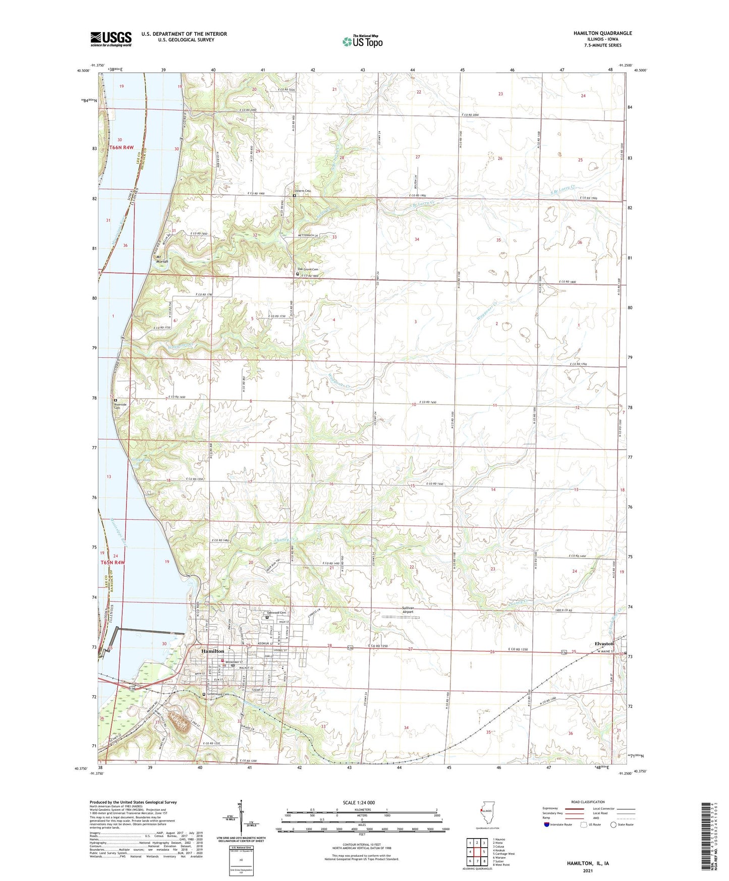
Hamilton Illinois US Topo Map
Couldn't load pickup availability
2024 topographic map quadrangle Hamilton in the state of Illinois. Scale: 1:24000. Based on the newly updated USGS 7.5' US Topo map series, this map is in the following counties: Hancock, Lee. The map contains contour data, water features, and other items you are used to seeing on USGS maps, but also has updated roads and other features. This is the next generation of topographic maps. Printed on high-quality waterproof paper with UV fade-resistant inks.
Quads adjacent to this one:
West: Keokuk
Northwest: Nauvoo
North: Niota
Northeast: Colusa
East: Carthage West
Southeast: West Point
South: Sutter
Southwest: Warsaw
This map covers the same area as the classic USGS quad with code o40091d3.
Contains the following named places: Bethel Presbyterian Church, Chaney Creek, City of Hamilton, Crystal Glen Creek, Elvaston Post Office, Eureka School, Fairview School, First Christian Church, Gibralter School, Golden Point School, Goldens Point Church, Gray Quarry, Grays Bay, Greenwood Cemetery, Hamilton, Hamilton Fire Department, Hamilton High School, Hamilton Police Department, Hamilton Post Office, Hyndman School, Keokuk Dam, KOKX-AM (Keokuk), Larry Creek, Larry School, Leyman School, Lock and Dam Number Nineteen, Lock Number 19, Mississippi Lock Number 019, Montebello State Park, Mount Moriah, North Branch Larry Creek, Oak Grove Cemetery, Oakwood Cemetery, Pool 19, Railroad Creek, Riverview School, Saint Marys Catholic Church, Sanobia Church, Sonora, South Branch Larry Creek, Stearns Cemetery, Sullivan Airport, Township of Montebello, Waggoner Creek, Washington School, Wildcat Springs Park, ZIP Code: 62341