MyTopo
Tonica Illinois US Topo Map
Couldn't load pickup availability
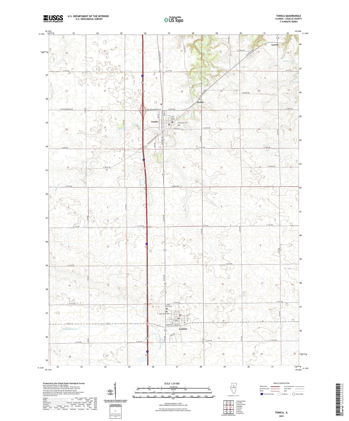
2024 topographic map quadrangle Tonica in the state of Illinois. Scale: 1:24000. Based on the newly updated USGS 7.5' US Topo map series, this map is in the following counties: LaSalle. The map contains contour data, water features, and other items you are used to seeing on USGS maps, but also has updated roads and other features. This is the next generation of topographic maps. Printed on high-quality waterproof paper with UV fade-resistant inks.
Quads adjacent to this one:
West: McNabb
Northwest: Spring Valley
North: La Salle
Northeast: Starved Rock
East: Leonore
Southeast: Long Point
South: Wenona
Southwest: Varna
This map covers the same area as the classic USGS quad with code o41089b1.
Contains the following named places: Alleman Lake, Alleman Lake Dam, Ashley Farms Landing Strip, Burgess School, Eden Center School, Fairview Cemetery, Foote School, Hope Center School, Hope Town Cemetery, Hull School, Janusick Airport, Knapp School, Lostant, Lostant Ambulance, Lostant Community Fire Protection District, Lostant Elementary School, Lostant Post Office, Old Tonica Cemetery, Pflibsen School, Pitts School, Prairie Center School, Saint John's Cemetery, Ticona, Tonica, Tonica Grade School, Tonica Post Office, Tonica Volunteer Fire Department, Township of Eden, Township of Hope, Township of Richland, Trout School, Village of Lostant, Village of Tonica, ZIP Codes: 61334, 61370