MyTopo
Wataga Illinois US Topo Map
Couldn't load pickup availability
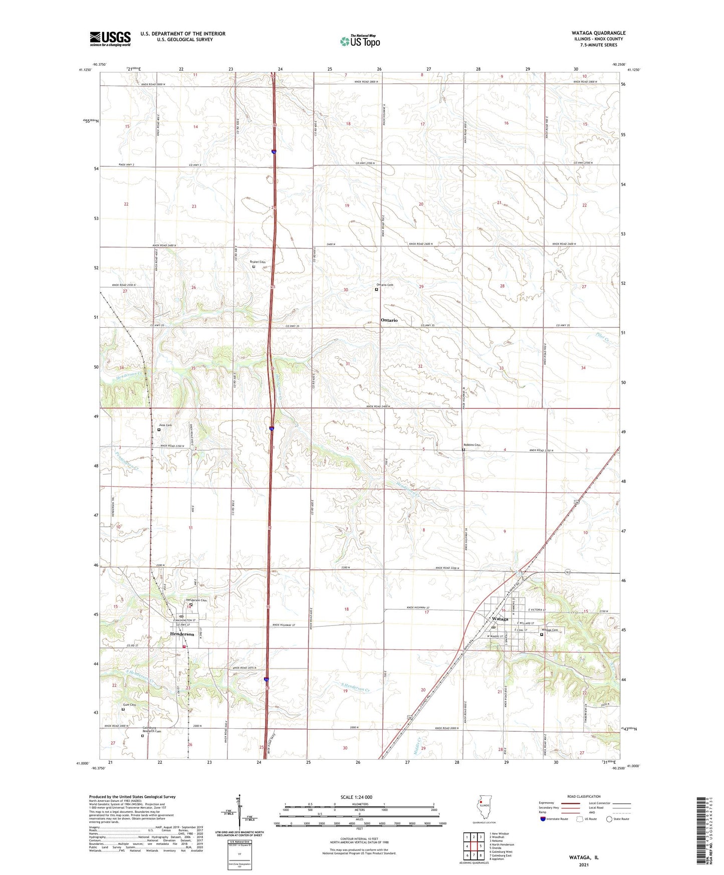
2024 topographic map quadrangle Wataga in the state of Illinois. Scale: 1:24000. Based on the newly updated USGS 7.5' US Topo map series, this map is in the following counties: Knox. The map contains contour data, water features, and other items you are used to seeing on USGS maps, but also has updated roads and other features. This is the next generation of topographic maps. Printed on high-quality waterproof paper with UV fade-resistant inks.
Quads adjacent to this one:
West: North Henderson
Northwest: New Windsor
North: Woodhull
Northeast: Nekoma
East: Oneida
Southeast: Appleton
South: Galesburg East
Southwest: Galesburg West
This map covers the same area as the classic USGS quad with code o41090a3.
Contains the following named places: Bruner Cemetery, Centennial School, Condra School, Galesburg Research Cemetery, Gum Cemetery, Henderson, Henderson Cemetery, Henderson Post Office, Henderson Township Fire Protection District, Johnson Landing Strip, Junk Cemetery, Military School, Ontario, Ontario Cemetery, Robbins Cemetery, Robbins School, Rowe School, Sunrise School, Talbot School, Township of Ontario, Township of Sparta, Village of Henderson, Village of Wataga, Washington School, Wataga, Wataga Cemetery, Wataga Elementary School, Wataga Fire Department, Wataga Post Office, ZIP Codes: 61439, 61488