MyTopo
Woodhull Illinois US Topo Map
Couldn't load pickup availability
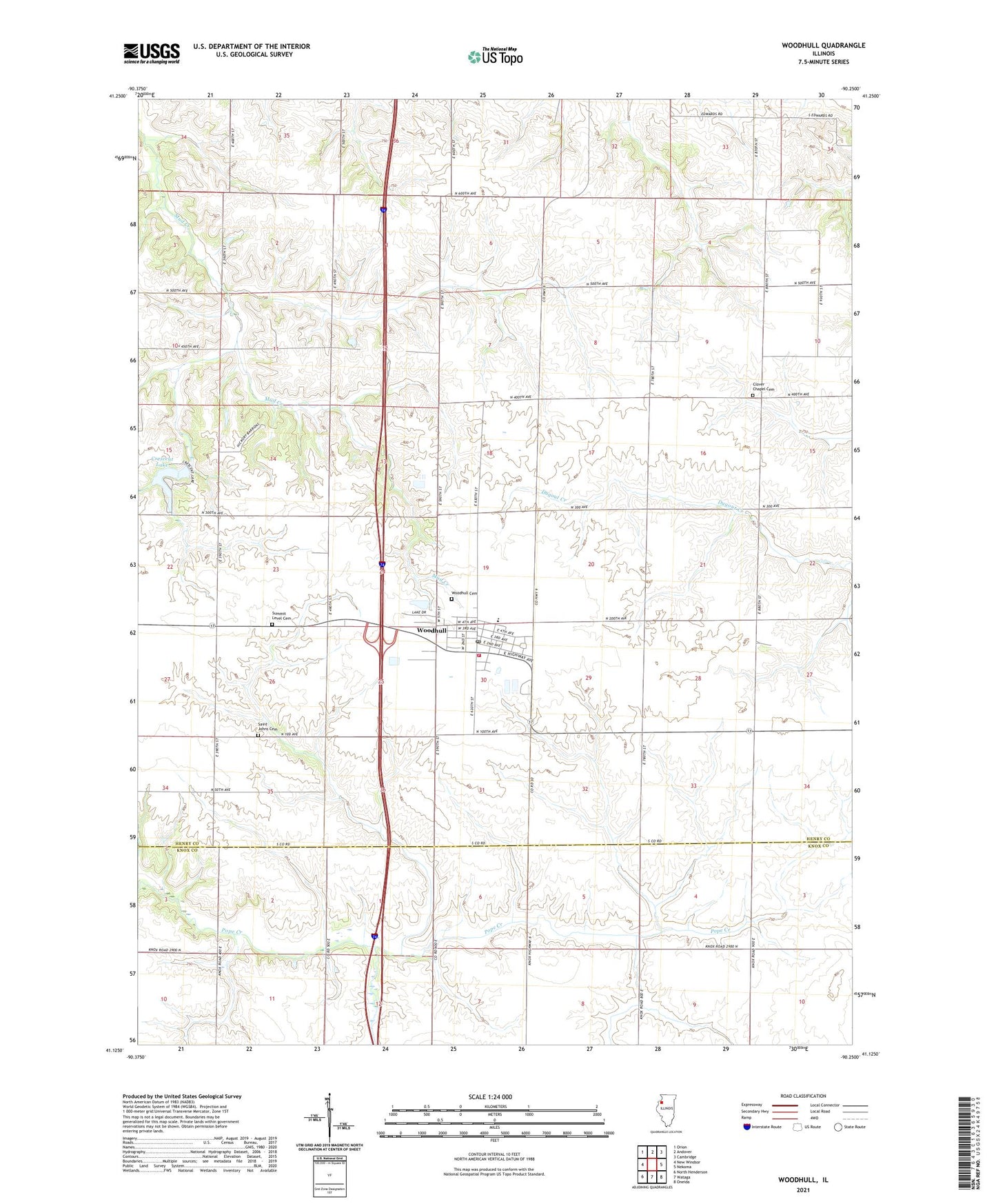
2024 topographic map quadrangle Woodhull in the state of Illinois. Scale: 1:24000. Based on the newly updated USGS 7.5' US Topo map series, this map is in the following counties: Henry, Knox. The map contains contour data, water features, and other items you are used to seeing on USGS maps, but also has updated roads and other features. This is the next generation of topographic maps. Printed on high-quality waterproof paper with UV fade-resistant inks.
Quads adjacent to this one:
West: New Windsor
Northwest: Orion
North: Andover
Northeast: Cambridge
East: Nekoma
Southeast: Oneida
South: Wataga
Southwest: North Henderson
This map covers the same area as the classic USGS quad with code o41090b3.
Contains the following named places: Alwood High School, Bethany Lutheran Church, Center School, Clover Chapel Cemetery, Clover Chapel Church, Clover Township Fire Protection District, Crescent Lake, Crescent Lake Dam, Doyle School, Fairplay School, Franklin School, Kansas School, Maple Valley School, Saint Johns Cemetery, Saint Johns Church, Stickney School, Summit Level Cemetery, Township of Clover, Tri - County Ambulance District, United Church of Woodhull, United Presbyterian Church, Village of Woodhull, White School, Woodhull, Woodhull Cemetery, Woodhull Post Office, Woodhull Town Hall, ZIP Codes: 61413, 61490