MyTopo
North Henderson Illinois US Topo Map
Couldn't load pickup availability
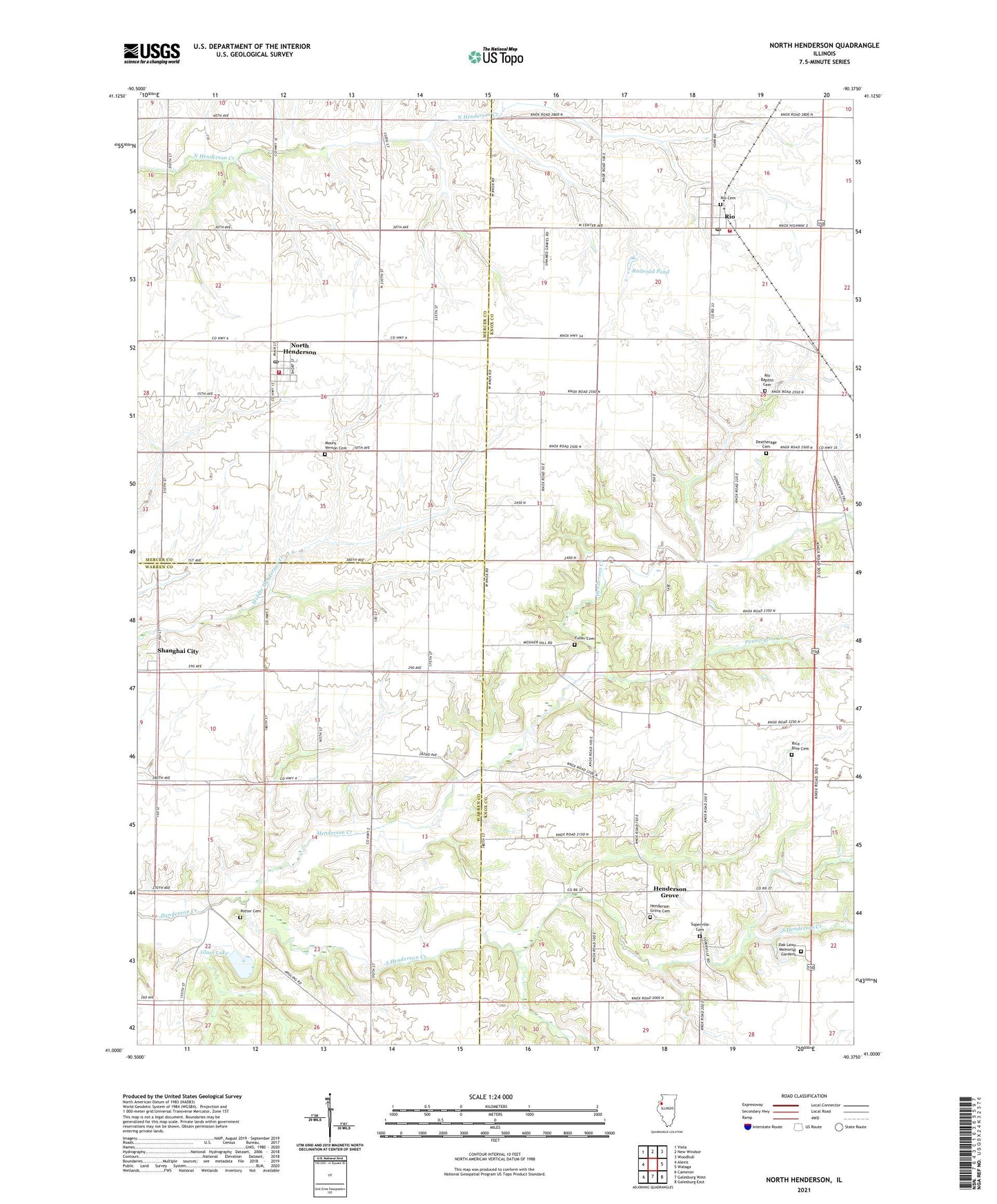
2024 topographic map quadrangle North Henderson in the state of Illinois. Scale: 1:24000. Based on the newly updated USGS 7.5' US Topo map series, this map is in the following counties: Knox, Warren, Mercer. The map contains contour data, water features, and other items you are used to seeing on USGS maps, but also has updated roads and other features. This is the next generation of topographic maps. Printed on high-quality waterproof paper with UV fade-resistant inks.
Quads adjacent to this one:
West: Alexis
Northwest: Viola
North: New Windsor
Northeast: Woodhull
East: Wataga
Southeast: Galesburg East
South: Galesburg West
Southwest: Cameron
This map covers the same area as the classic USGS quad with code o41090a4.
Contains the following named places: Alexis North Henderson Ambulance Service, Deatherage Cemetery, Ernest E Orwig Airport, Ethel School, Forest Flower School, Fuller Cemetery, Glass Lake, Greenleaf School, Henderson Grove, Henderson Grove Cemetery, Henderson Grove Grange, Mount Joy School, Mount Vernon Cemetery, Mount Vernon School, New Salem School, North Henderson, North Henderson Fire Department, North Henderson Post Office, Oak Lawn Memorial Gardens, Pennington Creek, Pleasant Grove School, Potter Cemetery, Prairie Flower School, Railroad Pond, Rice - Blue Cemetery, Rio, Rio Baptist Cemetery, Rio Cemetery, Rio Elementary School, Rio Fire Department, Rio Post Office, Shanghai City, Soperville, Soperville Cemetery, South Henderson Creek, Starr School, Township of Henderson, Township of Kelly, Township of North Henderson, Township of Rio, Tri - County Ambulance District, Union School, Village of North Henderson, Village of Rio, ZIP Codes: 61466, 61472