MyTopo
Bement Illinois US Topo Map
Couldn't load pickup availability
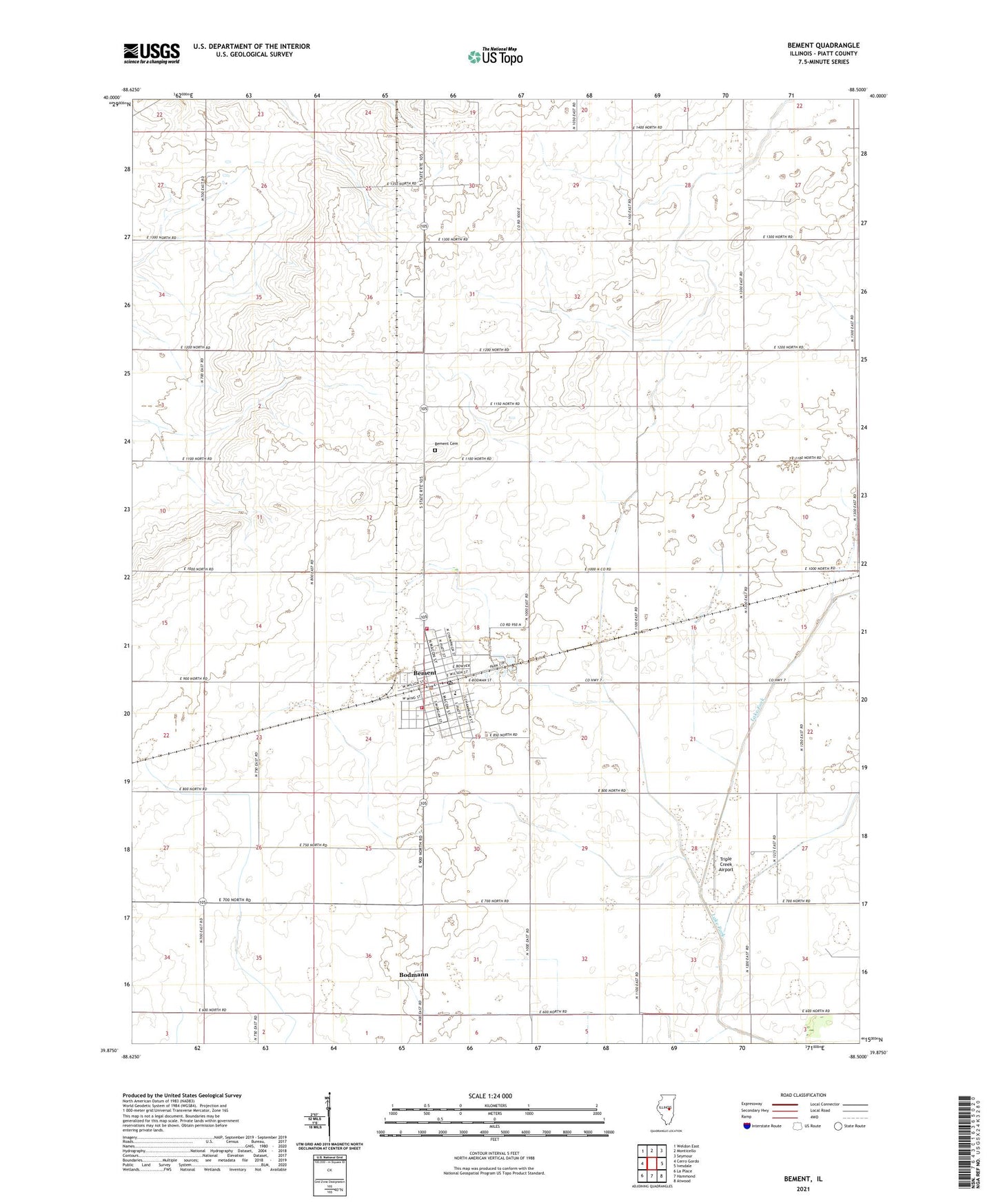
2024 topographic map quadrangle Bement in the state of Illinois. Scale: 1:24000. Based on the newly updated USGS 7.5' US Topo map series, this map is in the following counties: Piatt. The map contains contour data, water features, and other items you are used to seeing on USGS maps, but also has updated roads and other features. This is the next generation of topographic maps. Printed on high-quality waterproof paper with UV fade-resistant inks.
Quads adjacent to this one:
West: Cerro Gordo
Northwest: Weldon East
North: Monticello
Northeast: Seymour
East: Ivesdale
Southeast: Atwood
South: Hammond
Southwest: La Place
This map covers the same area as the classic USGS quad with code o39088h5.
Contains the following named places: Bartram Landing Strip, Bement, Bement Baptist Church, Bement Cemetery, Bement County Forest Preserve, Bement Elementary School, Bement Fire Protection District Station 1, Bement Fire Protection District Station 2, Bement High School, Bement Police Department, Bement Post Office, Bement United Methodist Church, Bodmann, Church of God, First Christian Church, First Presbyterian Church, Piatt, Saint Michaels Roman Catholic Church, Township of Bement, Triple Creek Airport, Village of Bement, ZIP Code: 61813