MyTopo
Churubusco Indiana US Topo Map
Couldn't load pickup availability
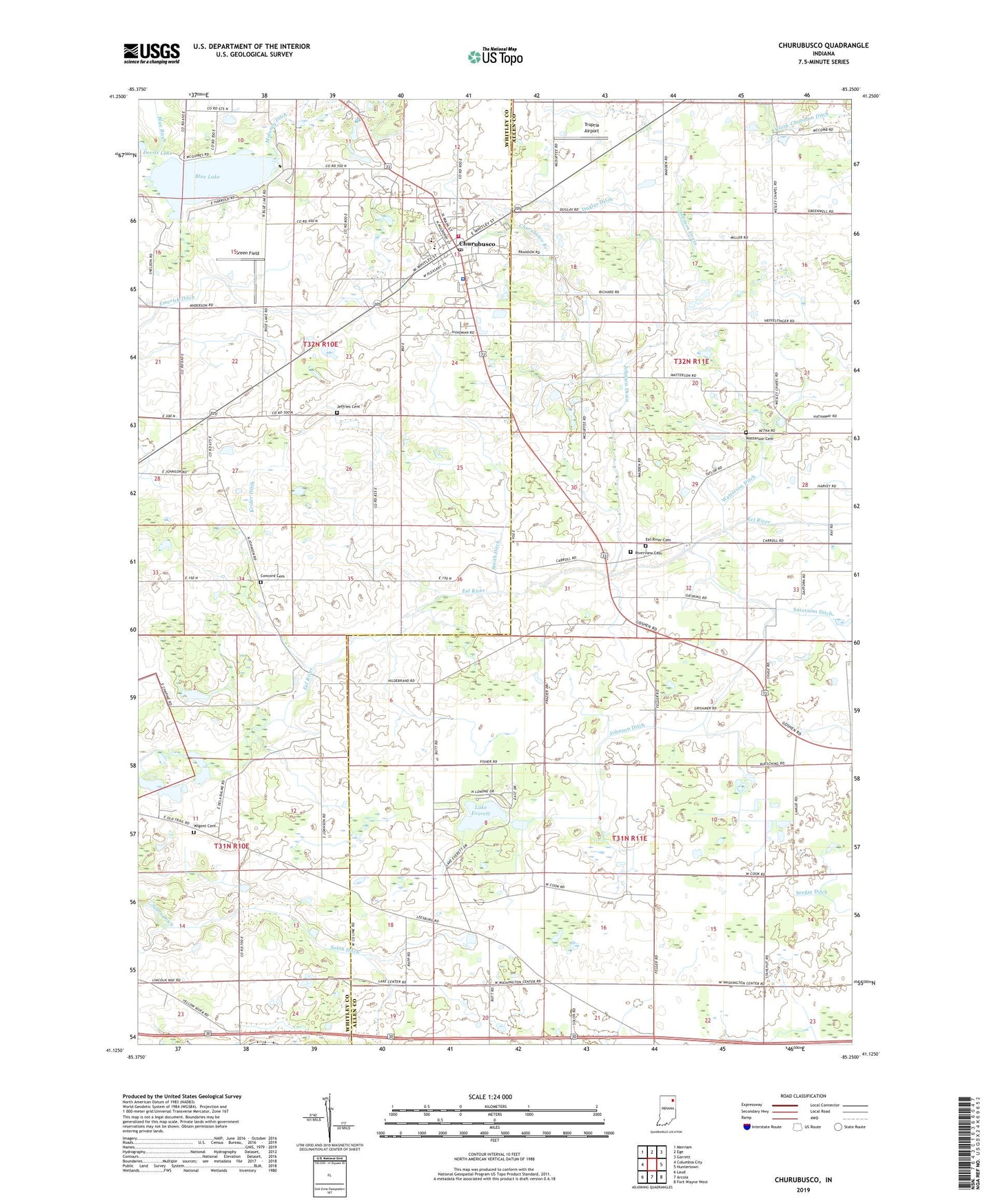
2022 topographic map quadrangle Churubusco in the state of Indiana. Scale: 1:24000. Based on the newly updated USGS 7.5' US Topo map series, this map is in the following counties: Allen, Whitley. The map contains contour data, water features, and other items you are used to seeing on USGS maps, but also has updated roads and other features. This is the next generation of topographic maps. Printed on high-quality waterproof paper with UV fade-resistant inks.
Quads adjacent to this one:
West: Columbia City
Northwest: Merriam
North: Ege
Northeast: Garrett
East: Huntertown
Southeast: Fort Wayne West
South: Arcola
Southwest: Laud
This map covers the same area as the classic USGS quad with code o41085b3.
Contains the following named places: Blue Lake, Churubusco, Churubusco Branch, Churubusco Police Department, Churubusco Post Office, Concord Cemetery, Devils Lake, Duglay Ditch, Eel River Cemetery, Eel River Church, Emerick Ditch, Green Field, Jeffries Cemetery, Johnson Ditch, Johnson Drain, Krider Ditch, Lake Chapel, Lake Everett, Levert, Maloney Ditch, Pleasant Hill Church, Riverview Cemetery, Smith Ditch, Smith Township Fire Department, Sutorious Ditch, Town of Churubusco, Township of Eel River, Township of Lake, Township of Smith, Tropria Airport, Watterson Cemetery, Watterson Ditch, Wesley Chapel, Whitley County Emergency Medical Services, Wigent Cemetery, ZIP Codes: 46723, 46818