MyTopo
Laud Indiana US Topo Map
Couldn't load pickup availability
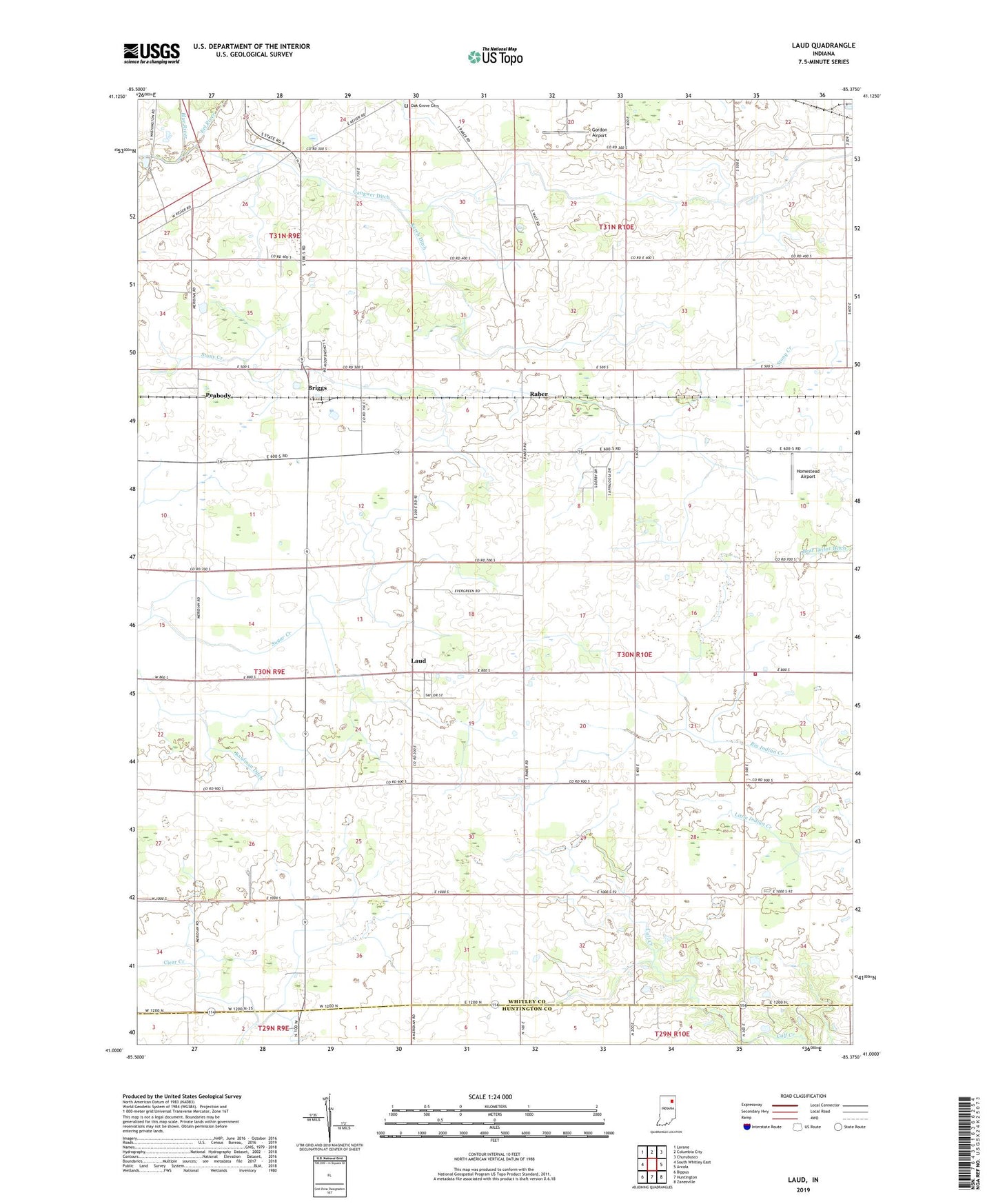
2022 topographic map quadrangle Laud in the state of Indiana. Scale: 1:24000. Based on the newly updated USGS 7.5' US Topo map series, this map is in the following counties: Whitley, Huntington. The map contains contour data, water features, and other items you are used to seeing on USGS maps, but also has updated roads and other features. This is the next generation of topographic maps. Printed on high-quality waterproof paper with UV fade-resistant inks.
Quads adjacent to this one:
West: South Whitley East
Northwest: Lorane
North: Columbia City
Northeast: Churubusco
East: Arcola
Southeast: Zanesville
South: Huntington
Southwest: Bippus
This map covers the same area as the classic USGS quad with code o41085a4.
Contains the following named places: Blue River, Briggs, Evergreen Church, Gangwer Ditch, Gordon Airport, Homestead Airport, Jefferson Center School, Jefferson Chapel, Jefferson Township Fire Department, Kaufman Ditch, Kerch Ditch, Laud, Oak Grove Cemetery, Peabody, Raber, Township of Jefferson