MyTopo
English Indiana US Topo Map
Couldn't load pickup availability
Also explore the English Forest Service Topo of this same quad for updated USFS data
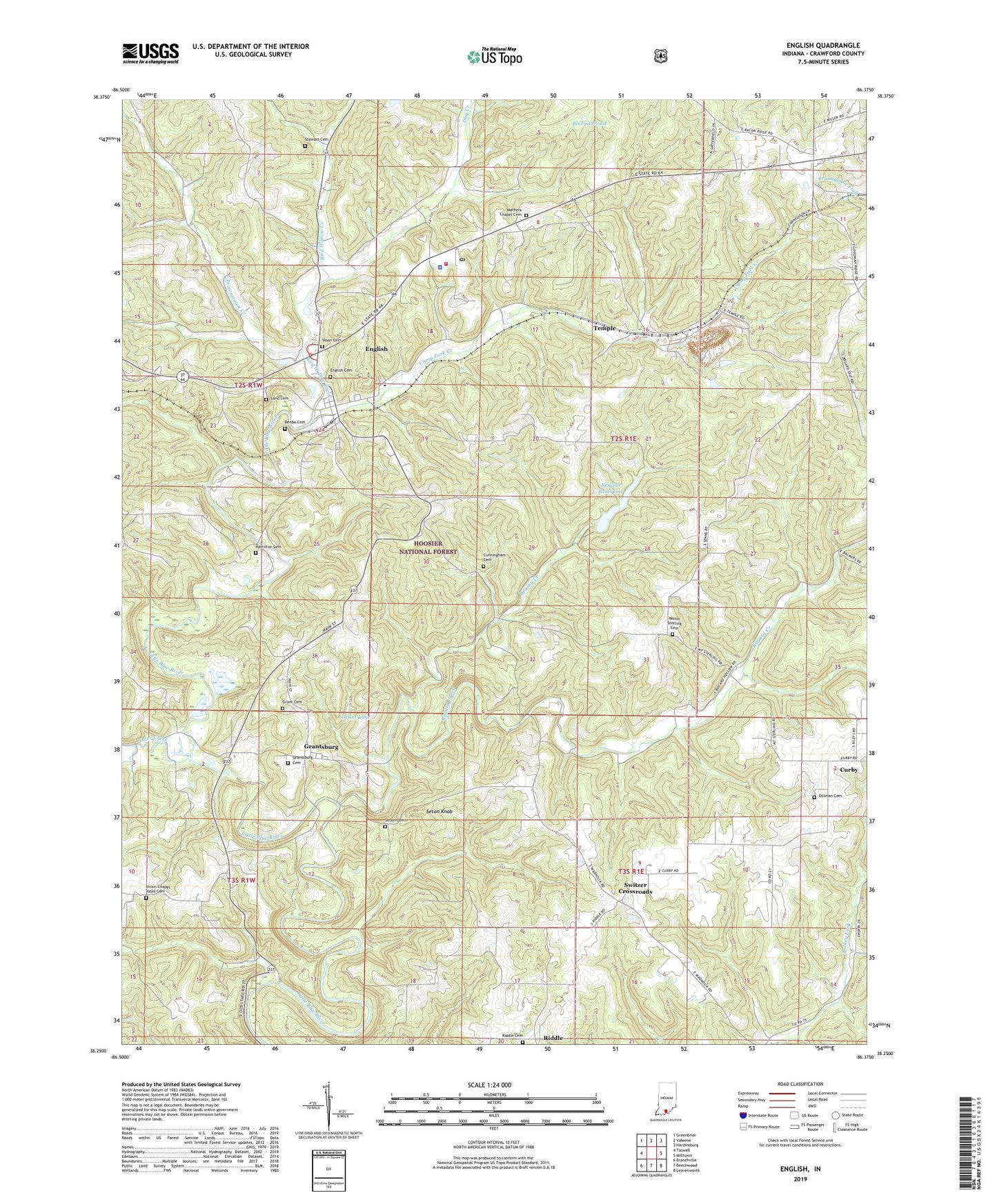
2022 topographic map quadrangle English in the state of Indiana. Scale: 1:24000. Based on the newly updated USGS 7.5' US Topo map series, this map is in the following counties: Crawford. The map contains contour data, water features, and other items you are used to seeing on USGS maps, but also has updated roads and other features. This is the next generation of topographic maps. Printed on high-quality waterproof paper with UV fade-resistant inks.
Quads adjacent to this one:
West: Taswell
Northwest: Greenbrier
North: Valeene
Northeast: Hardinsburg
East: Milltown
Southeast: Leavenworth
South: Beechwood
Southwest: Branchville
This map covers the same area as the classic USGS quad with code o38086c4.
Contains the following named places: Bird Hollow Creek, Bluegill Pond, Bogard Church, Bogard Creek, Brownstown Creek, Brushy Creek, Camp Fork Creek, Crawford County, Crawford County Emergency Medical Service, Crawford County Sheriff's Office, Cunningham Cemetery, Curby, Denbo Cemetery, Dillman Cemetery, Dillman Church, Dog Creek, English, English Cemetery, English Post Office, English Reservoir, English School, English Volunteer Fire Department, English Water Supply Dam, Grant Cemetery, Grant Lake, Grantsburg, Grantsburg Cemetery, Hamilton Cemetery, Hilands Overlook State Park, Land Cemetery, Mathers Chapel, Mathers Chapel Cemetery, Mount Sterling Cemetery, Mount Sterling Church, Otter Creek, Riddle, Riddle Cemetery, Roberson Airport, Rock Springs Church, Seton Cemetery, Seton Knob, Simpson Chapel, Sloan Cemetery, Stewart Cemetery, Switzer Crossroads, Temple, Temple Quarry, Town of English, Township of Sterling, Union Chapel, Union Chapel Yates Cemetery, ZIP Codes: 47118, 47123