MyTopo
Leavenworth Indiana US Topo Map
Couldn't load pickup availability
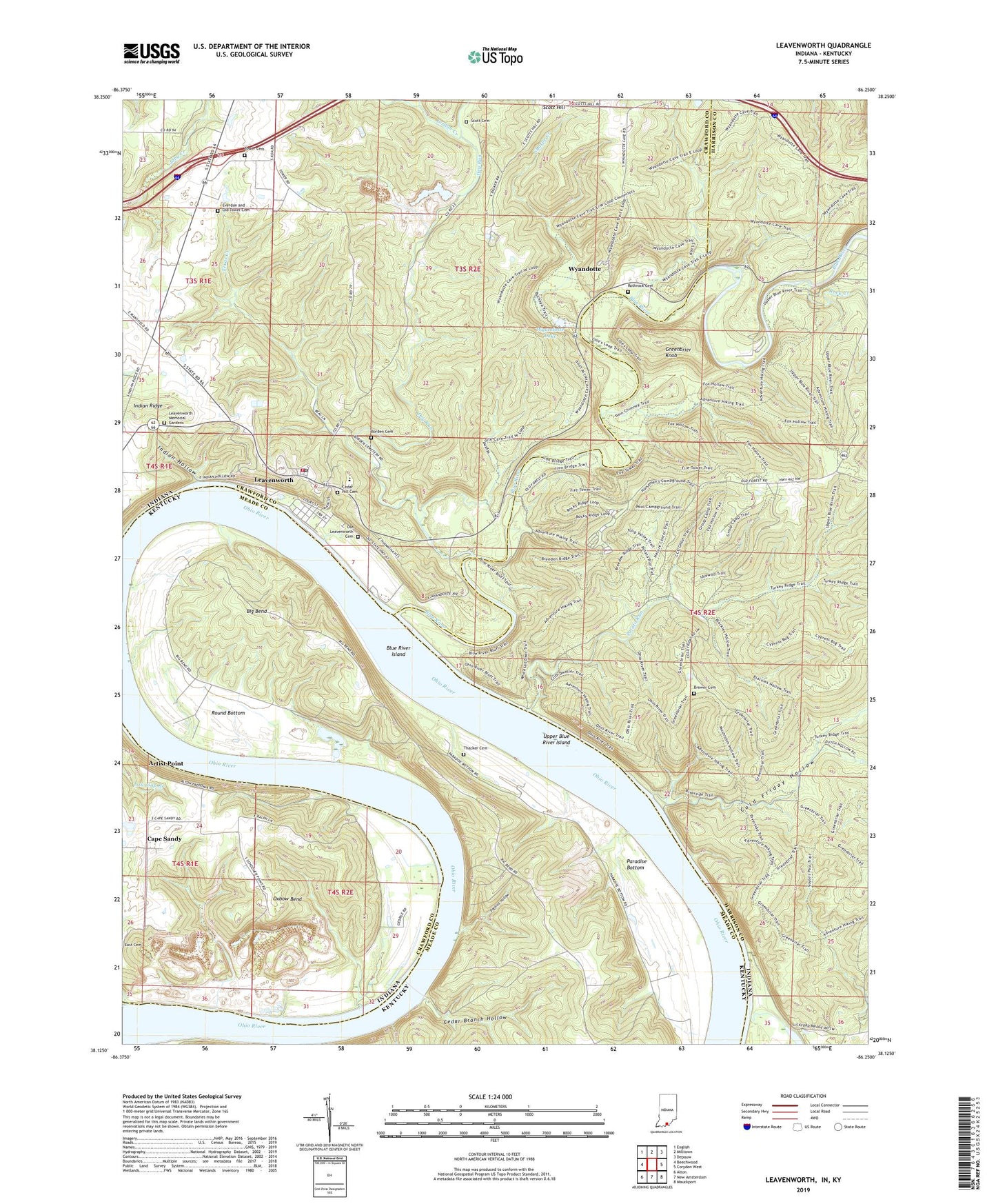
2022 topographic map quadrangle Leavenworth in the states of Indiana, Kentucky. Scale: 1:24000. Based on the newly updated USGS 7.5' US Topo map series, this map is in the following counties: Crawford, Harrison, Meade. The map contains contour data, water features, and other items you are used to seeing on USGS maps, but also has updated roads and other features. This is the next generation of topographic maps. Printed on high-quality waterproof paper with UV fade-resistant inks.
Quads adjacent to this one:
West: Beechwood
Northwest: English
North: Milltown
Northeast: Depauw
East: Corydon West
Southeast: Mauckport
South: New Amsterdam
Southwest: Alton
Contains the following named places: Artist Point, Big Bend, Blue River, Blue River Chapel, Blue River Island, Borden Cemetery, Brewer Cemetery, Cape Sandy, Cape Sandy Quarry Number 1, Cape Sandy Quarry Number 2, Cedar Branch Hollow, Cedar Hill Cemetery, Cold Friday Hollow, Dry Run, Dry Run Church, Everdon and Old Tower Cemetery, Greenbrier Knob, Harrison-Crawford State Forest, Highland Creek, Indian Hollow, Indian Ridge, Jordan Creek, Leavenworth, Leavenworth Memorial Gardens, Leavenworth Post Office, Leavenworth School, Leavenworth Volunteer Fire Department, Mount Hope Church, Old Leavenworth Cemetery, Oxbow Bend, Paradise Bottom, Paris Landing, Peckenpaugh, Pioneer Cabin, Pophins Hollow, Potato Run, Potato Run Church, Rock Creek, Rothrock Cemetery, Round Bottom, Schooler Point Landing, Scott Cemetery, Scott Hill, Sharpe Creek, Texas Creek, Thacker Cemetery, Tower Cemetery, Town of Leavenworth, Township of Jennings, Upper Blue River Island, Wyandotte, Wyandotte Cave, Wyandotte Lake, Wyandotte Lake Dam, Wyandotte Woods