MyTopo
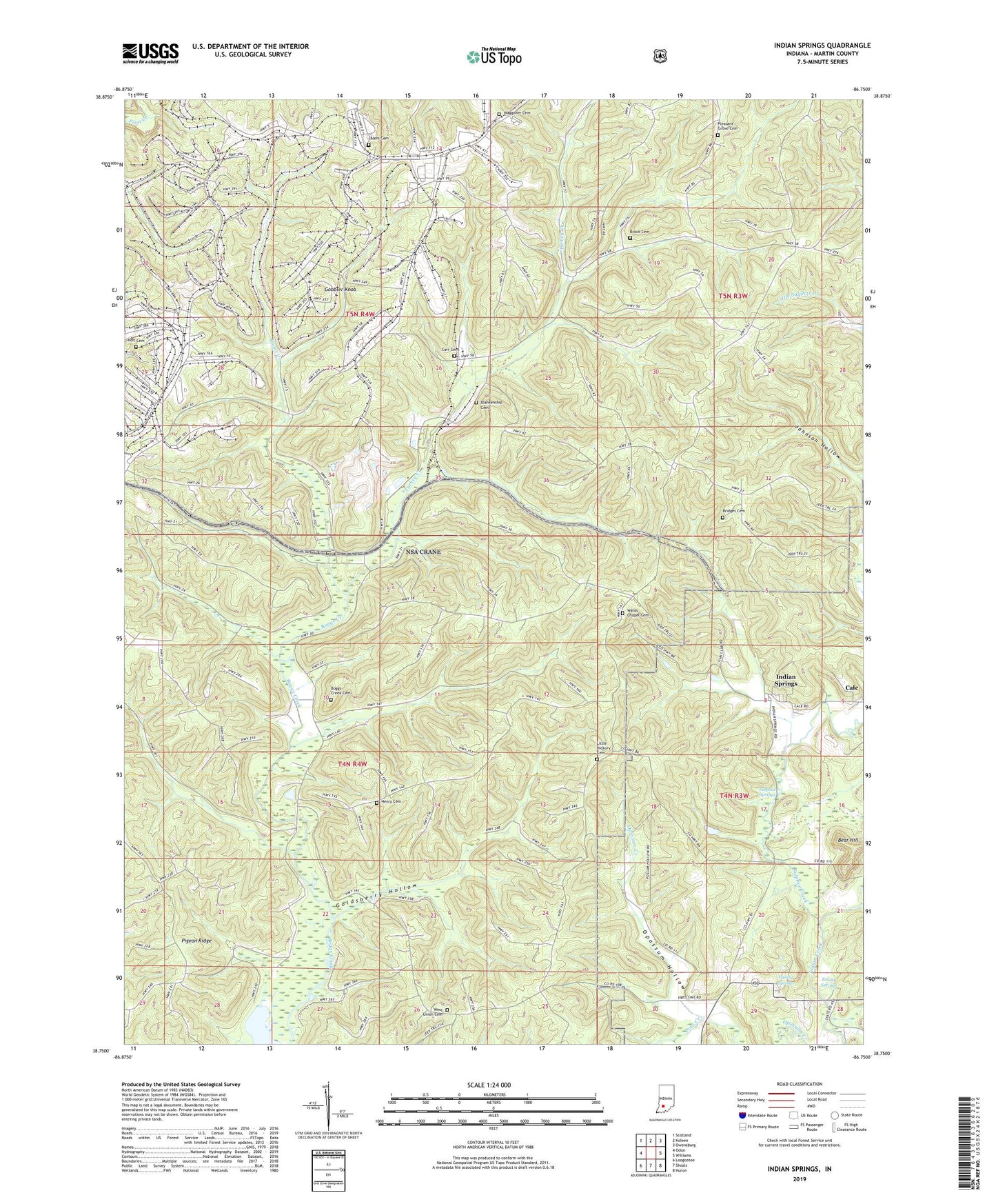
Indian Springs Indiana US Topo Map
Couldn't load pickup availability
Also explore the Indian Springs Forest Service Topo of this same quad for updated USFS data
2022 topographic map quadrangle Indian Springs in the state of Indiana. Scale: 1:24000. Based on the newly updated USGS 7.5' US Topo map series, this map is in the following counties: Martin. The map contains contour data, water features, and other items you are used to seeing on USGS maps, but also has updated roads and other features. This is the next generation of topographic maps. Printed on high-quality waterproof paper with UV fade-resistant inks.
Quads adjacent to this one:
West: Odon
Northwest: Scotland
North: Koleen
Northeast: Owensburg
East: Williams
Southeast: Huron
South: Shoals
Southwest: Loogootee
This map covers the same area as the classic USGS quad with code o38086g7.
Contains the following named places: Bear Hill, Blankenship Cemetery, Boggs Creek Cemetery, Bridges Cemetery, Brock Cemetery, Cale, Carr Cemetery, Dye Post Office, Gobbler Knob, Goldsberry Hollow, Henry Cemetery, Holt Cemetery, Indian Springs, Johnson Hollow, Little Hickory Cemetery, Naval Surface Warfare Center Crane, Opossum Hollow, Pigeon Ridge, Pleasant Grove Cemetery, Poss Creek, Salem Cemetery, Sulphur Creek, Sulphur Springs, Township of Perry, Trinity Springs, Turkey Creek, Waggoner Cemetery, Wards Chapel Cemetery, West Union Cemetery