MyTopo
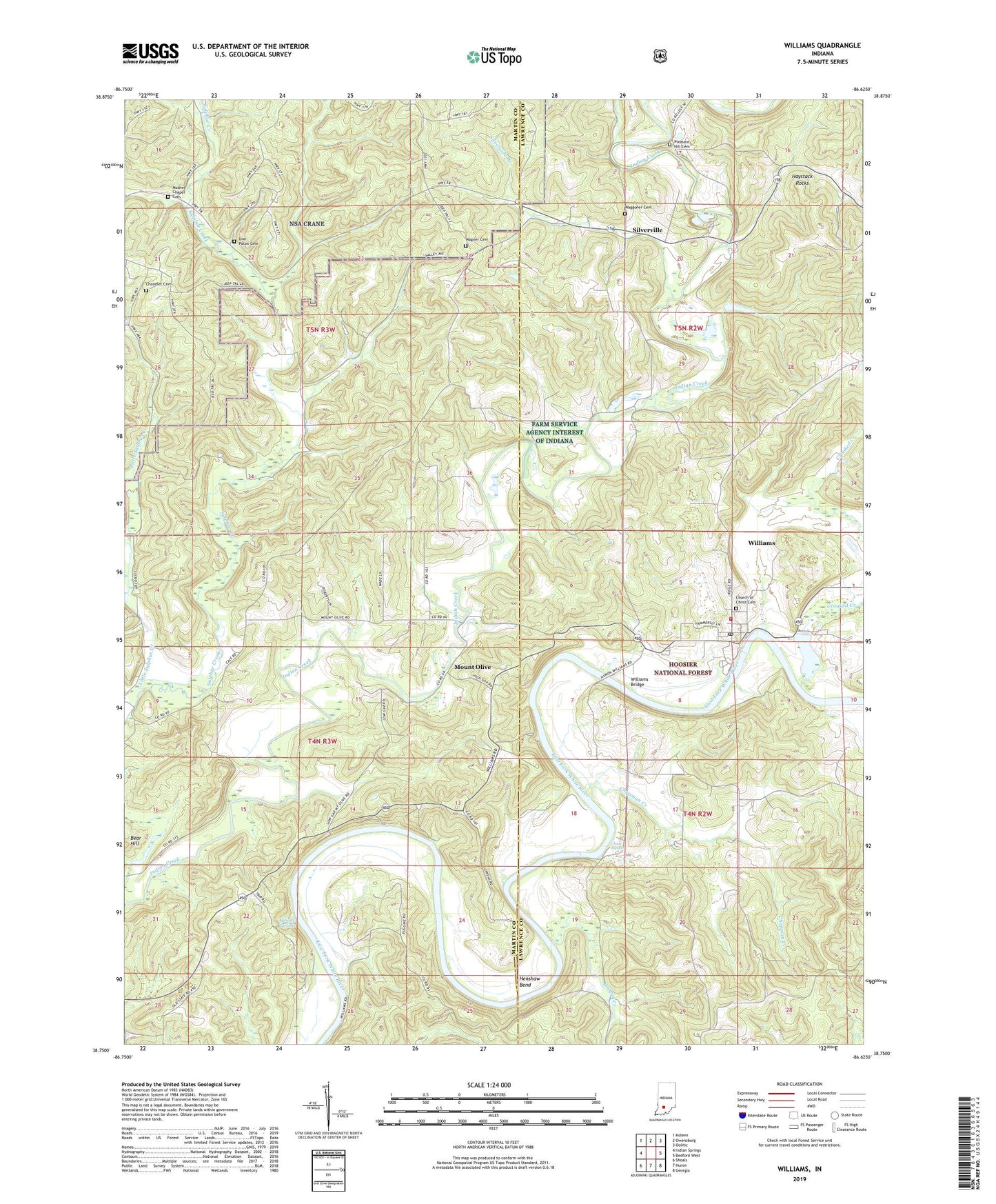
Williams Indiana US Topo Map
Couldn't load pickup availability
Also explore the Williams Forest Service Topo of this same quad for updated USFS data
2022 topographic map quadrangle Williams in the state of Indiana. Scale: 1:24000. Based on the newly updated USGS 7.5' US Topo map series, this map is in the following counties: Lawrence, Martin. The map contains contour data, water features, and other items you are used to seeing on USGS maps, but also has updated roads and other features. This is the next generation of topographic maps. Printed on high-quality waterproof paper with UV fade-resistant inks.
Quads adjacent to this one:
West: Indian Springs
Northwest: Koleen
North: Owensburg
Northeast: Oolitic
East: Bedford West
Southeast: Georgia
South: Huron
Southwest: Shoals
This map covers the same area as the classic USGS quad with code o38086g6.
Contains the following named places: Chandler Cemetery, Chapman Creek, Chase Ripple, Church of Christ Cemetery, Crooked Creek, Fairview Church, Fort Williams Church, Haystack Rocks, Henshaw Bend, Hooper Creek, Indian Creek Church, LaSalle Springs, Little Sulphur Creek, Modrel Chapel Cemetery, Mount Olive, Mount Olive Church, Mount Pleasant Church, Mountain Spring Post Office, Pleasant Hill Cemetery, Pleasant View Church, Silverville, Silverville Branch, Township of Mitcheltree, Uno - Paton Cemetery, Waggoner Cemetery, Wagner Cemetery, Williams, Williams Bridge, Williams Census Designated Place, Williams Dam, Williams Dam Public Fishing Area, Williams Post Office, Williams Volunteer Fire Department, ZIP Code: 47470