MyTopo
Laconia Indiana US Topo Map
Couldn't load pickup availability
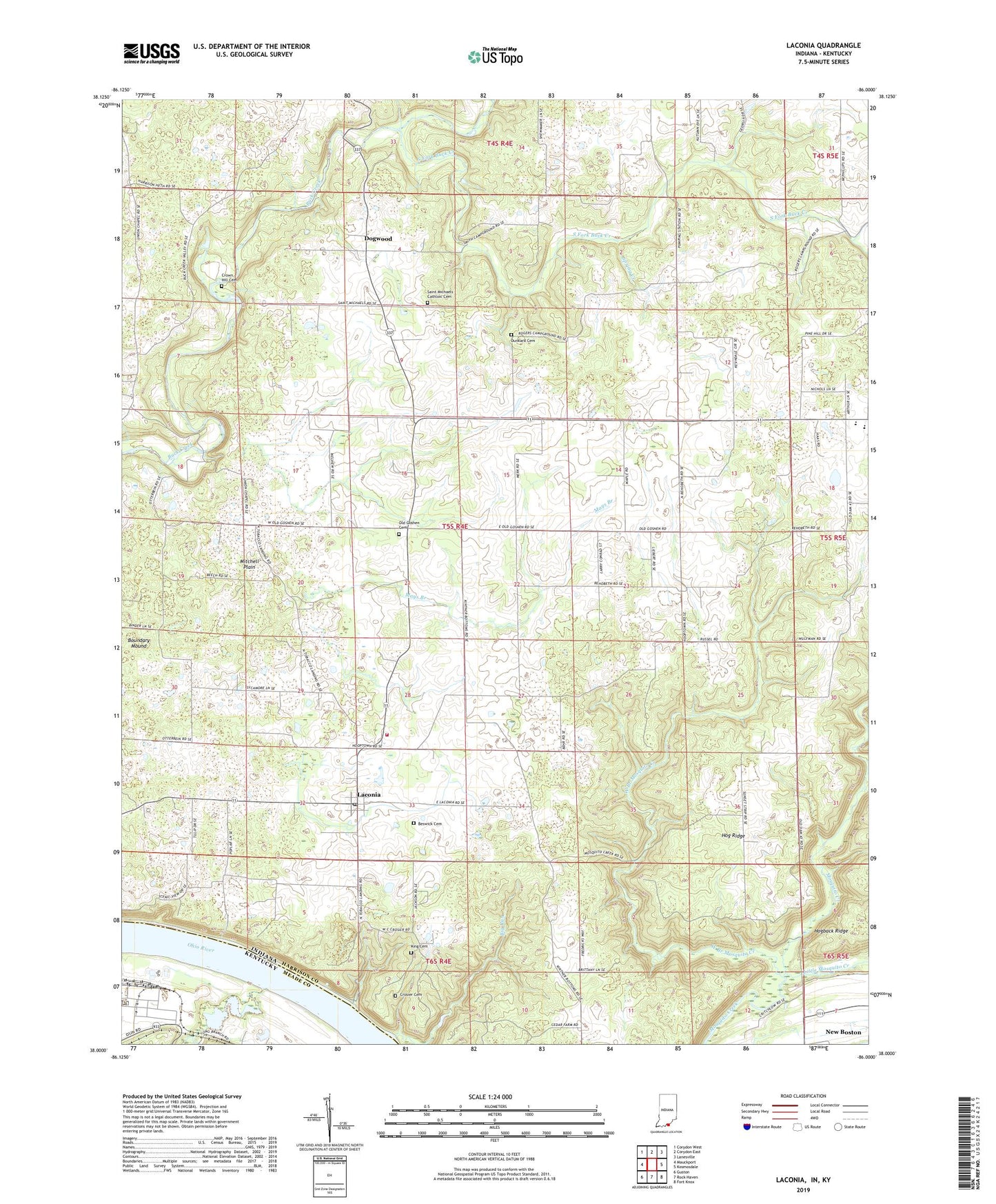
2022 topographic map quadrangle Laconia in the states of Indiana, Kentucky. Scale: 1:24000. Based on the newly updated USGS 7.5' US Topo map series, this map is in the following counties: Harrison, Meade. The map contains contour data, water features, and other items you are used to seeing on USGS maps, but also has updated roads and other features. This is the next generation of topographic maps. Printed on high-quality waterproof paper with UV fade-resistant inks.
Quads adjacent to this one:
West: Mauckport
Northwest: Corydon West
North: Corydon East
Northeast: Lanesville
East: Kosmosdale
Southeast: Fort Knox
South: Rock Haven
Southwest: Guston
Contains the following named places: Beswick Cemetery, Big Run, Blue River Church, Boone Township Volunteer Fire Department, Boundary Mound, Buck Creek Lodge, Crosier Cemetery, Crown Hill Cemetery, Doe Run, Doe Run Gas Storage Field, Dogwood, Dunkard Cemetery, Hog Ridge, King Cemetery, Laconia, Laconia Elementary School, Laconia Post Office, Little Mosquito Creek, Long Branch, Mays Branch, Memorial Church, Old Goshen Cemetery, Rehoboth, Rehoboth Church, Rogers Campground Church, Saint Michaels Cathloic Cemetery, Smith Campground Church, South Central Junior and High School, South Fork Buck Creek, Spring Creek, Tobacco Landing, Town of Laconia, Township of Boone, Union Chapel, West Branch Mosquito Creek, ZIP Code: 47135