MyTopo
Fort Knox Kentucky US Topo Map
Couldn't load pickup availability
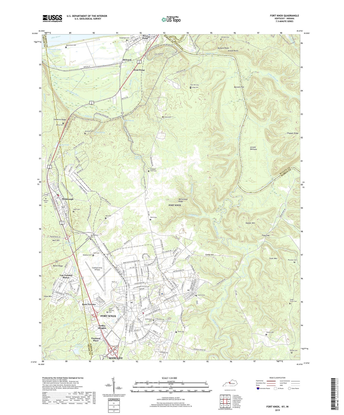
2022 topographic map quadrangle Fort Knox in the state of Kentucky. Scale: 1:24000. Based on the newly updated USGS 7.5' US Topo map series, this map is in the following counties: Hardin, Bullitt, Meade, Jefferson, Harrison. The map contains contour data, water features, and other items you are used to seeing on USGS maps, but also has updated roads and other features. This is the next generation of topographic maps. Printed on high-quality waterproof paper with UV fade-resistant inks.
Quads adjacent to this one:
West: Rock Haven
Northwest: Laconia
North: Kosmosdale
Northeast: Valley Station
East: Pitts Point
Southeast: Colesburg
South: Vine Grove
Southwest: Flaherty
This map covers the same area as the classic USGS quad with code o37085h8.
Contains the following named places: Anderson Golf Course, Arnold Bottoms, Arnold Rocks, Bleakley Cemetery, Boone Cemetery, Briscoe School, Burcham Cemetery, Burnett Flat, Buzzard Roost, Calvin Cemetery Number 1, Cameron Ridge, Canby Hill, Cedar Grove Cemetery, Cedar Point Branch, Chappel Ridge, City of Muldraugh, City of West Point, Cornwell Field, Crittenberger School, Crystal Lake, Davis Cemetery, Dickerson Lake, Dripping Springs, Dry Branch, Easy Gap, Eisenhower Chapel, Field Cemetery, Fort Hill Cemetery, Fort Hill City Park, Fort Knox, Fort Knox Census Designated Place, Fort Knox Division, Fort Knox Fire Division Station 1, Fort Knox Post Cemetery, Fort Knox Post Office, Gaffey Heights, Gander Branch, Gentry Cemetery, Geoghegan Cemetery, Godman Army Airfield, Godman Chapel, Golf Course, Hart Cemetery, Heard Park, High School, Hilltop Chapel, Hooker Mountain, Howard, HRCoe Post Office, Ireland Army Community Hospital, Johnson Branch, Johnson Cemetery, Kingsolver School, Long Cemetery, MacDonald Junior High School, March Ridge, McClelland Ridge, McCormick Cemetery, McIntire Cemetery, Mill Creek, Montgomery Cemetery, Mudge School, Muir Hill, Muldraugh, Muldraugh Fire Department, Muldraugh Post Office, Muth Cemetery, North Fork Dry Branch, Phillips Cemetery, Pierce School, Pleasant View Cemetery East, Pond Creek, Poplar Spring, Prewitts Lake, Prichard Chapel, Prichard Place, Ray Cemetery, Rose Terrace, Round Hollow, Scott Junior High School, Scott Mountain, Stevens School, Sutherland Cemetery, The Armor Center, Thorne Park, Tioga Creek, Tioga Spring, Tip Top, Tip Top Station, Tobacco Leaf Lake, Tollgate Creek, Turret Field, United States Bullion Depository, Van Voorhis Manor, VanVoorhis School, West Point, West Point Division, West Point Post Office, Withers Cemetery, ZIP Codes: 40121, 40155