MyTopo
Springville Indiana US Topo Map
Couldn't load pickup availability
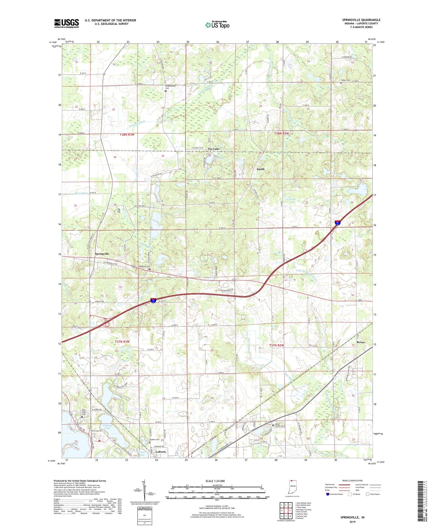
2022 topographic map quadrangle Springville in the state of Indiana. Scale: 1:24000. Based on the newly updated USGS 7.5' US Topo map series, this map is in the following counties: LaPorte. The map contains contour data, water features, and other items you are used to seeing on USGS maps, but also has updated roads and other features. This is the next generation of topographic maps. Printed on high-quality waterproof paper with UV fade-resistant inks.
Quads adjacent to this one:
West: Michigan City East
Northwest: New Buffalo West
North: New Buffalo East
Northeast: Three Oaks
East: New Carlisle
Southeast: Stillwell
South: LaPorte East
Southwest: LaPorte West
This map covers the same area as the classic USGS quad with code o41086f6.
Contains the following named places: Collins Ditch, Downing Arm, Fishtrap Lake, Foster Cemetery, Galena Elementary School, Hog Lake, Holmes Island, Horseshoe Lake, La Porte Fire Department Station 2, Lalimere, Lambs Chapel, Lower Lake, Miller Griffin Cemetery, Moon Ditch, Pine Lake Cemetery, Porter Lake, Quaker Cemetery, Rossburg Cemetery, Shippeeburg Cemetery, Smith, Springville, Tee Lake, Township of Galena, Township of Kankakee, Warwick Ditch