MyTopo
Ogden Dunes Indiana US Topo Map
Couldn't load pickup availability
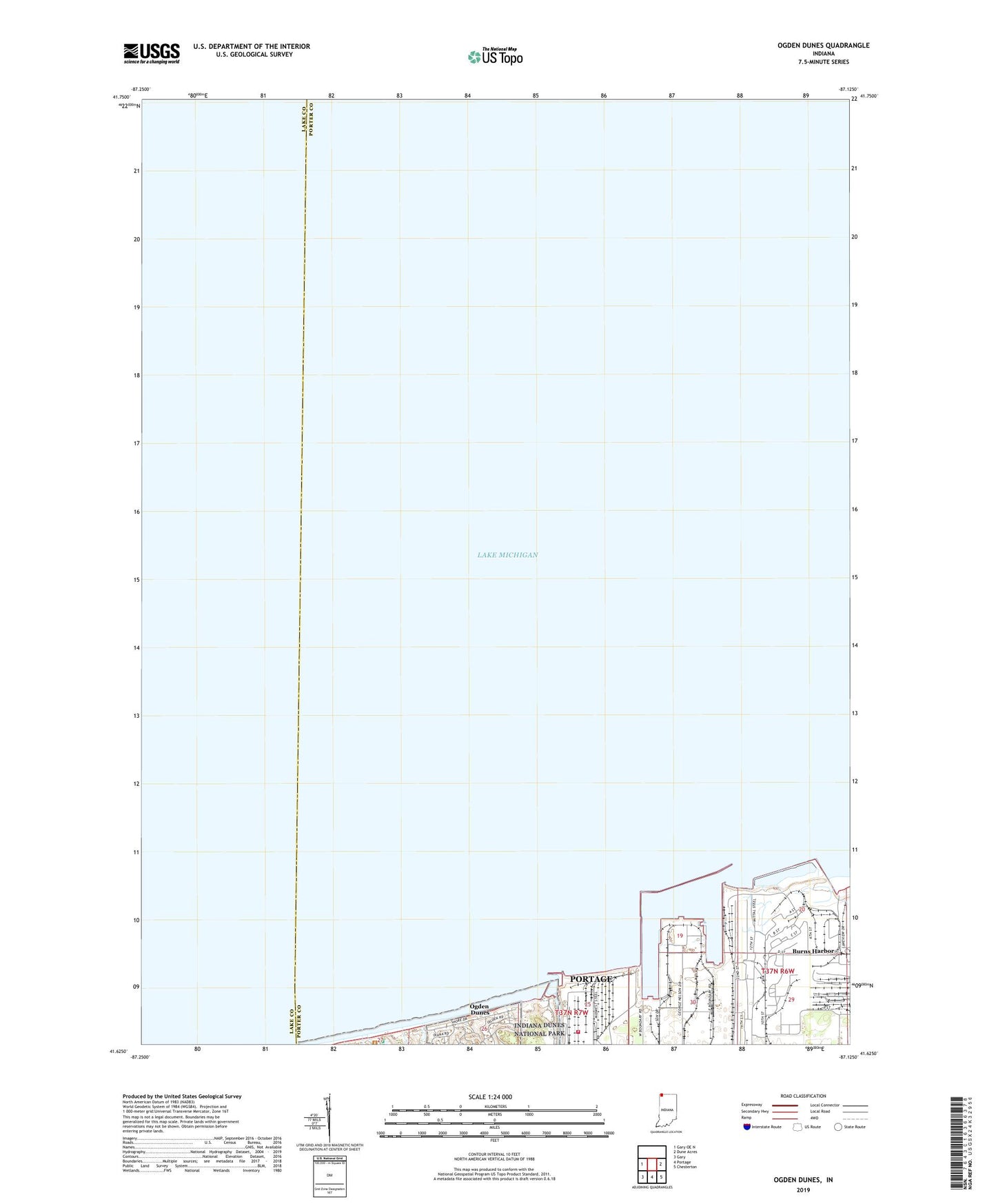
2022 topographic map quadrangle Ogden Dunes in the state of Indiana. Scale: 1:24000. Based on the newly updated USGS 7.5' US Topo map series, this map is in the following counties: Porter, Lake. The map contains contour data, water features, and other items you are used to seeing on USGS maps, but also has updated roads and other features. This is the next generation of topographic maps. Printed on high-quality waterproof paper with UV fade-resistant inks.
Quads adjacent to this one:
West: Gary OE N
East: Dune Acres
Southeast: Chesterton
South: Portage
Southwest: Gary
This map covers the same area as the classic USGS quad with code o41087f2.
Contains the following named places: Burns Harbor, Burns Harbor East Light, Burns Harbor North Light 2, Burns Harbor South Light 3, Burns Haror West Light 4, Burns International Harbor, Burns Waterway East Jetty North Light, Burns Waterway East Jetty South Light, Burns Waterway East Pier Light, Burns Waterway West Pier Inner Light, Burns Waterway West Pier Outer Light, East Harbor Arm, Port of Indiana, Town of Ogden Dunes, United States Steel Midwest Division Fire Department, West Harbor Arm