MyTopo
Jacksonburg Indiana US Topo Map
Couldn't load pickup availability
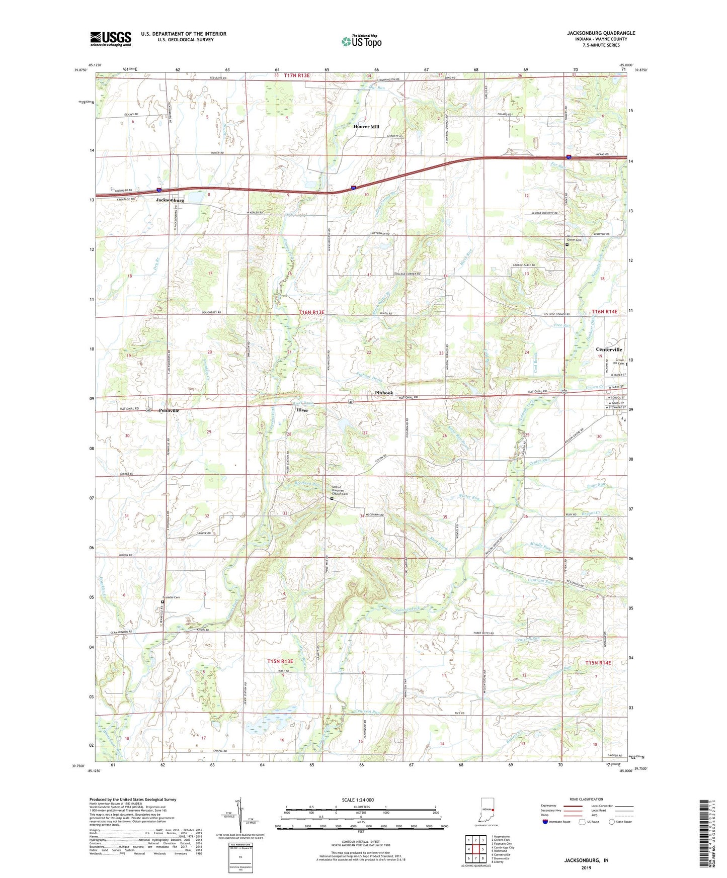
2022 topographic map quadrangle Jacksonburg in the state of Indiana. Scale: 1:24000. Based on the newly updated USGS 7.5' US Topo map series, this map is in the following counties: Wayne. The map contains contour data, water features, and other items you are used to seeing on USGS maps, but also has updated roads and other features. This is the next generation of topographic maps. Printed on high-quality waterproof paper with UV fade-resistant inks.
Quads adjacent to this one:
West: Cambridge City
Northwest: Hagerstown
North: Greens Fork
Northeast: Fountain City
East: Richmond
Southeast: Liberty
South: Brownsville
Southwest: Connersville
This map covers the same area as the classic USGS quad with code o39085g1.
Contains the following named places: Black Run, Black Water Branch, Brethren Run, Bryant Church, Bryant Creek, Center Run, Centeral Run, Centrum Run, Cold Run, College Corner, College Corner Branch, Common Run, Cool Brook, Crown Creek, Doddridge Chapel, Far Run, Franklin Cemetery, Franklin Creek, Free Run, Greens Fork, Hiser, Hiser Drain, Hoover Mill, Jacksonburg, Middle Run, Our Run, Pennville, Pinhook, Pinhook Drain, Point Run, Sleet Brook, Snow Run Brook, Township of Harrison, Township of Washington, United Brethren Church Cemetery, Warm Run, Wayne County, West Grove, West Grove Cemetery, Winter Run, ZIP Code: 47330