MyTopo
Santa Claus Indiana US Topo Map
Couldn't load pickup availability
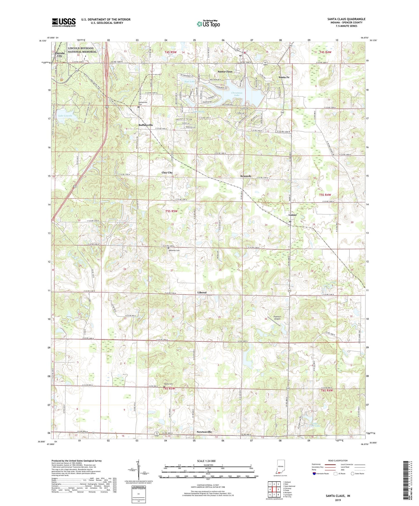
2022 topographic map quadrangle Santa Claus in the state of Indiana. Scale: 1:24000. Based on the newly updated USGS 7.5' US Topo map series, this map is in the following counties: Spencer. The map contains contour data, water features, and other items you are used to seeing on USGS maps, but also has updated roads and other features. This is the next generation of topographic maps. Printed on high-quality waterproof paper with UV fade-resistant inks.
Quads adjacent to this one:
West: Chrisney
Northwest: Holland
North: Dale
Northeast: Saint Meinrad
East: Fulda
Southeast: Tell City
South: Lewisport
Southwest: Rockport
This map covers the same area as the classic USGS quad with code o38086a8.
Contains the following named places: Buffaloville, Buffaloville Cemetery, Cedar Crest Lake, Christmas Lake, Christmas Lake Dam, Clay City, Clay-Huff Elementary School, Collins Chapel, Foertsch Airport, Kennedy, Lake Holly, Lake Holly Dam, Lake Lincoln, Lamar, Lamar Post Office, Liberal, Lincoln Boyhood National Memorial, Lincoln Cabin Site, Lincoln City, Lincoln State Park, Little Pigeon Church, Meeks Cemetery, Mount Zion Church, Nancy Hanks Lincoln State Memorial, New Hope Church, Newtonville, Noel Lake, Noel Lake Dam, Santa Claus, Santa Claus Post Office, Santa Claus Volunteer Fire Department, Santa Fe, Tableman Cemetery, Town of Santa Claus, Township of Clay, Union Chapel, ZIP Codes: 47550, 47552, 47579