MyTopo
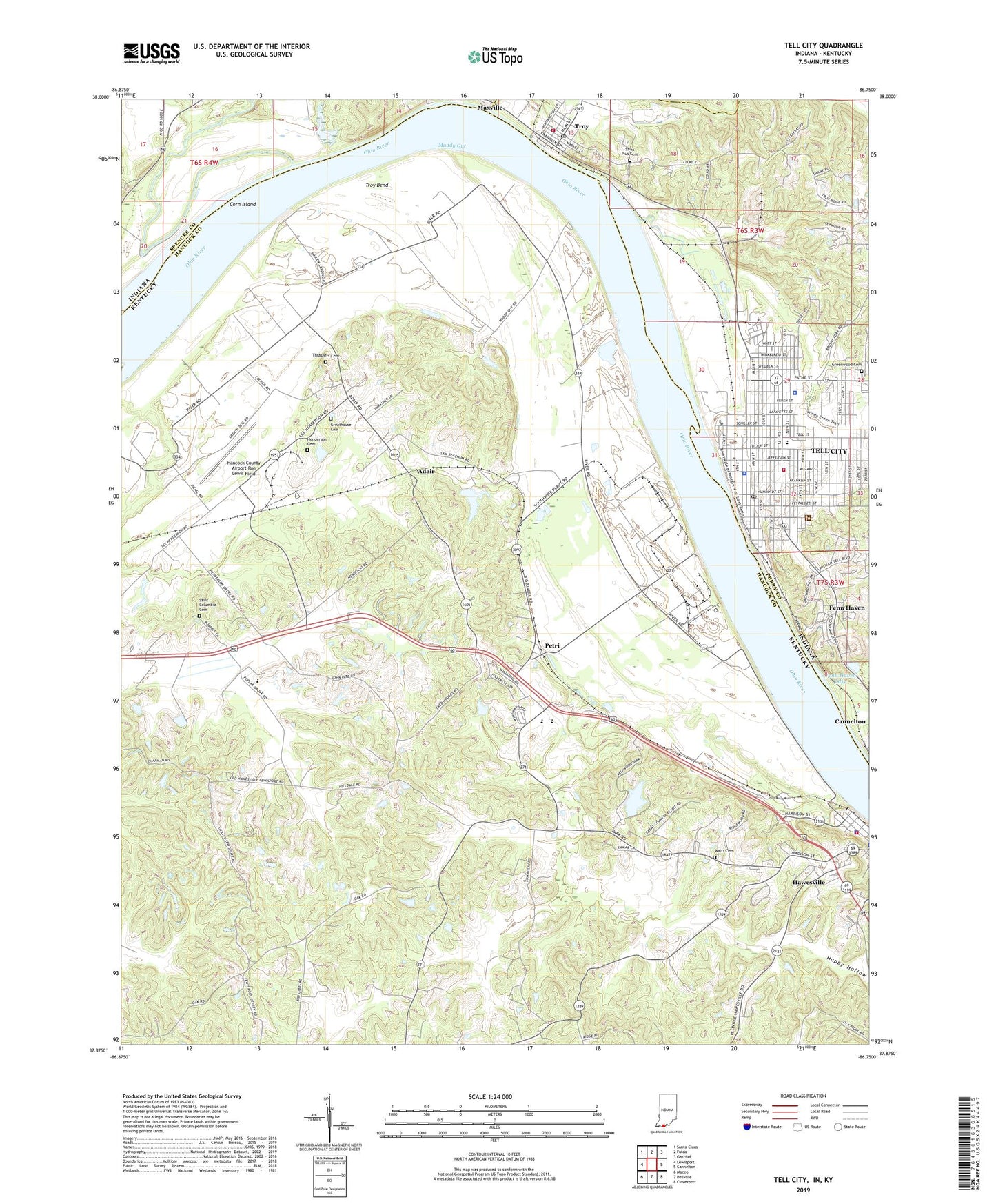
Tell City Indiana US Topo Map
Couldn't load pickup availability
2022 topographic map quadrangle Tell City in the states of Kentucky, Indiana. Scale: 1:24000. Based on the newly updated USGS 7.5' US Topo map series, this map is in the following counties: Perry, Hancock, Spencer. The map contains contour data, water features, and other items you are used to seeing on USGS maps, but also has updated roads and other features. This is the next generation of topographic maps. Printed on high-quality waterproof paper with UV fade-resistant inks.
Quads adjacent to this one:
West: Lewisport
Northwest: Santa Claus
North: Fulda
Northeast: Gatchel
East: Cannelton
Southeast: Cloverport
South: Pellville
Southwest: Maceo
Contains the following named places: Adair, Anderson River, City of Hawesville, City of Tell City, Crooked Creek, Fenn Haven, Fenn Haven Lake, Franklin School, Greathouse Cemetery, Greenwood Cemetery, Hancock Airfield, Hancock County Airport-Ron Lewis Field, Happy Hollow, Hawesville, Hawesville City Police Department, Hawesville Fire Department, Henderson Cemetery, Hilldale United Methodist Church, Lamar Field Airport, Lead Creek, Legion Field, Lewisport Division, Little Windy Creek, Mount Calvary Cemetery, Muddy Gut, New Chapel, Newman Elementary School, North Yellow Creek Fork, Perry County Sheriff's Office, Petri, Poplar Grove Church, Saint Columbia Cemetery, Saint Marys Chapel, Saint Paul Elementary School, Saint Pius Cemetery, South Yellow Creek Fork, Tell City, Tell City Fire Department, Tell City High School, Tell City Police Department, Tell City Post Office, Tell City Volunteer Fire Department, Thrashers Cemetery, Troy, Troy Bend, Troy Fire Department, Troy Post Office, Windy Creek, WKCM-AM (Hawesville), WTCJ-AM (Tell City), ZIP Code: 42351