MyTopo
Silver Lake Indiana US Topo Map
Couldn't load pickup availability
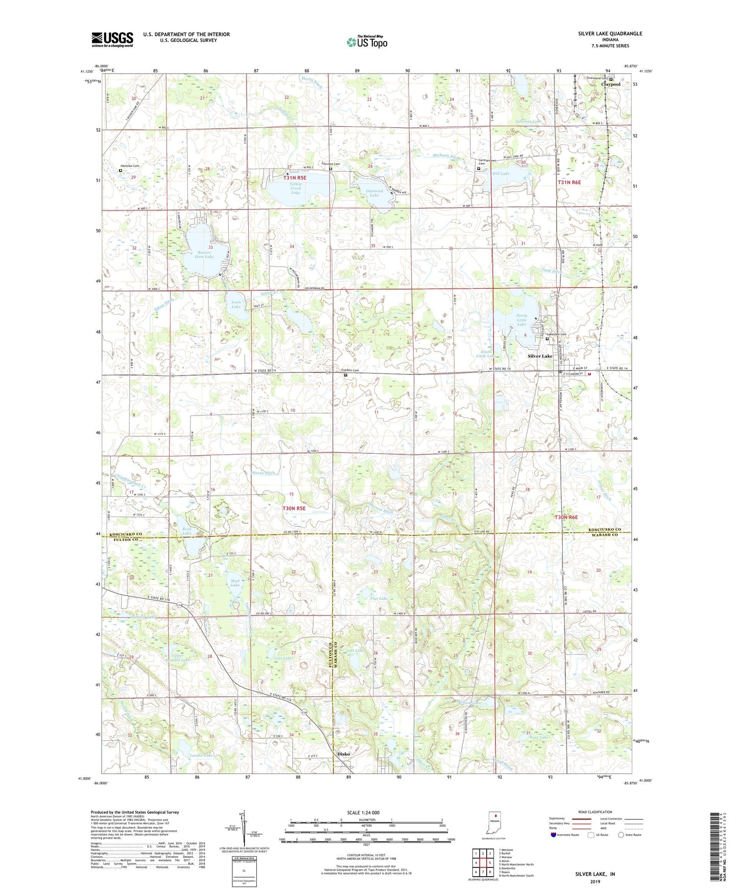
2022 topographic map quadrangle Silver Lake in the state of Indiana. Scale: 1:24000. Based on the newly updated USGS 7.5' US Topo map series, this map is in the following counties: Kosciusko, Wabash, Fulton. The map contains contour data, water features, and other items you are used to seeing on USGS maps, but also has updated roads and other features. This is the next generation of topographic maps. Printed on high-quality waterproof paper with UV fade-resistant inks.
Quads adjacent to this one:
West: Akron
Northwest: Mentone
North: Burket
Northeast: Warsaw
East: North Manchester North
Southeast: North Manchester South
South: Roann
Southwest: Deedsville
This map covers the same area as the classic USGS quad with code o41085a8.
Contains the following named places: Arthur Ditch, Bear Lake, Beaver Dam Lake, Brown Lake, Caldwell Lake, Center Church, Diamond Lake, Disko, Eaton Ditch, Fairview Cemetery, Flat Lake, Franklin Cemetery, Funk Ditch, Germantown Cemetery, Graceland Cemetery, Hamman Cemetery, Harsh Ditch, Hill Lake, Jamison Lake, Kroft Ditch, Lakeview Cemetery, Landis Ditch, Landis Lake, Lautzenhizer Ditch, Loon Lake, Lordan Farms, Lost Lake, Lotz Lake, McClures Lake, Michaels Ditch, Morrett Ditch, Mud Lake, Multiple Township Emergency Medical Services, North Little Lake, Rock Lake, Silver Creek Church, Silver Lake, Silver Lake Elementary School, Silver Lake Fire Department, Silver Lake Post Office, Silver Lake Town Marshal's Office, Silveus Ditch, South Little Lake, South Pleasant Church, Summit Lake, Town of Silver Lake, Township of Seward, Twin Lakes, Upper Summit Lake, Yellow Creek Lake, ZIP Code: 46982