MyTopo
North Manchester North Indiana US Topo Map
Couldn't load pickup availability
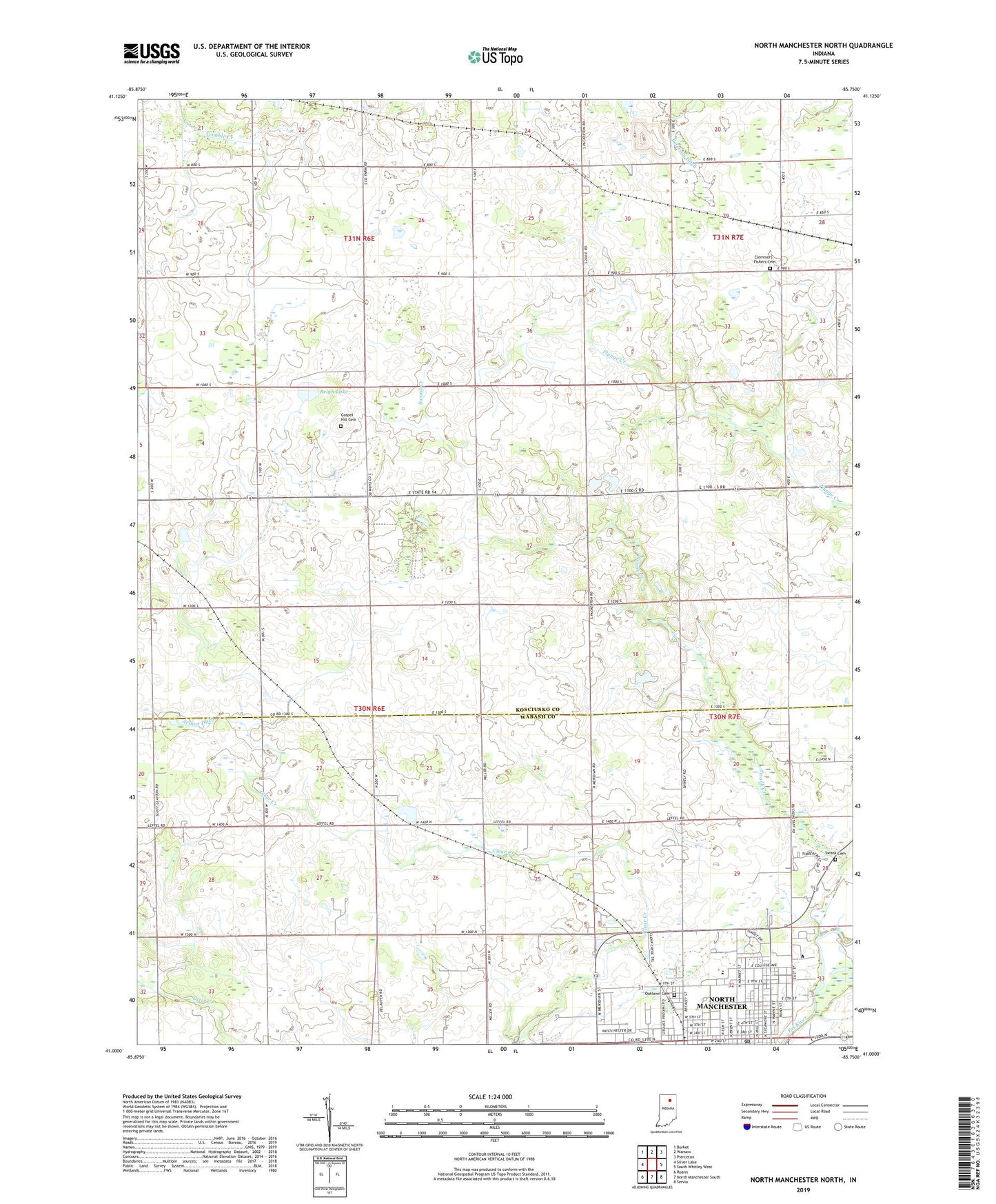
2022 topographic map quadrangle North Manchester North in the state of Indiana. Scale: 1:24000. Based on the newly updated USGS 7.5' US Topo map series, this map is in the following counties: Kosciusko, Wabash. The map contains contour data, water features, and other items you are used to seeing on USGS maps, but also has updated roads and other features. This is the next generation of topographic maps. Printed on high-quality waterproof paper with UV fade-resistant inks.
Quads adjacent to this one:
West: Silver Lake
Northwest: Burket
North: Warsaw
Northeast: Pierceton
East: South Whitley West
Southeast: Servia
South: North Manchester South
Southwest: Roann
This map covers the same area as the classic USGS quad with code o41085a7.
Contains the following named places: Beigh Lake, Christian Fellowship Church, Clemmers Fishers Ross Cemetery, Eel River Church, First Brethren Church, Gospel Hill Cemetery, Grove Chapel, Manchester College, Manchester High School, Manchester Junior High School, North Manchester, North Manchester Congregational Christian Church, North Manchester Post Office, North Manchester United Methodist Church, Oaklawn Cemetery, Old German Church, Packerton, Peabody Memorial Home, Saint Robert's Catholic Church, Swank Cemetery, Swank Creek, Thomas Marshall Elementary School, Town of North Manchester, Township of Lake, Warvel Park, WBKE-FM (North Manchester), West Eel River Church, ZIP Code: 46510