MyTopo
Tunnelton Indiana US Topo Map
Couldn't load pickup availability
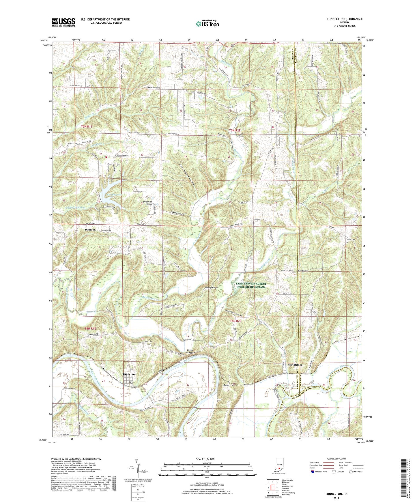
2022 topographic map quadrangle Tunnelton in the state of Indiana. Scale: 1:24000. Based on the newly updated USGS 7.5' US Topo map series, this map is in the following counties: Lawrence, Jackson, Washington. The map contains contour data, water features, and other items you are used to seeing on USGS maps, but also has updated roads and other features. This is the next generation of topographic maps. Printed on high-quality waterproof paper with UV fade-resistant inks.
Quads adjacent to this one:
West: Bedford East
Northwest: Bartlettsville
North: Norman
Northeast: Kurtz
East: Medora
Southeast: Smedley
South: Campbellsburg
Southwest: Mitchell
This map covers the same area as the classic USGS quad with code o38086g3.
Contains the following named places: Back Creek, Brown Cemetery, Coxs Ferry, Dennison Ridge, Devils Backbone, Ditney Ridge, Dixon Chapel, Dodd Cemetery, Dry Creek, Fairview Church, Fort Ritner, Guthrie Township Volunteer Fire Department Station 1, Jones Defeat Hollow, Ken-Ray Lake, Ken-Ray Lake Dam, Leesville, Pinhook, Shawswick Township Volunteer Fire Department Station 4, Shawswick Volunteer Fire Department Station 4, Sherrill Cemetery, Township of Guthrie, Tunnel Hill, Tunnelton, Tunnelton Post Office, Twin Creek, ZIP Code: 47467