MyTopo
Warren Indiana US Topo Map
Couldn't load pickup availability
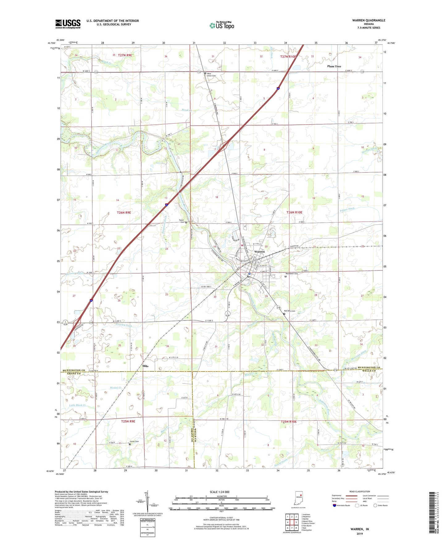
2022 topographic map quadrangle Warren in the state of Indiana. Scale: 1:24000. Based on the newly updated USGS 7.5' US Topo map series, this map is in the following counties: Huntington, Wells, Grant. The map contains contour data, water features, and other items you are used to seeing on USGS maps, but also has updated roads and other features. This is the next generation of topographic maps. Printed on high-quality waterproof paper with UV fade-resistant inks.
Quads adjacent to this one:
West: Mount Etna
Northwest: Andrews
North: Majenica
Northeast: Markle
East: Liberty Center
Southeast: Montpelier
South: Roll
Southwest: Van Buren
This map covers the same area as the classic USGS quad with code o40085f4.
Contains the following named places: Black Creek, Corey Cemetery, David Drain, Detamore Ditch, Little Black Creek, McNatts Church, Milo, Morrison Ditch, Owl Creek, Plum Tree, Red Men Cemetery, Salamonie School, Taylor Cemetery, Tower Park, Town of Warren, Township of Salamonie, Warren, Warren Police Department, Warren Post Office, Warren Volunteer Fire Department, Wearley Ditch, Weasel Creek, West Union Cemetery, Woodlawn Cemetery, ZIP Code: 46792