MyTopo
Roll Indiana US Topo Map
Couldn't load pickup availability
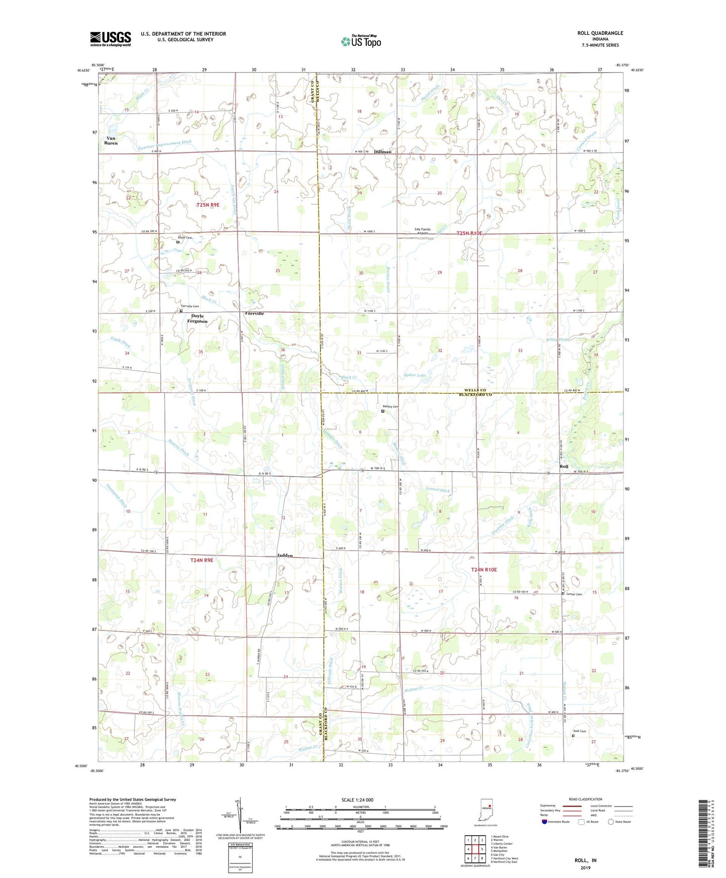
2022 topographic map quadrangle Roll in the state of Indiana. Scale: 1:24000. Based on the newly updated USGS 7.5' US Topo map series, this map is in the following counties: Blackford, Grant, Wells. The map contains contour data, water features, and other items you are used to seeing on USGS maps, but also has updated roads and other features. This is the next generation of topographic maps. Printed on high-quality waterproof paper with UV fade-resistant inks.
Quads adjacent to this one:
West: Van Buren
Northwest: Mount Etna
North: Warren
Northeast: Liberty Center
East: Montpelier
Southeast: Hartford City East
South: Hartford City West
Southwest: Gas City
This map covers the same area as the classic USGS quad with code o40085e4.
Contains the following named places: Balsley Cemetery, Bricker Drain, Casterline Forkner Ditch, Center Cemetery, Dillman, Doyle Cemetery, Doyle Ditch, Doyle Ferguson, Enoch Lee Ditch, Farrville, Farrville Cemetery, Ferguson Ditch, Gillespie Ditch, Greenlee Ditch, Hodson Ditch, Independence Church, Jadden, Kelley Drain, Kelly Ditch, Lee Farms Airport, Lemuel Ditch, Maddox Ditch, McNatts, Oak Chapel, Pond Drain, Roll, Roods Run, Skinner Ditch, Spiker Lake, Stoll Cemetery, Sweetser Improvement Ditch, Thompson Ditch, Township of Jackson, Township of Washington