MyTopo
Ainsworth Iowa US Topo Map
Couldn't load pickup availability
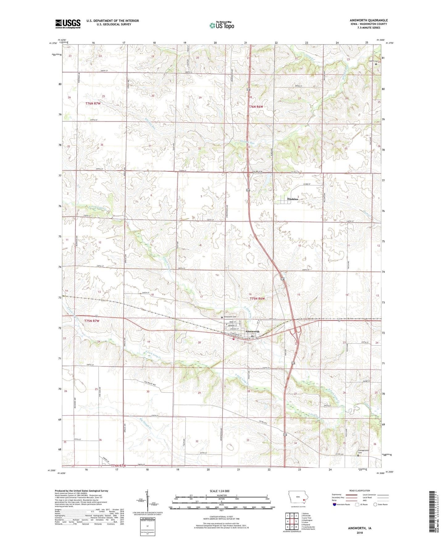
2022 topographic map quadrangle Ainsworth in the state of Iowa. Scale: 1:24000. Based on the newly updated USGS 7.5' US Topo map series, this map is in the following counties: Washington. The map contains contour data, water features, and other items you are used to seeing on USGS maps, but also has updated roads and other features. This is the next generation of topographic maps. Printed on high-quality waterproof paper with UV fade-resistant inks.
Quads adjacent to this one:
West: Washington
Northwest: Kalona
North: Riverside
Northeast: Lone Tree
East: Cotter
Southeast: Winfield North
South: Crawfordsville
Southwest: Wayland
This map covers the same area as the classic USGS quad with code o41091c5.
Contains the following named places: Ainsworth, Ainsworth Cemetery, Ainsworth Community Church, Ainsworth Community Presbyterian Church, Ainsworth Elementary School, Ainsworth Fire and Rescue, Ainsworth Post Office, Ainsworth Town Hall, Bethel Church, Campground Cemetery, Center Hill Post Office, City of Ainsworth, Crawford Pond Park, Dairy, Farmers Co-op Elevator, Haskins, Haskins Post Office, Havre, Havre Post Office, Johnson County Home, Marr Park, North Fork Long Creek, Pottsville Post Office, Salem Cemetery, Salem Church, South Fork Long Creek, Township of Oregon, Whiskey Run, ZIP Code: 52201