MyTopo
Riverside Iowa US Topo Map
Couldn't load pickup availability
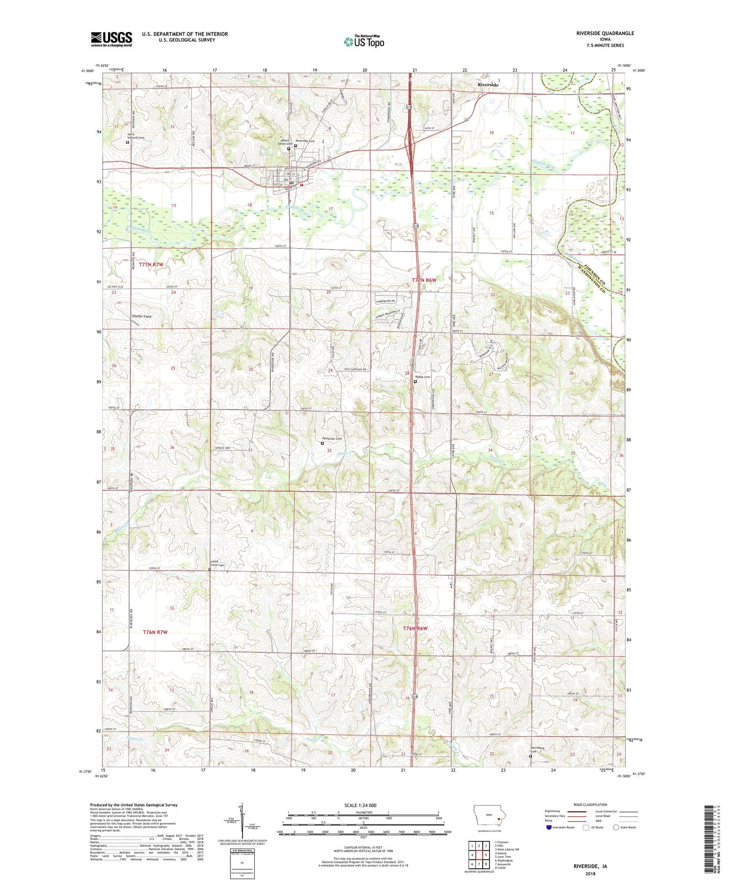
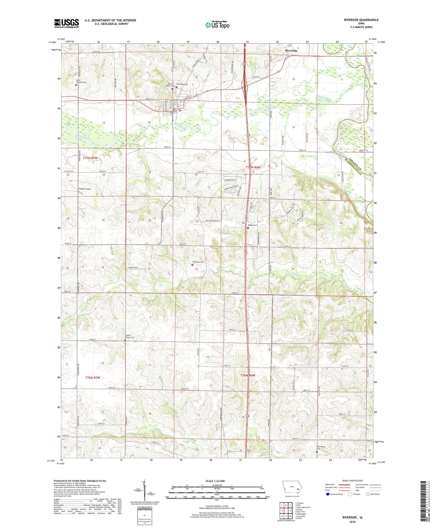
2022 topographic map quadrangle Riverside in the state of Iowa. Scale: 1:24000. Based on the newly updated USGS 7.5' US Topo map series, this map is in the following counties: Washington, Johnson. The map contains contour data, water features, and other items you are used to seeing on USGS maps, but also has updated roads and other features. This is the next generation of topographic maps. Printed on high-quality waterproof paper with UV fade-resistant inks.
Quads adjacent to this one:
West: Kalona
Northwest: Frytown
North: Hills
Northeast: West Liberty SW
East: Lone Tree
Southeast: Cotter
South: Ainsworth
Southwest: Washington
This map covers the same area as the classic USGS quad with code o41091d5.
Contains the following named places: Bulgers Run, City of Riverside, Cumberland - Havel Cemetery, Dairy Post Office, Davis Creek, Davis Creek Post Office, English River, Harrisburg Cemetery, Highland High School, Highland Middle School, Iowa Junction, Iowa Township Park, Kupka Cemetery, Mount Olivet Cemetery, Patterson Cemetery, Pfeifer Field, Riverside, Riverside Cemetery, Riverside City Hall, Riverside Elementary School, Riverside Fire Department, Riverside Grain and Feed Company Elevator, Riverside Post Office, Saint Mary's Church, Saint Vincent Cemetery, Township of Highland, Township of Iowa, Trinity Methodist Church, Yalton, Yatton, Yatton Post Office, ZIP Code: 52327