MyTopo
Atlantic SW Iowa US Topo Map
Couldn't load pickup availability
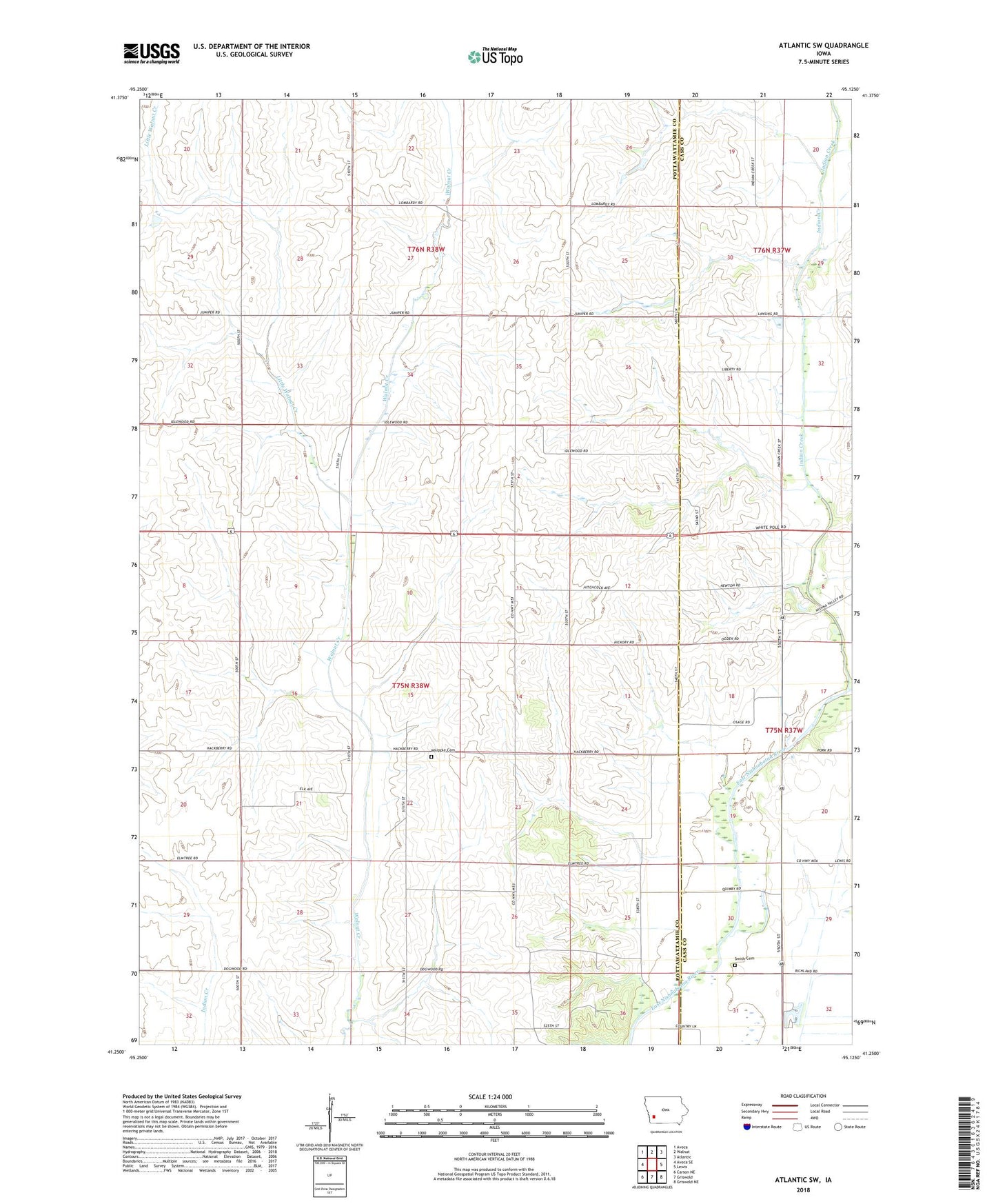
2022 topographic map quadrangle Atlantic SW in the state of Iowa. Scale: 1:24000. Based on the newly updated USGS 7.5' US Topo map series, this map is in the following counties: Pottawattamie, Cass. The map contains contour data, water features, and other items you are used to seeing on USGS maps, but also has updated roads and other features. This is the next generation of topographic maps. Printed on high-quality waterproof paper with UV fade-resistant inks.
Quads adjacent to this one:
West: Avoca SE
Northwest: Avoca
North: Walnut
Northeast: Atlantic
East: Lewis
Southeast: Griswold NE
South: Griswold
Southwest: Carson NE
This map covers the same area as the classic USGS quad with code o41095c2.
Contains the following named places: Camp Wakonda, Cocklin Fish Farm, Eranistan, Griswold Park, Indian Creek, Indian Creek Wildlife Area, Iranistan Post Office, Iranistan Rock Quarry Park, Little Walnut Creek, Smith Cemetery, Township of Wright, Whipple Cemetery, Whipple Post Office