MyTopo
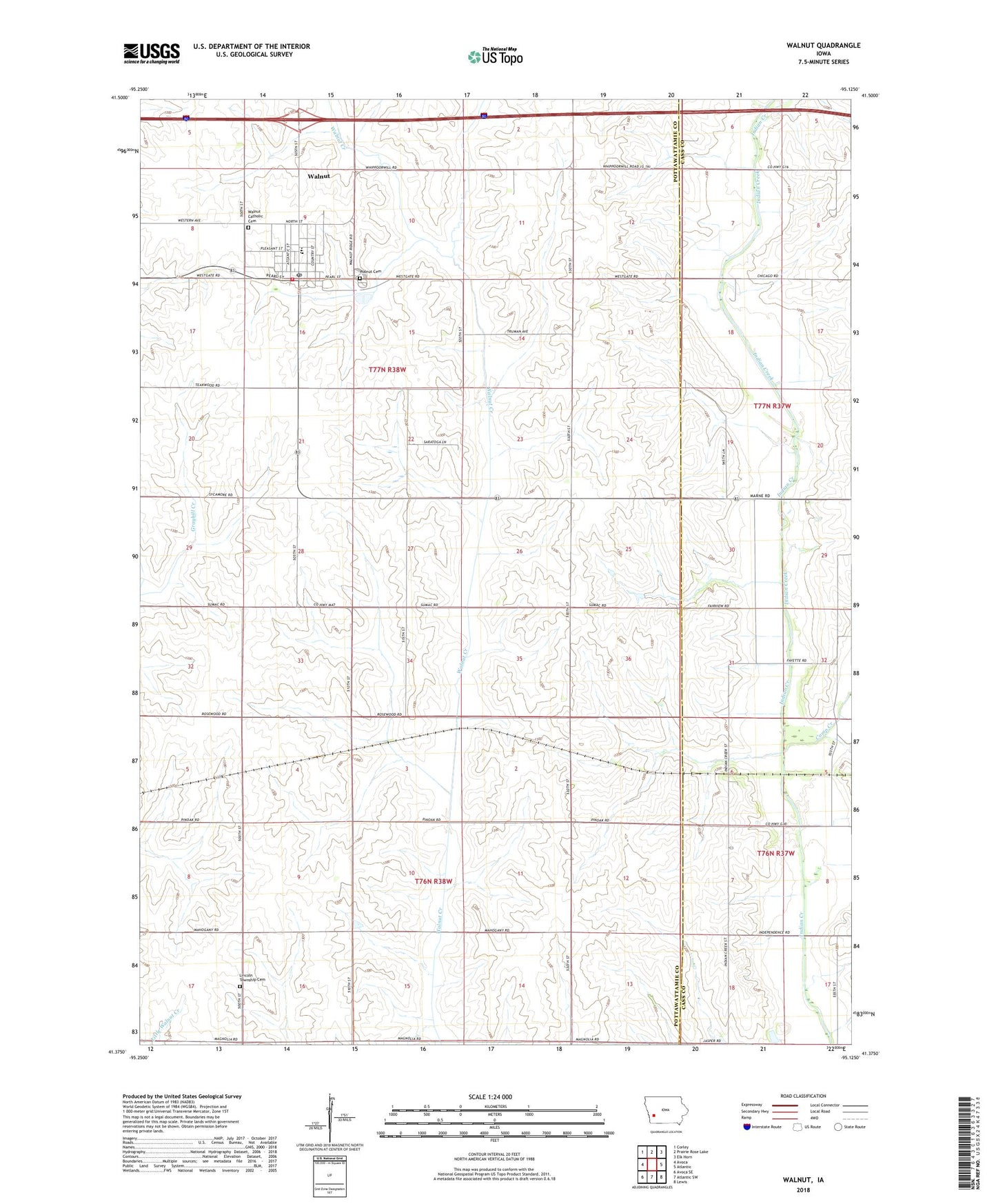
Walnut Iowa US Topo Map
Couldn't load pickup availability
2022 topographic map quadrangle Walnut in the state of Iowa. Scale: 1:24000. Based on the newly updated USGS 7.5' US Topo map series, this map is in the following counties: Pottawattamie, Cass. The map contains contour data, water features, and other items you are used to seeing on USGS maps, but also has updated roads and other features. This is the next generation of topographic maps. Printed on high-quality waterproof paper with UV fade-resistant inks.
Quads adjacent to this one:
West: Avoca
Northwest: Corley
North: Prairie Rose Lake
Northeast: Elk Horn
East: Atlantic
Southeast: Lewis
South: Atlantic SW
Southwest: Avoca SE
This map covers the same area as the classic USGS quad with code o41095d2.
Contains the following named places: Calvary Baptist Church, Camp Creek, City of Walnut, First Presbyterian Church, Layton Township Cemetery, Lincoln Township Cemetery, Monroe Methodist Church, Morton Post Office, Our Saviours Lutheran Church, Peace Haven Retirement Home, Peace United Church of Christ, Saint Patricks Catholic Cemetery, Township of Layton, Township of Lincoln, Walnut, Walnut Catholic Church, Walnut County Opera House, Walnut Creek Historical Museum, Walnut Elementary School, Walnut Elevator, Walnut High School, Walnut Medical Center, Walnut Middle School, Walnut Post Office, Walnut Public Library, Walnut Volunteer Fire Department, Walnut Welcome Center, ZIP Code: 51577