MyTopo
Ayrshire Iowa US Topo Map
Couldn't load pickup availability
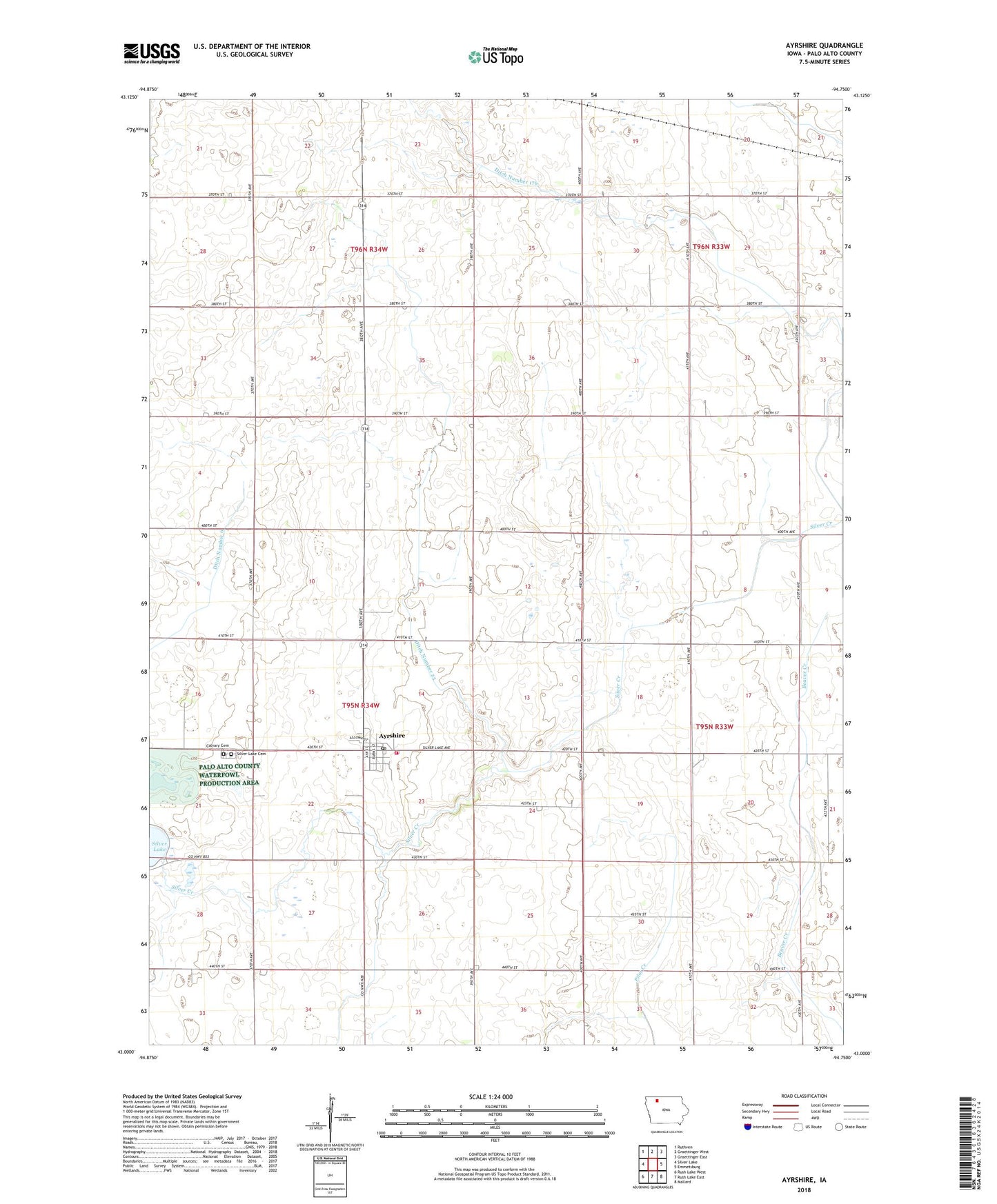
2022 topographic map quadrangle Ayrshire in the state of Iowa. Scale: 1:24000. Based on the newly updated USGS 7.5' US Topo map series, this map is in the following counties: Palo Alto. The map contains contour data, water features, and other items you are used to seeing on USGS maps, but also has updated roads and other features. This is the next generation of topographic maps. Printed on high-quality waterproof paper with UV fade-resistant inks.
Quads adjacent to this one:
West: Silver Lake
Northwest: Ruthven
North: Graettinger West
Northeast: Graettinger East
East: Emmetsburg
Southeast: Mallard
South: Rush Lake East
Southwest: Rush Lake West
This map covers the same area as the classic USGS quad with code o43094a7.
Contains the following named places: Ayrshire, Ayrshire City Hall, Ayrshire Post Office, Burns Prairie Area, Calvary Cemetery, City of Ayrshire, Crippen, Crippen Post Office, D W Farms, Darr Farms, Ditch Number 176, Ditch Number 23, Ditch Number 6, Ditch Number 62, Frederick Farm, Geelan Farm, Great Oak Farms, Lake View Post Office, Rockhill Farms, Sacred Heart Church, Sherlock Post Office, Silver Lake Cemetery, Silver Lake Fire and Rescue, Teleford Prairie Area, Township of Silver Lake, United Methodist Church, Wernimont Farm, West Bend Elevator Company Elevator, Wigdahl Farm, Wojahn Farm, Zion Lutheran Church, ZIP Code: 50515