MyTopo
Silver Lake Iowa US Topo Map
Couldn't load pickup availability
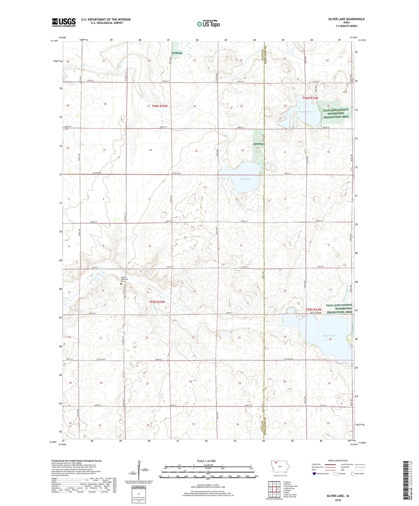
2022 topographic map quadrangle Silver Lake in the state of Iowa. Scale: 1:24000. Based on the newly updated USGS 7.5' US Topo map series, this map is in the following counties: Clay, Palo Alto. The map contains contour data, water features, and other items you are used to seeing on USGS maps, but also has updated roads and other features. This is the next generation of topographic maps. Printed on high-quality waterproof paper with UV fade-resistant inks.
Quads adjacent to this one:
West: Gillett Grove
Northwest: Dickens
North: Ruthven
Northeast: Graettinger West
East: Ayrshire
Southeast: Rush Lake East
South: Rush Lake West
Southwest: Webb
This map covers the same area as the classic USGS quad with code o43094a8.
Contains the following named places: Crooked Creek Farm, Dejong Farms, Ditch Number 60, Du Marsh Area, Elbow Lake, Elk Lake, Elk Lake State Game Mgt Area, Jade Farms, Little-Bit-of-Prairie Wildlife Area, Logan Township Cemetery, Myers Farm, Rolo Farms, Rusk Farms, Silver Lake, Silver Lake Wildlife Management Area, Township of Logan, Virgin Lake, Virgin Lake State Game Management Area, Wapiti Marsh State Game Management Area