MyTopo
Graettinger West Iowa US Topo Map
Couldn't load pickup availability
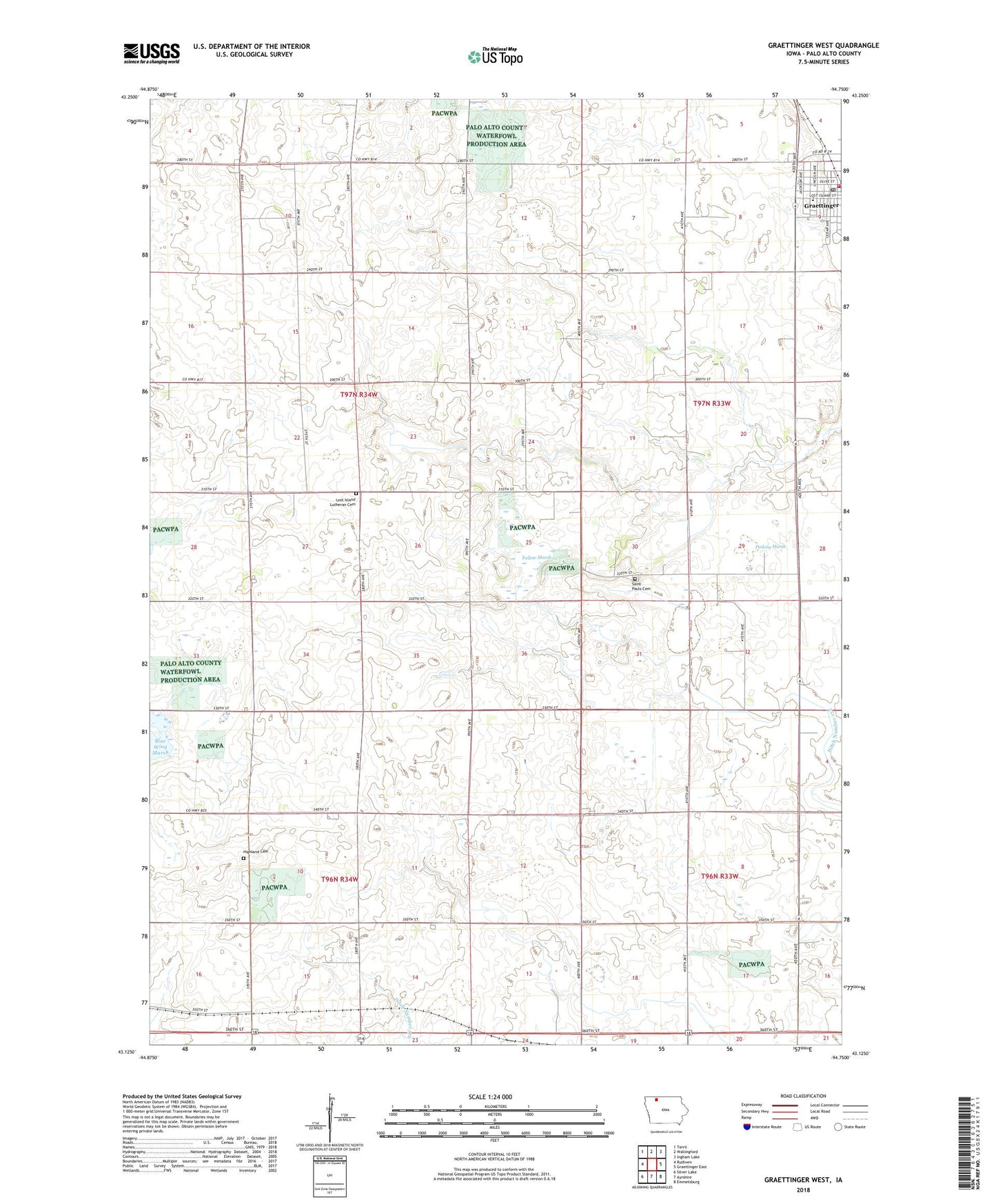
2022 topographic map quadrangle Graettinger West in the state of Iowa. Scale: 1:24000. Based on the newly updated USGS 7.5' US Topo map series, this map is in the following counties: Palo Alto. The map contains contour data, water features, and other items you are used to seeing on USGS maps, but also has updated roads and other features. This is the next generation of topographic maps. Printed on high-quality waterproof paper with UV fade-resistant inks.
Quads adjacent to this one:
West: Ruthven
Northwest: Terril
North: Wallingford
Northeast: Ingham Lake
East: Graettinger East
Southeast: Emmetsburg
South: Ayrshire
Southwest: Silver Lake
This map covers the same area as the classic USGS quad with code o43094b7.
Contains the following named places: B W Farms, Bethel Lutheran Church, Blue Wing Marsh, Blue Wing Marsh Wildlife Management Area, Brennan Farms, City of Graettinger, Ditch Number 132, Evergreen Park, Fallow, Fallow Marsh, Fallow Marsh Wildlife Management Area, Fallow Post Office, Generations Farm, Graettinger, Graettinger - Terril High / Middle School, Graettinger City Hall, Graettinger Clinic of Chiropractic Care, Graettinger Dental Clinic, Graettinger Fire Department, Graettinger Medical Clinic, Graettinger Police Department, Graettinger Post Office, Graettinger Public Library, Graettinger United Methodist Church, Hawkeye Dairy, Henningsen Farms, Highland Cemetery, Hillcrest Golf and Country Club, Immaculate Conception Church, Lost Island Church, Lost Island Lutheran Cemetery, Palo Alto Community Ambulance Graettinger, Perkins Marsh, Perkins Marsh State Game Management Area, Saint Pauls Cemetery, Township of Highland, Township of Lost Island