MyTopo
Balltown Iowa US Topo Map
Couldn't load pickup availability
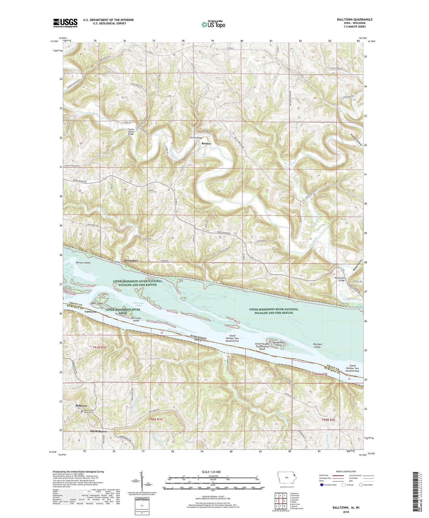
2022 topographic map quadrangle Balltown in the states of Wisconsin, Iowa. Scale: 1:24000. Based on the newly updated USGS 7.5' US Topo map series, this map is in the following counties: Dubuque, Grant. The map contains contour data, water features, and other items you are used to seeing on USGS maps, but also has updated roads and other features. This is the next generation of topographic maps. Printed on high-quality waterproof paper with UV fade-resistant inks.
Quads adjacent to this one:
West: Cassville
Northwest: Beetown
North: Hurricane
Northeast: Lancaster
East: Potosi
Southeast: Dubuque North
South: Sherrill
Southwest: Holy Cross
Contains the following named places: Arrow Branch, Aspinwall Post Office, Balls Island, Balltown, Balltown Methodist Church, Balltown Post Office, Basswood Creek, Bertom Island, Bertom Island Sanctuary, Boice Creek, Burton, Burton Bridge, Burton School, Cameron, Chaffie Hollow Bridge, City of Balltown, Elwell School, Finley Landing Post Light, Finleys Landing Park, Graham Hollow, Hurricane Chute, Hurricane Island, Island Number Two Hundred Five, Island Number Two Hundred Nine, Island Number Two Hundred Seven, Masseyville Bridge, McCartney, McCartney Branch, Mulligan Island, Oak Ridge School, Old Balltown, Pea Ridge School, Rigsby Hollow, Rosebrook Island, Saint Francis of Assisi Cemetery, Sinners Creek School, Snyder Slough, Spring Lake, Town of Waterloo, West Basswood Creek