MyTopo
Hurricane Wisconsin US Topo Map
Couldn't load pickup availability
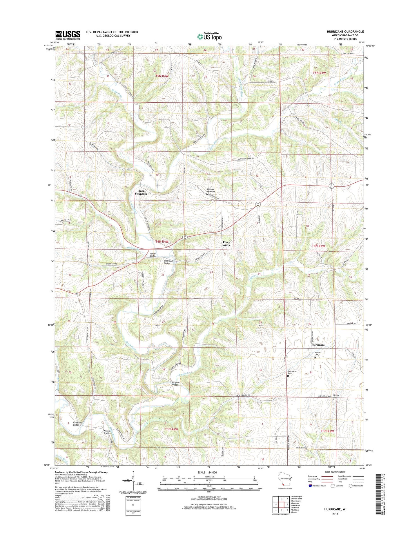
2022 topographic map quadrangle Hurricane in the state of Wisconsin. Scale: 1:24000. Based on the newly updated USGS 7.5' US Topo map series, this map is in the following counties: Grant. The map contains contour data, water features, and other items you are used to seeing on USGS maps, but also has updated roads and other features. This is the next generation of topographic maps. Printed on high-quality waterproof paper with UV fade-resistant inks.
Quads adjacent to this one:
West: Beetown
Northwest: Bloomington
North: Mount Hope
Northeast: Fennimore
East: Lancaster
Southeast: Potosi
South: Balltown
Southwest: Cassville
This map covers the same area as the classic USGS quad with code o42090g7.
Contains the following named places: Bahl Farms, Beetown Branch, Blackburn Bridge, Blake Fork, Day Branch, Five Points, Flora Fountain, Grant Hills Farm, Hackett Branch, Hidden Acres Farms, Hurricane, Hurricane Cemetery, Hurricane School, Kinney Cemetery, Little Grant River, Martin Branch, Morrell Cemetery, Pidgeon Bridge, Pigeon Creek, Pleasant Ridge Cemetery, Porters Bridge, Raiseback Bridge, Town of Beetown, Wilcox Bridge