MyTopo
Blockton Iowa US Topo Map
Couldn't load pickup availability
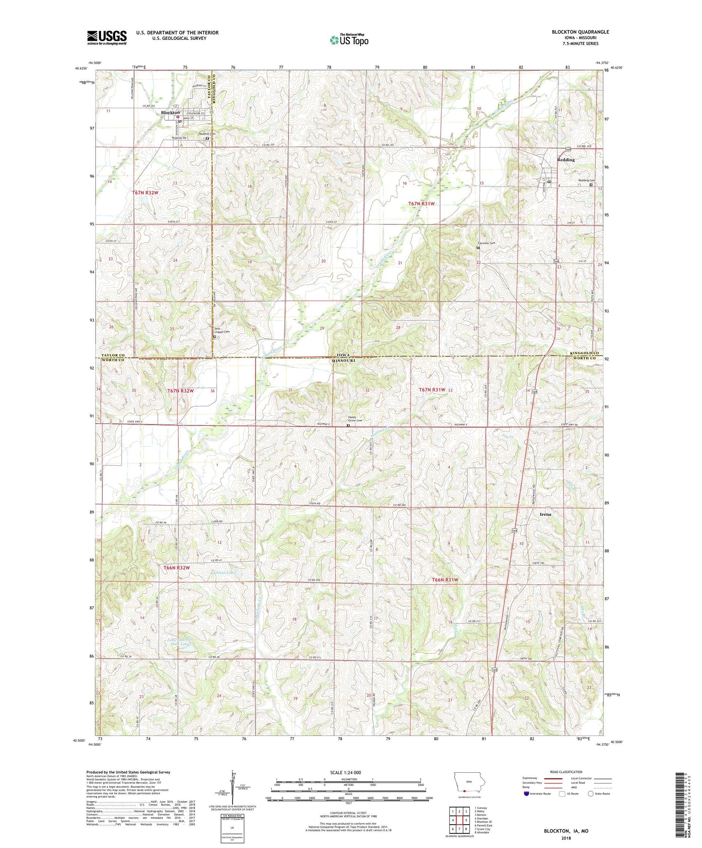
2022 topographic map quadrangle Blockton in the states of Missouri, Iowa. Scale: 1:24000. Based on the newly updated USGS 7.5' US Topo map series, this map is in the following counties: Ringgold, Worth, Taylor. The map contains contour data, water features, and other items you are used to seeing on USGS maps, but also has updated roads and other features. This is the next generation of topographic maps. Printed on high-quality waterproof paper with UV fade-resistant inks.
Quads adjacent to this one:
West: Sheridan
Northwest: Conway
North: Maloy
Northeast: Benton
East: Blockton SE
Southeast: Allendale
South: Grant City
Southwest: Parnell East
Contains the following named places: Blockton, Blockton Baptist Church, Blockton Christian Church, Blockton City Hall, Blockton Fire Department and Ambulance Service, Blockton Post Office, Bozzaris Post Office, City of Blockton, City of Redding, Crestland Co-op Elevator, Fairview Cemetery, Hass School, Honey Grove Cemetery, Honey Grove School, Irena, John Andrews Dam Lake, Kemp Lake Dam, Lone Star School, Maloy - Redding First Response Team, Methodist Church, Pleasant Ridge School, Pleasant Valley School, Redding, Redding Cemetery, Redding Post Office, Rosehill Cemetery, Tent Chapel, Tent Chapel Cemetery, Township of Clinton, Township of Fletchall, Victory School, Village of Irena, Warden Lake Dam - North, Warden Lake Dam - South, Zollman Lake, Zollman Lake Dam