MyTopo
Sheridan Missouri US Topo Map
Couldn't load pickup availability
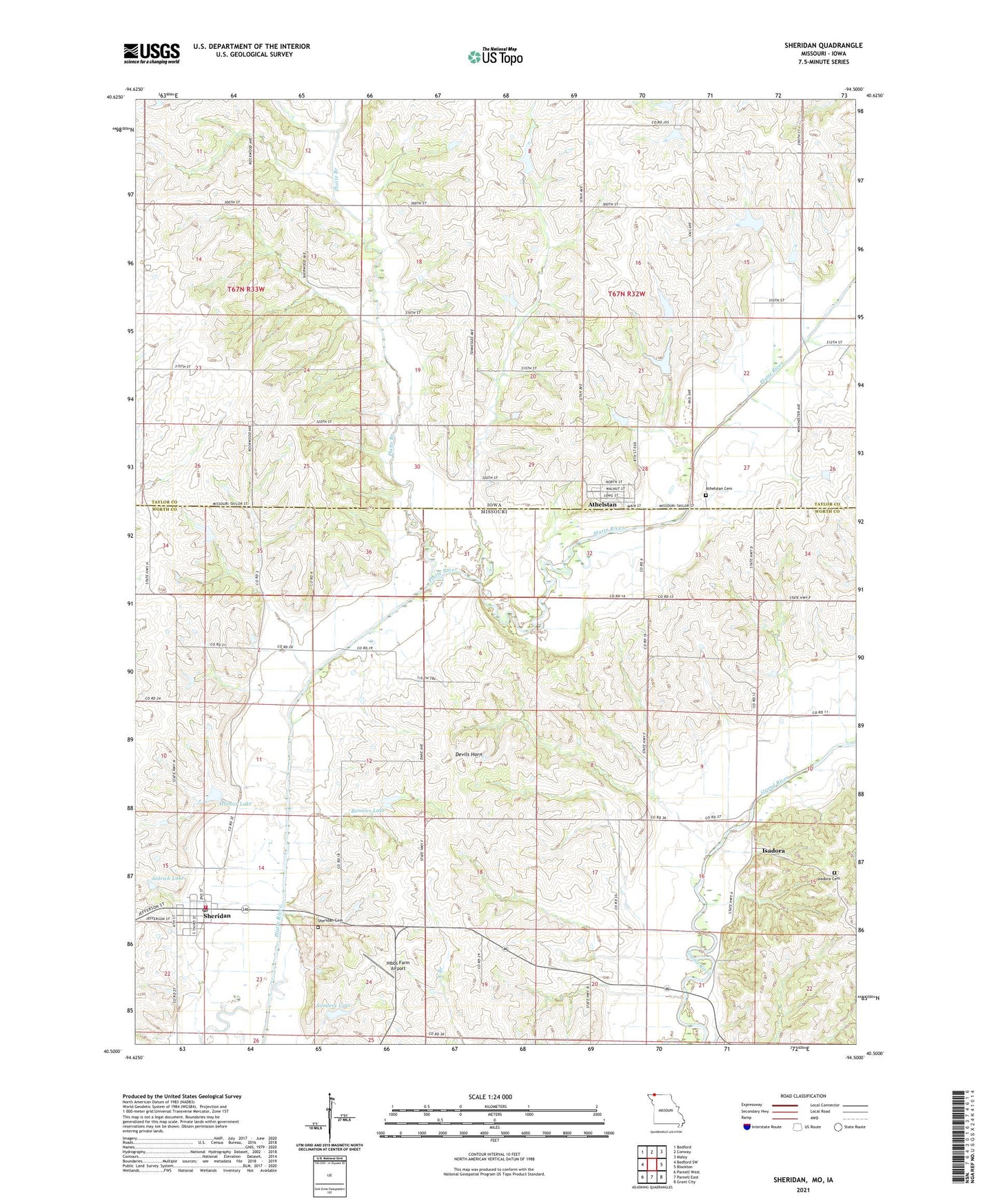
2021 topographic map quadrangle Sheridan in the states of Missouri, Iowa. Scale: 1:24000. Based on the newly updated USGS 7.5' US Topo map series, this map is in the following counties: Worth, Taylor. The map contains contour data, water features, and other items you are used to seeing on USGS maps, but also has updated roads and other features. This is the next generation of topographic maps. Printed on high-quality waterproof paper with UV fade-resistant inks.
Quads adjacent to this one:
West: Bedford SW
Northwest: Bedford
North: Conway
Northeast: Maloy
East: Blockton
Southeast: Grant City
South: Parnell East
Southwest: Parnell West
This map covers the same area as the classic USGS quad with code o40094e5.
Contains the following named places: Aldrich Lake, Arthur Scott Dam, Arthur Scott Lake, Athelstan, Athelstan Cemetery, Athelstan Census Designated Place, Athelstan Post Office, Bonnies Lake, Columbia School, Devils Horn, Gravel Hill School, Hibbs Farm Airport, Hoover Lake, Iona City, Isadora, Isadora Cemetery, Isadora School, Mission Ridge School, Mononame 29 Lake, Platte Branch, Platte Dell School, Platte River Tributaries Dam 3-B, Platte River Tributaries Watershed Dam 1-B, Platte River Tributaries Watershed Dam 2-A, Platte River Tributaries Watershed Dam 8-B, Platte River Tributaries Watershed Dam 8-C, Pleasant Hill School, Sanders Lake, Sheridan, Sheridan Cemetery, Sheridan Fire Protection District, Sheridan Post Office, Sheridan School, Town of Sheridan, Township of Jefferson, Township of Union, ZIP Code: 64486