MyTopo
Sheridan Iowa US Topo Map
Couldn't load pickup availability
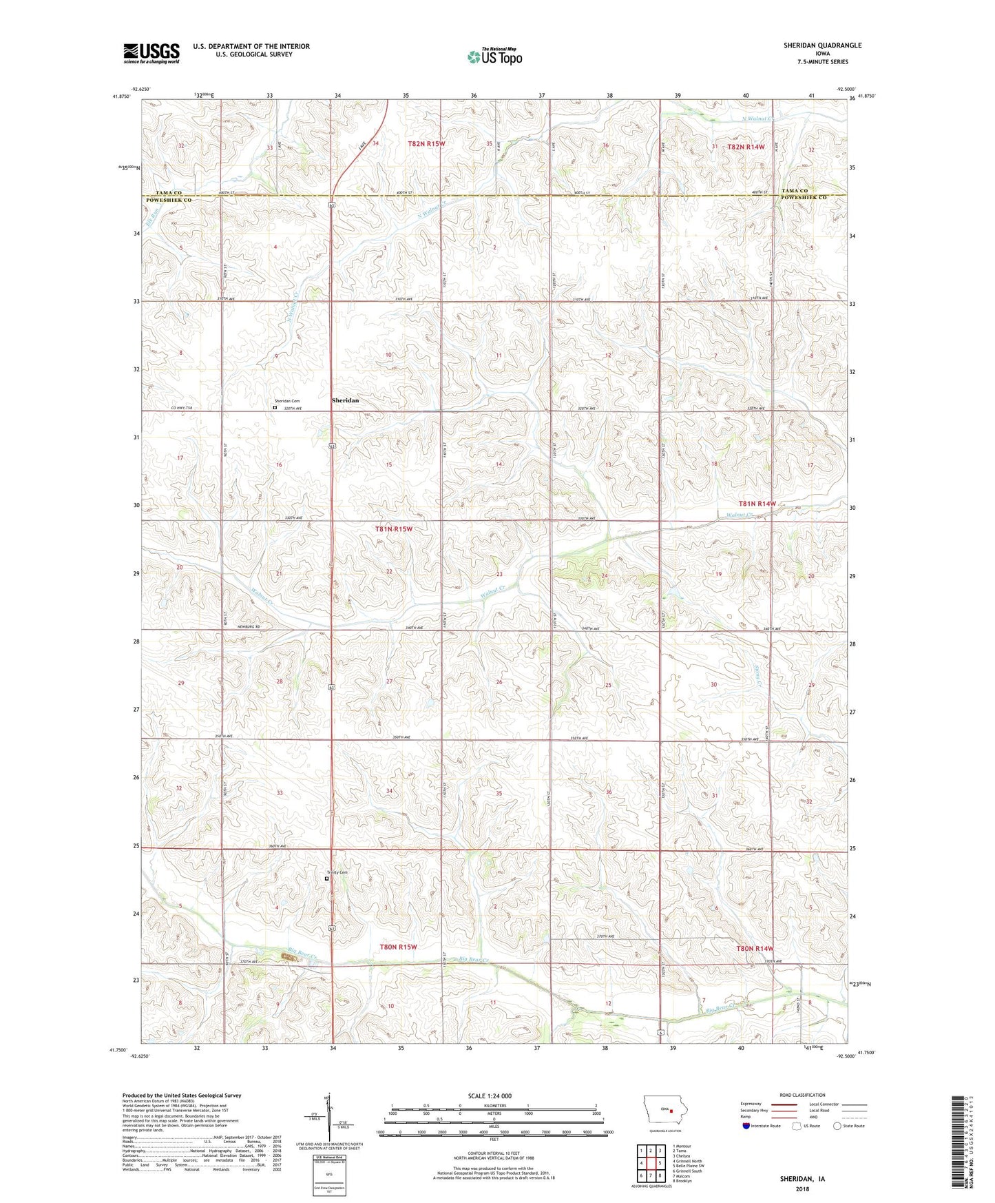
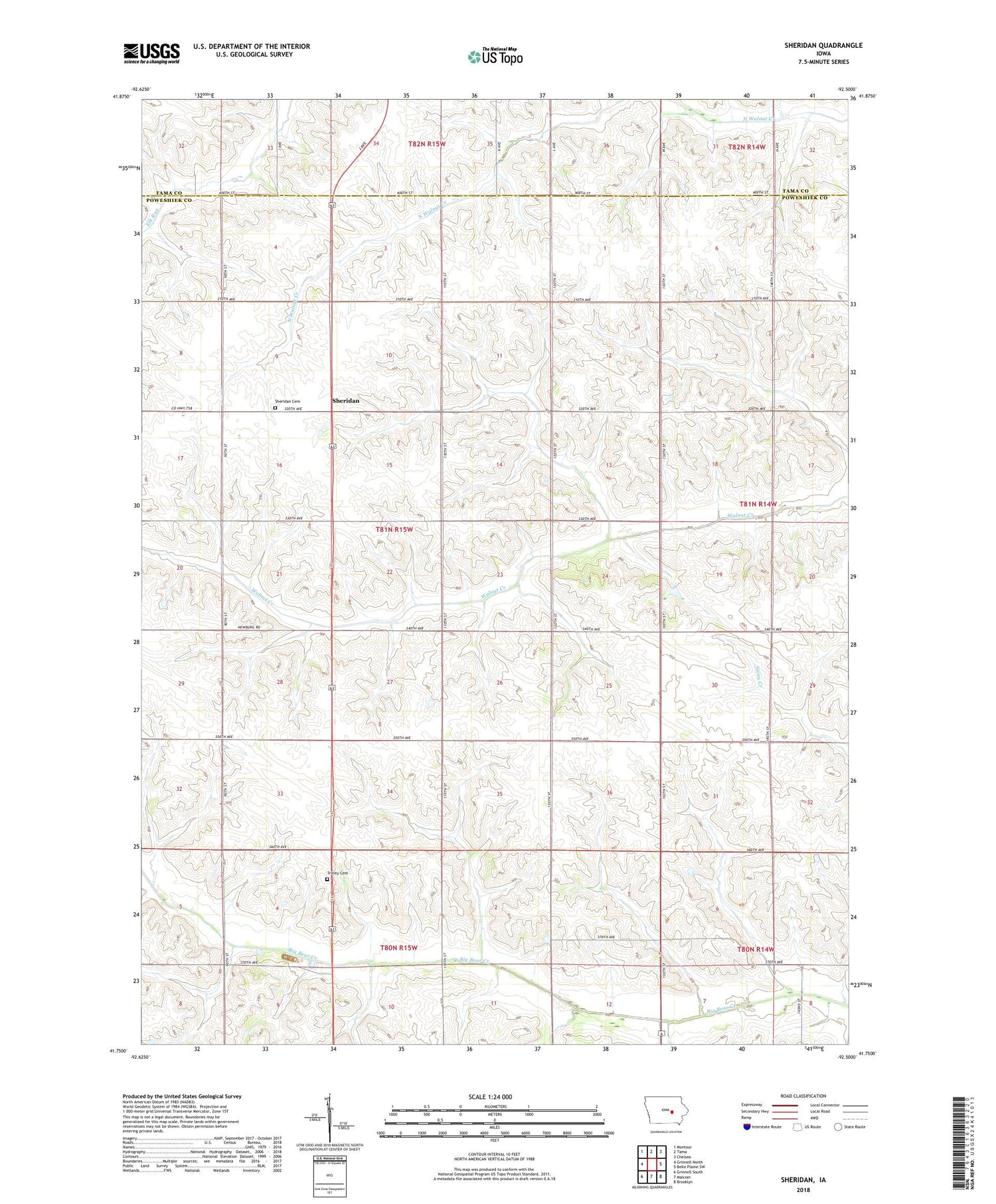
2022 topographic map quadrangle Sheridan in the state of Iowa. Scale: 1:24000. Based on the newly updated USGS 7.5' US Topo map series, this map is in the following counties: Poweshiek, Tama. The map contains contour data, water features, and other items you are used to seeing on USGS maps, but also has updated roads and other features. This is the next generation of topographic maps. Printed on high-quality waterproof paper with UV fade-resistant inks.
Quads adjacent to this one:
West: Grinnell North
Northwest: Montour
North: Tama
Northeast: Chelsea
East: Belle Plaine SW
Southeast: Brooklyn
South: Malcom
Southwest: Grinnell South
This map covers the same area as the classic USGS quad with code o41092g5.
Contains the following named places: Madison Church, Malcom Mine, Sheridan, Sheridan Cemetery, Sheridan Church, Sheridan Post Office, Township of Sheridan, Trinity Cemetery, Trinity Church