MyTopo
Buckingham Iowa US Topo Map
Couldn't load pickup availability
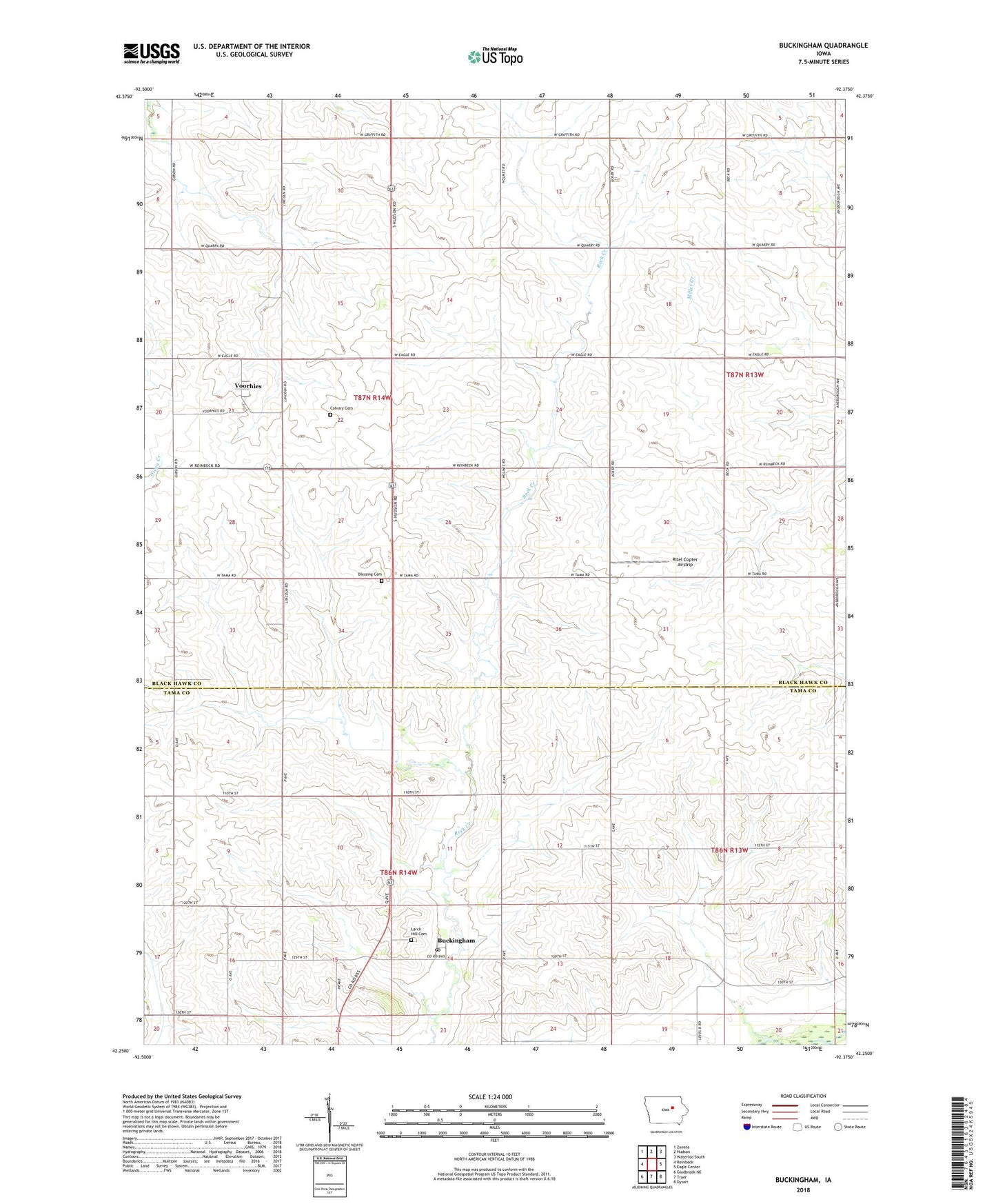
2022 topographic map quadrangle Buckingham in the state of Iowa. Scale: 1:24000. Based on the newly updated USGS 7.5' US Topo map series, this map is in the following counties: Black Hawk, Tama. The map contains contour data, water features, and other items you are used to seeing on USGS maps, but also has updated roads and other features. This is the next generation of topographic maps. Printed on high-quality waterproof paper with UV fade-resistant inks.
Quads adjacent to this one:
West: Reinbeck
Northwest: Zaneta
North: Hudson
Northeast: Waterloo South
East: Eagle Center
Southeast: Dysart
South: Traer
Southwest: Gladbrook NE
This map covers the same area as the classic USGS quad with code o42092c4.
Contains the following named places: Blessing, Blessing Cemetery, Blessing Post Office, Bovina, Bovina Post Office, Buckingham, Buckingham Cooperative Company Elevator, Buckingham Post Office, Calvary Cemetery, Church of Promise, Immaculate Conception of Blessed Virgin Mary Church, Larch Hill Cemetery, Midland Post Office, Ritel Copter Airstrip, Township of Buckingham, Township of Lincoln, Voorhies, Voorhies Post Office, ZIP Codes: 50612, 50643