MyTopo
Reinbeck Iowa US Topo Map
Couldn't load pickup availability
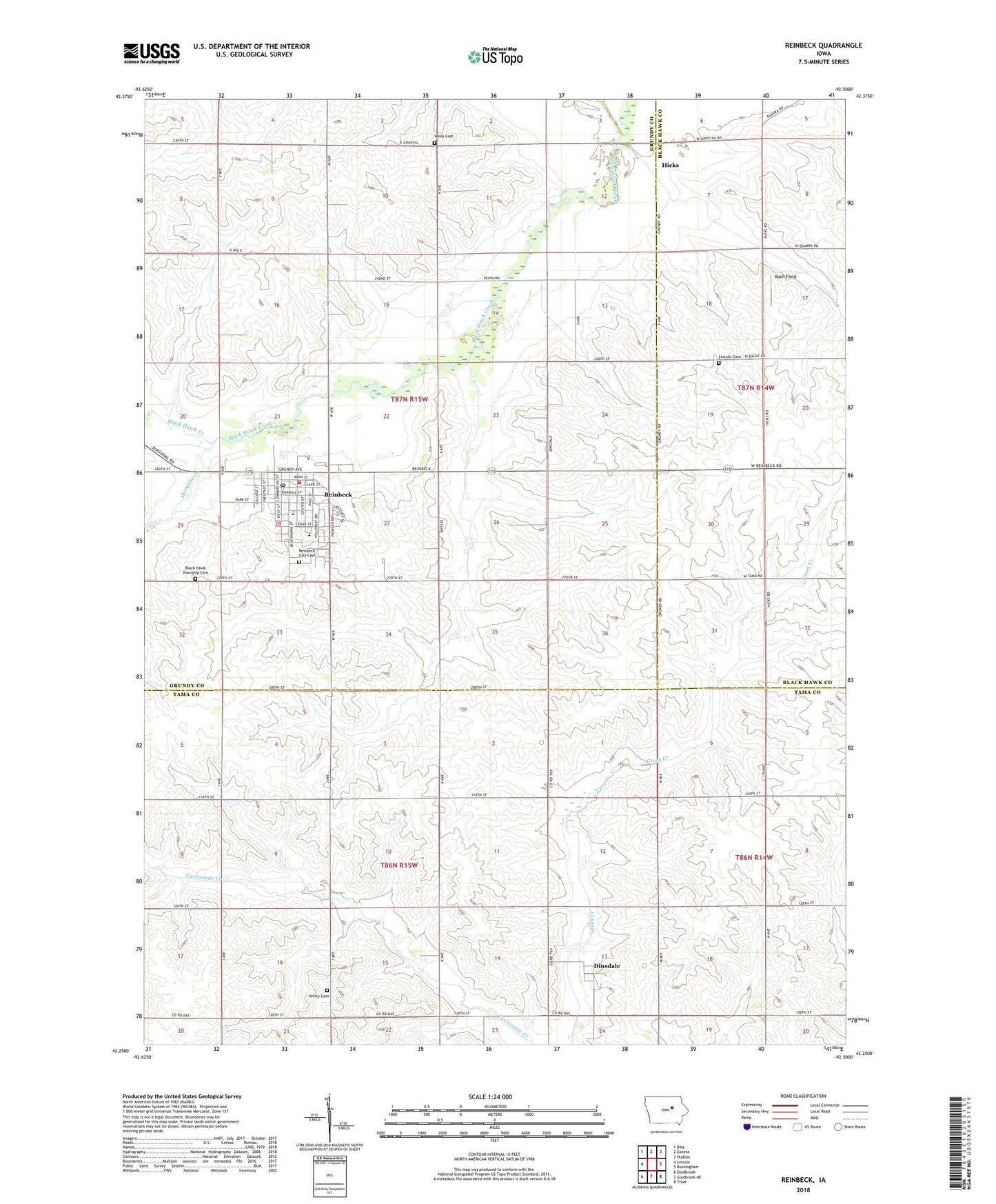
2022 topographic map quadrangle Reinbeck in the state of Iowa. Scale: 1:24000. Based on the newly updated USGS 7.5' US Topo map series, this map is in the following counties: Grundy, Tama, Black Hawk. The map contains contour data, water features, and other items you are used to seeing on USGS maps, but also has updated roads and other features. This is the next generation of topographic maps. Printed on high-quality waterproof paper with UV fade-resistant inks.
Quads adjacent to this one:
West: Lincoln
Northwest: Dike
North: Zaneta
Northeast: Hudson
East: Buckingham
Southeast: Traer
South: Gladbrook NE
Southwest: Gladbrook
This map covers the same area as the classic USGS quad with code o42092c5.
Contains the following named places: Amity Church, Black Hawk Township Cemetery, City of Reinbeck, Connell Post Office, Covenant Reinbeck Clinic, Dinsdale, Dinsdale Post Office, Farmers Cooperative Company Elevator, First Baptist Church, First United Presbyterian Church, Gladbrook - Reinbeck Junior / Senior High School, Grant Township Cemetery, Hicks, Hicks Post Office, Koch Field, Lincoln Cemetery, Mosquito Creek, New Life Assembly of God Church, Parkview Manor Nursing Home, Queen of Heaven Catholic Church, Reinbeck, Reinbeck Cemetery, Reinbeck Elementary School, Reinbeck Family Dental Clinic, Reinbeck Fire and Rescue Department, Reinbeck Memorial Building, Reinbeck Post Office, Reinbeck Public Library, Saint John's Lutheran Church, Township of Black Hawk, Township of Grant, United Church of Christ, United Methodist Church, Weiss Cemetery, ZIP Code: 50669