MyTopo
Traer Iowa US Topo Map
Couldn't load pickup availability
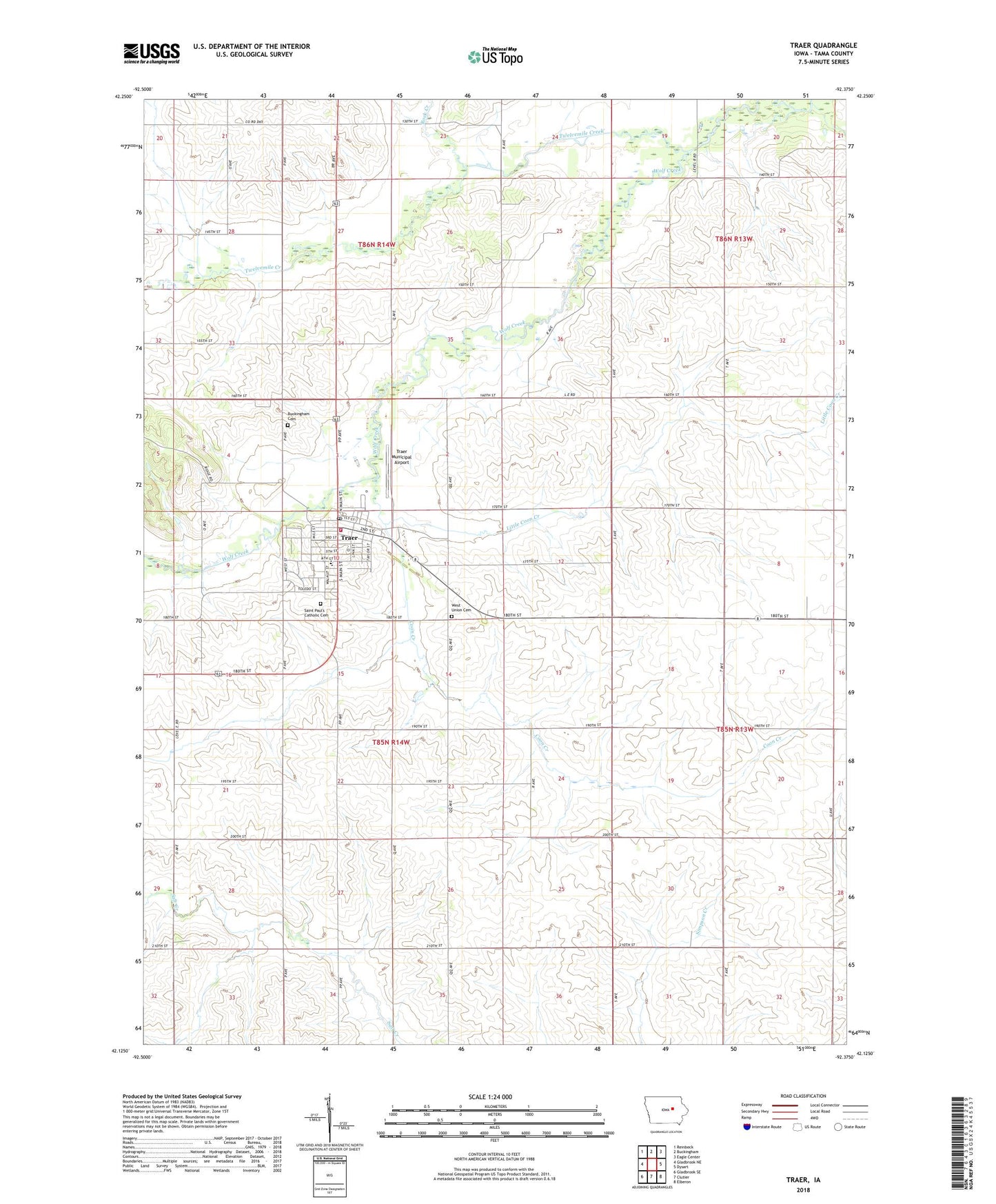
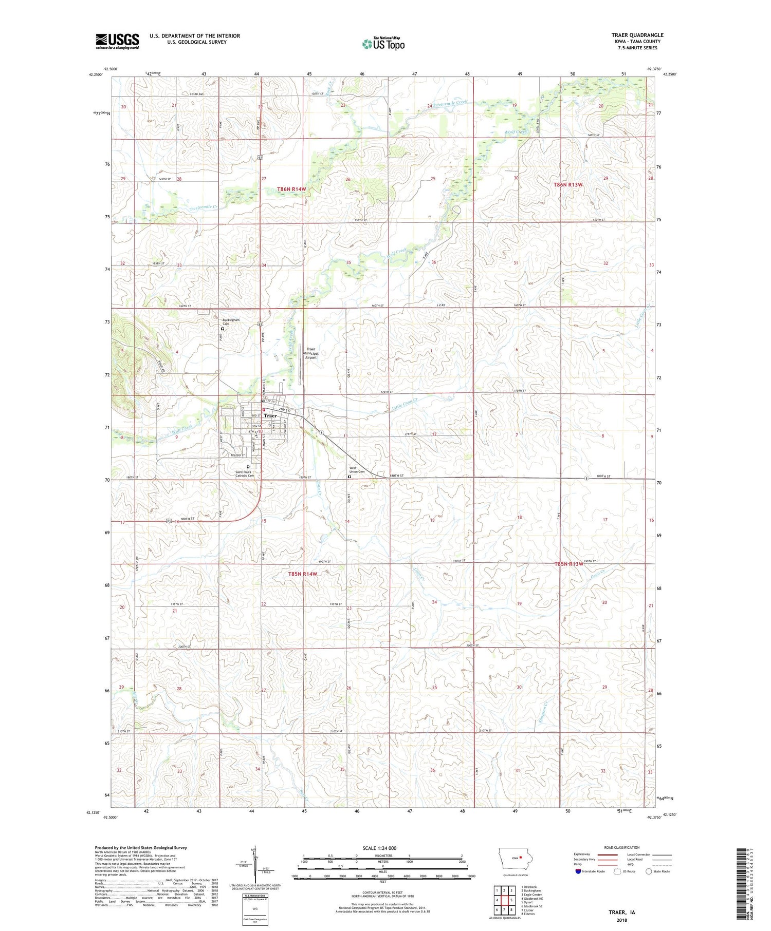
2022 topographic map quadrangle Traer in the state of Iowa. Scale: 1:24000. Based on the newly updated USGS 7.5' US Topo map series, this map is in the following counties: Tama. The map contains contour data, water features, and other items you are used to seeing on USGS maps, but also has updated roads and other features. This is the next generation of topographic maps. Printed on high-quality waterproof paper with UV fade-resistant inks.
Quads adjacent to this one:
West: Gladbrook NE
Northwest: Reinbeck
North: Buckingham
Northeast: Eagle Center
East: Dysart
Southeast: Elberon
South: Clutier
Southwest: Gladbrook SE
This map covers the same area as the classic USGS quad with code o42092b4.
Contains the following named places: Buckingham, Buckingham Cemetery, Buckingham Post Office, City of Traer, Coon Creek, Geneseo Post Office, James 'Tame Jim' Wilson State Historical Marker, Little Coon Creek, North Tama Elementary School, North Tama Junior - Senior High School, Ripley United Church of Christ, Rock Creek, Saint Luke Evangelical Lutheran Church, Saint Paul Church, Saint Pauls Catholic Cemetery, Sunrise Hill Care Center, T F Clark State Park, Taylor Park, Township of Perry, Traer, Traer Ambulance Service, Traer City Hall, Traer Covenant Clinic, Traer Fire Department, Traer Municipal Airport, Traer Post Office, Traer Public Library, Traer United Methodist Church, Twelvemile Creek, United Presbyterian Church, West Union, West Union Cemetery