MyTopo
Burlington Iowa US Topo Map
Couldn't load pickup availability
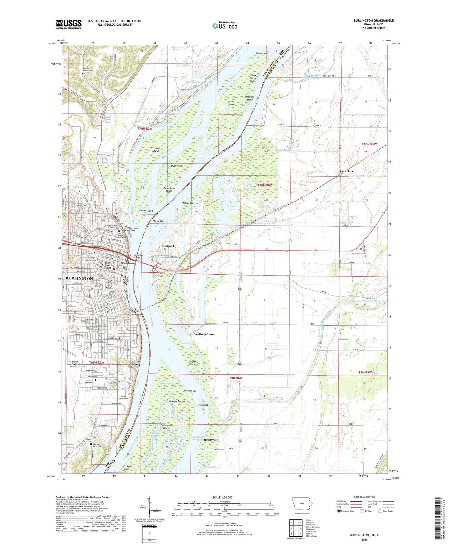
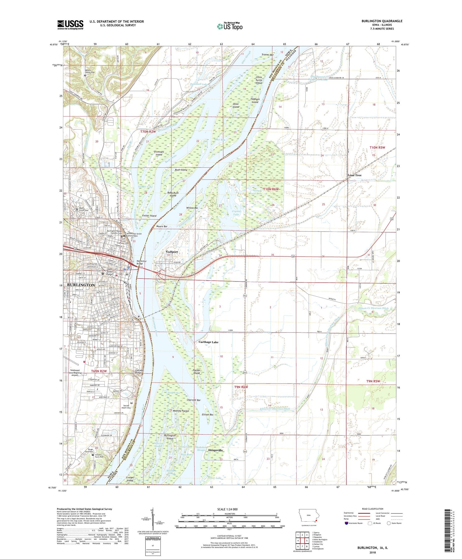
2022 topographic map quadrangle Burlington in the states of Illinois, Iowa. Scale: 1:24000. Based on the newly updated USGS 7.5' US Topo map series, this map is in the following counties: Des Moines, Henderson. The map contains contour data, water features, and other items you are used to seeing on USGS maps, but also has updated roads and other features. This is the next generation of topographic maps. Printed on high-quality waterproof paper with UV fade-resistant inks.
Quads adjacent to this one:
West: West Burlington
Northwest: Sperry
North: Kingston
Northeast: Oquawka
East: Gladstone
Southeast: Stronghurst
South: Lomax
Southwest: Dallas City
Contains the following named places: ABC Dermatology Center, Airport Fire Station, Allergy and Asthma Clinic, Apollo Central School, Apple Trees Museum, Asbury United Methodist Church, Aspen Grove Cemetery, Baby Rush Island, Bass Run, Bethany Lutheran Church, Black Hawk Elementary School, Black Hawk Springs Historical Marker, Bluffdale School, Bradwell Stadium, Burlington, Burlington Care Center, Burlington City Auditorium, Burlington City Hall, Burlington Fire Department - Central Fire Station, Burlington Fire Department Airport Fire Station, Burlington Golf Club, Burlington Medical Center, Burlington Medical Center at Klein, Burlington Medical Center Emergency Medical Heliport, Burlington Medical Center Resource Library, Burlington Police Department, Burlington Post Office, Burlington Public Library, Burlington Railroad Passenger Station, Burlington Residential Correctional Facility, Burlington Roman Catholic Cemetery, Carthage Junction, Carthage Lake, Cascade Bridge, Central Avenue School, Charcoal Bar, Child Health Specialty Clinic, Childrens Christian Academy, Christ Episcopal Church, Church of the Open Bible, City of Burlington, Clark Fieldhouse, Community of Christ Reorganized Church of Jesus Christ of Latter Day Saints, Corse Elementary School, Cowles Farm Plot, Crapo Park, Crystal Lake, Crystal Lake School, Crystal Springs Golf Club Post Office, Dankwardt Memorial Park, Des Moines County Courthouse, Des Moines County Sheriff's Office, Drew Chute Post Light, Dry Branch, Dry Branch School, Dumbbell Lake, Ellison Bar, Ellison Creek, Ellison Creek Diverson Ditch, Ellison Valley School, Faith Presbyterian Church, Faith Temple, Fetter Island, First Christian Church, First Congregational Church, First Legislative Assembly of Iowa Territory Historical Marker, First Presbyterian Church, First United Church of Christ, First United Methodist Church, Flint Creek, Flint Hills Golf Course, Flint Hills Park, Fort of Burlington Welcome Center, Foursquare Church, Free Methodist Church, Grace United Methodist Church, Great River Christian School, Greater Hope Missionary Baptist Church, Green Acres Mobile Home Park, Grimes Elementary School, Gulfport, Gulfport Ambulance Service, Harper Island, Hawkeye Log Cabin Museum, Heapsville, Heritage Baptist Church, Hogback Island, Hope Temple Christian Church, James Madison Middle School, James Wilson Grimes Homesite Historical Marker, Jesus Christ Apostolic Temple, Jordan Chute, KDWD-FM (Burlington), Kirby School, Lieutenant Zebulon Pike's Landing Historical Marker, Lily Lake, Little Turtle Island, Lone Tree, Long Lake, MacArthur Bridge, Mann School, Marsden Slough, Merry Dell School, Meyers Family Plot, Mooney Pocket, Moore Bar, Mosquito Park, New Fellowship Christian Church, New Hope Christian Church, New Hope Community Church, North Hill Dermatology Office, North Hill Elementary School, North Sixth Street Catholic Cemetery, Oak Street Baptist Church, Oak Street Junior High School, O'connell Island, O'Connell Slough, Orchard City Lake, Otter Bay, Otter Island, Otter Slough, Park View Care Center, Pediatric Physicians and Surgeons Center, Perkins Park, Perkins School, Prugh Farm Plot, Rhodes Lake, Riverwalk Park, Rush Chute, Rush Island, Sacred Heart Cemetery, Saint Francis Nursing Home, Saint John African Methodist Episcopal Church, Saint John's Catholic Church, Saint Johns School, Saint Luke United Church of Christ, Saint Patrick's Church, Saint Paul's Church, Saint Pauls Roman Catholic Church, Salter School, Salvation Army Church, Seven Revolutionary Soldiers Buried in Des Moines County Historical Museum, Seventh Day Adventist Church, Silver Lake, Sixth Street Catholic Cemetery, Sixth Street Viaduct, Snag Lake, Snake Alley, Solar Eclipse of 1869 Historical Marker, Southeast Iowa Orthopaedics Center, Southeast Iowa Regional Airport, Stony Point Lake, Sullivan Slough, Sunnyside Elementary School, Temple Israel, The Phelps House, The Willow Patch Post Office, Township of Burlington, Township of Carman, Township of Tama, Trienes Bar, Trinity Evangelical Lutheran Church, Union Baptist Church Full Gospel Fellowship, Unitarian Universalist Fellowship, United Pentecostal Church, Village of Gulf Port, Walnut Street First Baptist Church, West Hill United Methodist Church, Whole Truth Gospel Church of Holiness, Willow Bar, Yeager Lake, Zion United Church of Christ, ZIP Code: 61425


