MyTopo
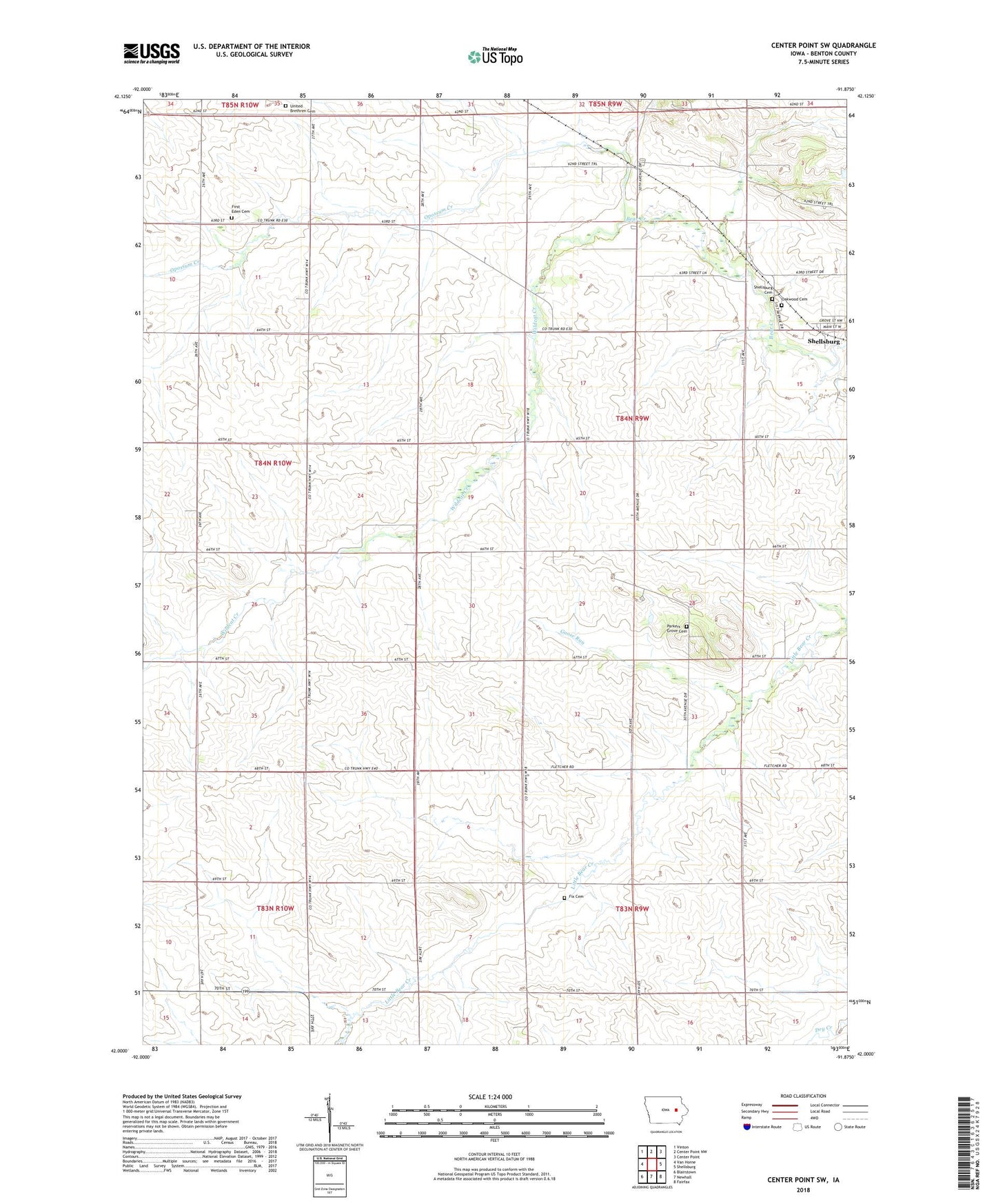
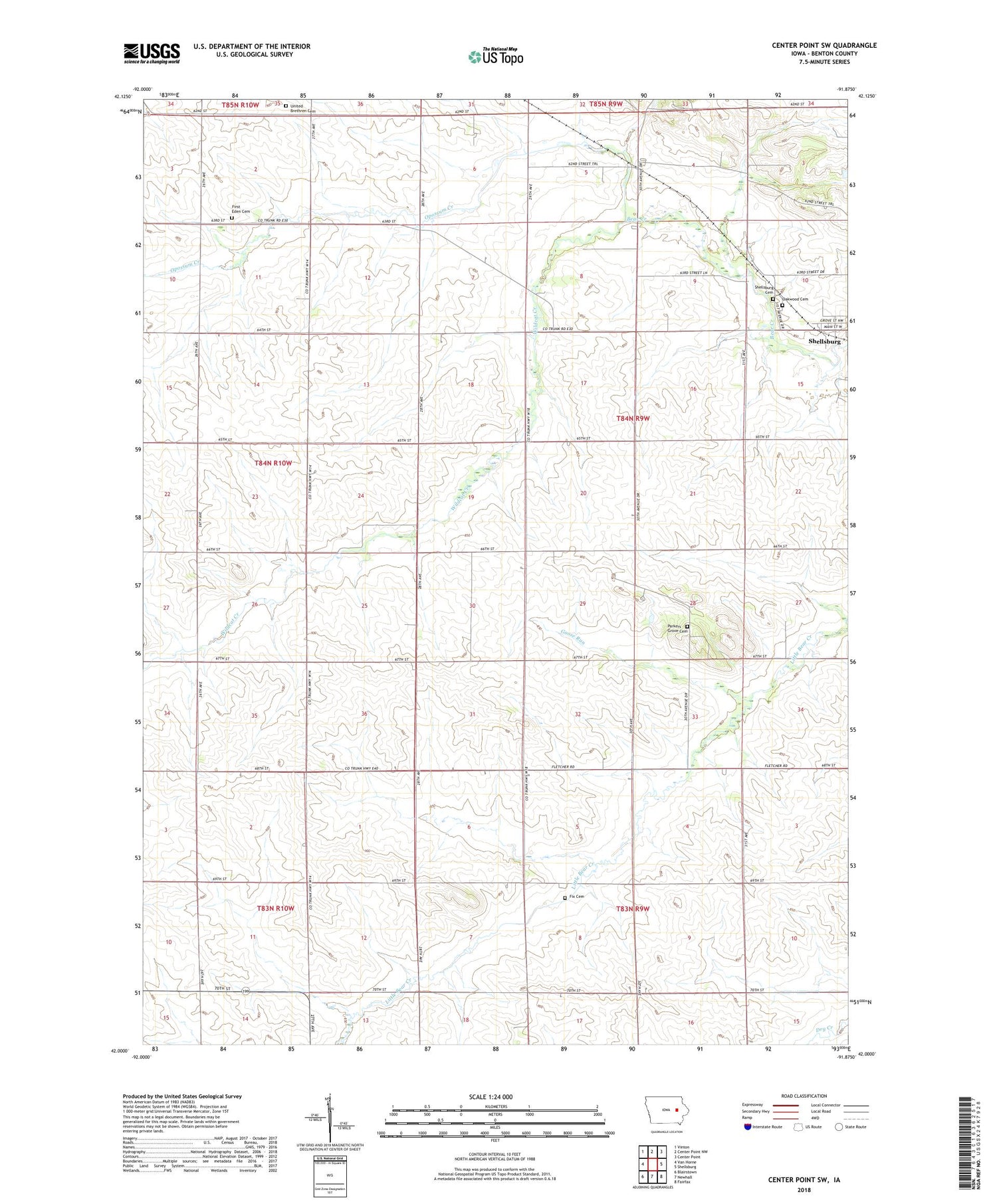
Center Point SW Iowa US Topo Map
Couldn't load pickup availability
2022 topographic map quadrangle Center Point SW in the state of Iowa. Scale: 1:24000. Based on the newly updated USGS 7.5' US Topo map series, this map is in the following counties: Benton. The map contains contour data, water features, and other items you are used to seeing on USGS maps, but also has updated roads and other features. This is the next generation of topographic maps. Printed on high-quality waterproof paper with UV fade-resistant inks.
Quads adjacent to this one:
West: Van Horne
Northwest: Vinton
North: Center Point NW
Northeast: Center Point
East: Shellsburg
Southeast: Fairfax
South: Newhall
Southwest: Blairstown
This map covers the same area as the classic USGS quad with code o42091a8.
Contains the following named places: East - Eden Cemetery, Eden, Fix Cemetery, Goose Run, Oakwood Cemetery, Opossum Creek, Parkers Grove Cemetery, Parkers Grove Church, Shellsburg Cemetery, Summers Post Office, Township of Canton, United Brethren Cemetery, Warren H Pangborn Wildlife Area, Wildcat Creek, ZIP Codes: 52315, 52332